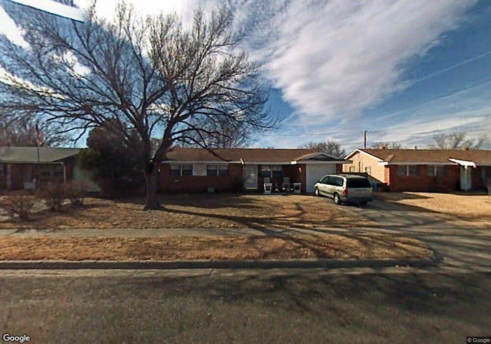
4920 Goodnight Trail Amarillo, TX 79109
Western Plateau NeighborhoodEstimated Value: $163,000 - $173,000
3
Beds
2
Baths
1,173
Sq Ft
$143/Sq Ft
Est. Value
About This Home
This home is located at 4920 Goodnight Trail, Amarillo, TX 79109 and is currently estimated at $168,246, approximately $143 per square foot. 4920 Goodnight Trail is a home located in Randall County with nearby schools including Western Plateau Elementary School, Carver Early Childhood Academy, and George Washington Carver Elementary Academy.
Ownership History
Date
Name
Owned For
Owner Type
Purchase Details
Closed on
Nov 4, 2019
Sold by
Rosenstein Mark R and Alvizo Aston Dacuysn
Bought by
Rosenstein Mark R and Alvizo Aston Dacuyan
Current Estimated Value
Home Financials for this Owner
Home Financials are based on the most recent Mortgage that was taken out on this home.
Original Mortgage
$106,500
Outstanding Balance
$93,786
Interest Rate
3.65%
Mortgage Type
New Conventional
Estimated Equity
$74,460
Purchase Details
Closed on
Nov 16, 2018
Sold by
Sickles Bryan and Sickles Julie
Bought by
Rosenstein Mark R and Alvizo Aston Decuyan
Home Financials for this Owner
Home Financials are based on the most recent Mortgage that was taken out on this home.
Original Mortgage
$100,000
Interest Rate
4.7%
Mortgage Type
New Conventional
Purchase Details
Closed on
Mar 14, 2013
Sold by
Cantwell Stacy
Bought by
Sickles Bryan and Sickles Julie
Home Financials for this Owner
Home Financials are based on the most recent Mortgage that was taken out on this home.
Original Mortgage
$94,050
Interest Rate
3.57%
Mortgage Type
New Conventional
Purchase Details
Closed on
Jan 18, 2011
Sold by
Howe Properties Llc
Bought by
Cantwell Stacy
Home Financials for this Owner
Home Financials are based on the most recent Mortgage that was taken out on this home.
Original Mortgage
$50,000
Interest Rate
4.56%
Mortgage Type
Seller Take Back
Purchase Details
Closed on
Oct 18, 2010
Sold by
Wade Mitchell Properties Llc
Bought by
Howe Properties Llc
Home Financials for this Owner
Home Financials are based on the most recent Mortgage that was taken out on this home.
Original Mortgage
$85,000
Interest Rate
4.38%
Mortgage Type
Future Advance Clause Open End Mortgage
Purchase Details
Closed on
Aug 13, 2010
Sold by
Martin Sam and Martin Tina
Bought by
Wade Mitchell Properties Llc
Home Financials for this Owner
Home Financials are based on the most recent Mortgage that was taken out on this home.
Original Mortgage
$72,000
Interest Rate
4.54%
Mortgage Type
Purchase Money Mortgage
Create a Home Valuation Report for This Property
The Home Valuation Report is an in-depth analysis detailing your home's value as well as a comparison with similar homes in the area
Home Values in the Area
Average Home Value in this Area
Purchase History
| Date | Buyer | Sale Price | Title Company |
|---|---|---|---|
| Rosenstein Mark R | -- | Servicelink | |
| Rosenstein Mark R | -- | Lawyers Title | |
| Sickles Bryan | -- | None Available | |
| Cantwell Stacy | -- | Tllt | |
| Howe Properties Llc | -- | None Available | |
| Wade Mitchell Properties Llc | -- | None Available |
Source: Public Records
Mortgage History
| Date | Status | Borrower | Loan Amount |
|---|---|---|---|
| Open | Rosenstein Mark R | $106,500 | |
| Closed | Rosenstein Mark R | $100,000 | |
| Previous Owner | Sickles Bryan | $94,050 | |
| Previous Owner | Cantwell Stacy | $50,000 | |
| Previous Owner | Howe Properties Llc | $85,000 | |
| Previous Owner | Wade Mitchell Properties Llc | $72,000 |
Source: Public Records
Tax History Compared to Growth
Tax History
| Year | Tax Paid | Tax Assessment Tax Assessment Total Assessment is a certain percentage of the fair market value that is determined by local assessors to be the total taxable value of land and additions on the property. | Land | Improvement |
|---|---|---|---|---|
| 2025 | $2,615 | $139,455 | $13,860 | $125,595 |
| 2024 | $2,615 | $138,335 | $13,860 | $127,417 |
| 2023 | $2,444 | $133,805 | $13,860 | $119,945 |
| 2022 | $2,442 | $122,785 | $13,860 | $108,925 |
| 2021 | $2,318 | $103,933 | $13,860 | $90,073 |
| 2020 | $2,200 | $98,545 | $13,860 | $84,685 |
| 2019 | $2,138 | $94,924 | $13,860 | $81,064 |
| 2018 | $1,787 | $81,925 | $13,860 | $68,065 |
| 2017 | $1,780 | $82,038 | $13,860 | $68,178 |
| 2016 | $1,728 | $74,779 | $11,340 | $63,439 |
| 2015 | $1,361 | $74,779 | $11,340 | $63,439 |
| 2014 | $1,361 | $71,626 | $11,340 | $60,286 |
Source: Public Records
Map
Nearby Homes
- 5117 Goodnight Trail
- 5117 Mesa Cir
- 4720 Oregon Trail
- 4903 Princeton St
- 4721 Cherokee Trail
- 5014 SW 55th Ave
- 4919 Yale St
- 5016 Yale St
- 4719 Buffalo Trail
- 5107 Greenway Place
- 5614 Tranquil Cir
- 4511 Mesa Cir
- 5005 Westway Trail
- 5811 Oregon Trail
- 5109 Theda Dr
- 5207 While A Way Rd
- 5712 SW 50th Ave
- 4444 Summit Cir
- 5800 Bell Park St
- 5805 Purdue St
- 4922 Goodnight Trail
- 4918 Goodnight Trail
- 4924 Goodnight Trail
- 4916 Goodnight Trail
- 4921 Chisholm Trail
- 4919 Chisholm Trail
- 4923 Chisholm Trail
- 4921 Goodnight Trail
- 4917 Chisholm Trail
- 4923 Goodnight Trail
- 4919 Goodnight Trail
- 4925 Chisholm Trail
- 4926 Goodnight Trail
- 4925 Goodnight Trail
- 4917 Goodnight Trail
- 4915 Chisholm Trail
- 4927 Chisholm Trail
- 4912 Goodnight Trail
- 4927 Goodnight Trail
- 4915 Goodnight Trail