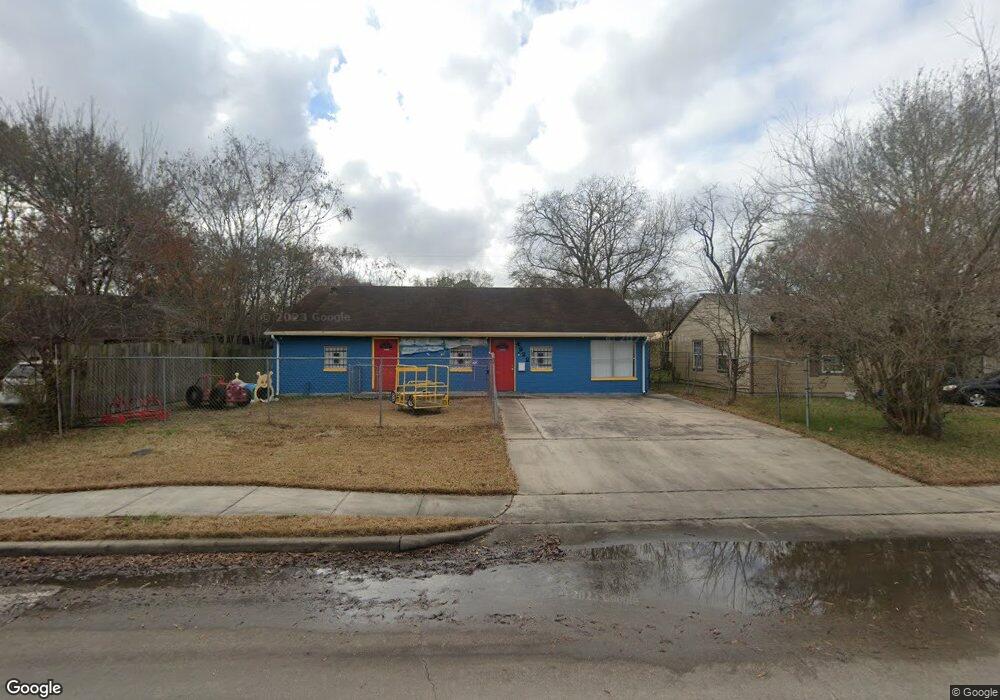
4922 Perry St Houston, TX 77021
OST-South Union NeighborhoodEstimated Value: $243,000 - $990,000
--
Bed
--
Bath
1,936
Sq Ft
$245/Sq Ft
Est. Value
About This Home
This home is located at 4922 Perry St, Houston, TX 77021 and is currently estimated at $475,222, approximately $245 per square foot. 4922 Perry St is a home with nearby schools including Hartsfield Elementary Animal and Environmental Sciences Magnet, Cullen Middle School, and Yates High School.
Ownership History
Date
Name
Owned For
Owner Type
Purchase Details
Closed on
May 1, 2020
Sold by
10000 Northwest Freeway Llc
Bought by
Miles Herman Dale and Miles Bertha M
Current Estimated Value
Home Financials for this Owner
Home Financials are based on the most recent Mortgage that was taken out on this home.
Original Mortgage
$239,500
Interest Rate
3%
Mortgage Type
Commercial
Purchase Details
Closed on
Sep 3, 2019
Sold by
Richardson Candi L
Bought by
10000 Northwest Freeway Llc
Purchase Details
Closed on
Feb 25, 2016
Sold by
10000 Northwest Freeway Llc
Bought by
Richardson Candi L
Home Financials for this Owner
Home Financials are based on the most recent Mortgage that was taken out on this home.
Original Mortgage
$136,499
Interest Rate
3.72%
Mortgage Type
Commercial
Purchase Details
Closed on
Oct 30, 2015
Sold by
King Rei Llc
Bought by
10000 Northwest Freeway Llc
Purchase Details
Closed on
Sep 1, 2013
Sold by
Lewis Shonda
Bought by
King Rei Llc
Purchase Details
Closed on
May 26, 2006
Sold by
Robirson Roberta
Bought by
Lewis Shonda
Purchase Details
Closed on
Mar 17, 2006
Sold by
Roberson Sammie Lee and Robinson Willie A
Bought by
Roberson Roberta
Create a Home Valuation Report for This Property
The Home Valuation Report is an in-depth analysis detailing your home's value as well as a comparison with similar homes in the area
Home Values in the Area
Average Home Value in this Area
Purchase History
| Date | Buyer | Sale Price | Title Company |
|---|---|---|---|
| Miles Herman Dale | -- | None Available | |
| 10000 Northwest Freeway Llc | $60,100 | None Available | |
| Richardson Candi L | -- | None Available | |
| 10000 Northwest Freeway Llc | -- | None Available | |
| King Rei Llc | -- | None Available | |
| Lewis Shonda | -- | Southern American Title | |
| Roberson Roberta | -- | Southern American Title |
Source: Public Records
Mortgage History
| Date | Status | Borrower | Loan Amount |
|---|---|---|---|
| Previous Owner | Miles Herman Dale | $239,500 | |
| Previous Owner | Richardson Candi L | $136,499 |
Source: Public Records
Tax History Compared to Growth
Tax History
| Year | Tax Paid | Tax Assessment Tax Assessment Total Assessment is a certain percentage of the fair market value that is determined by local assessors to be the total taxable value of land and additions on the property. | Land | Improvement |
|---|---|---|---|---|
| 2025 | $7,876 | $382,460 | $116,820 | $265,640 |
| 2024 | $7,876 | $376,396 | $110,330 | $266,066 |
| 2023 | $7,876 | $322,241 | $110,330 | $211,911 |
| 2022 | $5,922 | $268,958 | $90,860 | $178,098 |
| 2021 | $4,223 | $181,195 | $58,410 | $122,785 |
| 2020 | $3,930 | $162,309 | $37,318 | $124,991 |
| 2019 | $3,976 | $171,615 | $37,318 | $134,297 |
| 2018 | $3,935 | $155,512 | $32,450 | $123,062 |
| 2017 | $3,087 | $122,190 | $25,960 | $96,230 |
| 2016 | $2,745 | $108,568 | $16,225 | $92,343 |
| 2015 | $2,810 | $109,853 | $16,225 | $93,628 |
| 2014 | $2,810 | $109,295 | $16,225 | $93,070 |
Source: Public Records
Map
Nearby Homes
- 5023 Cosby St
- 0 Perry St
- 5111 Cosby St
- 6109 Grace Ln
- 6417 Madrid St
- 6419 Madrid St
- 6421 Madrid St
- 5022 Balkin St
- 4927 Kelso St
- 4611 Dewberry St
- 4624 Kingsbury St
- 4613 Dewberry St
- 6518 Weston St Unit 10
- 6014 Grace Ln Unit A/B
- 6309 Calhoun Rd
- 4604 Keystone St
- 6919 Calhoun Rd
- 6302 Calhoun Rd
- 4603 Keystone St
- 6326 Calhoun Rd