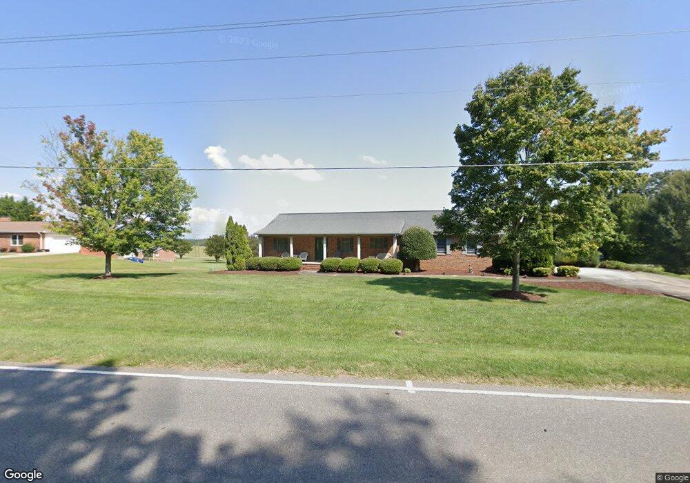
4922 W Nc 10 Hwy Newton, NC 28658
South Hickory NeighborhoodEstimated Value: $245,000 - $359,000
3
Beds
3
Baths
1,508
Sq Ft
$213/Sq Ft
Est. Value
About This Home
This home is located at 4922 W Nc 10 Hwy, Newton, NC 28658 and is currently estimated at $321,241, approximately $213 per square foot. 4922 W Nc 10 Hwy is a home located in Catawba County with nearby schools including Fred T. Foard High School, Blackburn Elementary School, and Jacobs Fork Middle School.
Ownership History
Date
Name
Owned For
Owner Type
Purchase Details
Closed on
Jul 15, 2013
Sold by
United Methodist Church Plateau & Wesley
Bought by
Sigmon Joel Brent and Sigmon Lynette King
Current Estimated Value
Purchase Details
Closed on
Apr 5, 2013
Sold by
Sigmon Joel Brent and Sigmon Lynette King
Bought by
Sigmon Joel Brent and Sigmon Lynette King
Purchase Details
Closed on
Mar 16, 1995
Purchase Details
Closed on
Mar 13, 1995
Create a Home Valuation Report for This Property
The Home Valuation Report is an in-depth analysis detailing your home's value as well as a comparison with similar homes in the area
Home Values in the Area
Average Home Value in this Area
Purchase History
| Date | Buyer | Sale Price | Title Company |
|---|---|---|---|
| Sigmon Joel Brent | -- | None Available | |
| Sigmon Joel Brent | -- | None Available | |
| -- | -- | -- | |
| -- | -- | -- |
Source: Public Records
Tax History Compared to Growth
Tax History
| Year | Tax Paid | Tax Assessment Tax Assessment Total Assessment is a certain percentage of the fair market value that is determined by local assessors to be the total taxable value of land and additions on the property. | Land | Improvement |
|---|---|---|---|---|
| 2025 | $1,453 | $317,600 | $15,500 | $302,100 |
| 2024 | $1,453 | $317,600 | $15,500 | $302,100 |
| 2023 | $1,453 | $219,300 | $15,500 | $203,800 |
| 2022 | $1,430 | $219,300 | $15,500 | $203,800 |
| 2021 | $1,397 | $219,300 | $15,500 | $203,800 |
| 2020 | $1,389 | $218,000 | $14,300 | $203,700 |
| 2019 | $1,363 | $214,000 | $0 | $0 |
| 2018 | $1,191 | $187,000 | $13,800 | $173,200 |
| 2017 | $1,191 | $0 | $0 | $0 |
| 2016 | $1,191 | $0 | $0 | $0 |
| 2015 | $1,101 | $187,000 | $13,800 | $173,200 |
| 2014 | $1,101 | $186,200 | $13,400 | $172,800 |
Source: Public Records
Map
Nearby Homes
- 4339 Angel Hill Dr
- 1 ACRE Jacobs Fork None
- 4149 River Run Cir
- 4176 River Run Cir
- 4175 River Run Cir
- 2114 Finger Bridge Rd
- 4146 Old State Rd
- 3425 Zion Church Rd
- 5780 W Nc 10 Hwy
- 1160 Mulberry Ln
- 3355 Stony Brook Cir
- 1263 Waterford Dr
- 3464 Rock Creek Dr
- 3651 W Nc 10 Hwy
- 1158 Waterford Dr
- 4063 Rainbow Hills Dr
- 6161 Willowbottom Rd
- 6314 Providence Church Rd
- 6554 Willowbottom Rd
- 1420 Windemere Ln
- 4946 W Nc 10 Hwy
- 4976 W Nc 10 Hwy
- 4937 W Nc 10 Hwy
- 4909 W Nc 10 Hwy
- 4995 W Nc 10 Hwy
- 4937 Nc Highway 10 W
- 4976 Nc Highway 10 W
- 0 Hwy 10 None Unit 829953
- 4962 W Nc 10 Hwy
- 4976 W Hwy 10 Hwy
- 4861 Whitener Rd
- 4901 W North Carolina 10 Hwy
- 4814 Whitener Rd
- 0 Hwy 10 Unit 9543949
- 4865 Whitener Rd
- 5032 W Nc 10 Hwy
- 2370 Ralph Rd
- 2370 Ralph L Rd
- 3850 W Nc 10 Hwy
- 4871 Whitener Rd