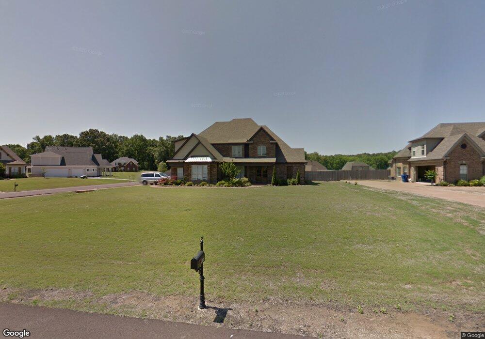
4923 Bakersfield Cove Nesbit, MS 38651
Lewisburg NeighborhoodEstimated Value: $424,875 - $494,000
5
Beds
3
Baths
2,900
Sq Ft
$161/Sq Ft
Est. Value
About This Home
This home is located at 4923 Bakersfield Cove, Nesbit, MS 38651 and is currently estimated at $466,719, approximately $160 per square foot. 4923 Bakersfield Cove is a home located in DeSoto County with nearby schools including Lewisburg Primary School, Lewisburg Elementary School, and Lewisburg Middle School.
Ownership History
Date
Name
Owned For
Owner Type
Purchase Details
Closed on
Dec 20, 2010
Sold by
The Citizens National Bank Of Meridian
Bought by
Lindsey Christopher T
Current Estimated Value
Home Financials for this Owner
Home Financials are based on the most recent Mortgage that was taken out on this home.
Original Mortgage
$249,740
Outstanding Balance
$163,370
Interest Rate
4.18%
Mortgage Type
New Conventional
Estimated Equity
$303,349
Create a Home Valuation Report for This Property
The Home Valuation Report is an in-depth analysis detailing your home's value as well as a comparison with similar homes in the area
Home Values in the Area
Average Home Value in this Area
Purchase History
We collect this data history from publicly available records. To have your information removed, we recommend requesting removal directly through your county’s website.
| Date | Buyer | Sale Price | Title Company |
|---|---|---|---|
| Lindsey Christopher T | -- | First National Title Llc |
Source: Public Records
Mortgage History
We collect this data history from publicly available records. To have your information removed, we recommend requesting removal directly through your county’s website.
| Date | Status | Borrower | Loan Amount |
|---|---|---|---|
| Open | Lindsey Christopher T | $249,740 |
Source: Public Records
Tax History
| Year | Tax Paid | Tax Assessment Tax Assessment Total Assessment is a certain percentage of the fair market value that is determined by local assessors to be the total taxable value of land and additions on the property. | Land | Improvement |
|---|---|---|---|---|
| 2025 | $2,003 | $27,922 | $3,600 | $24,322 |
| 2024 | $1,740 | $20,405 | $3,600 | $16,805 |
| 2023 | $1,740 | $20,405 | $0 | $0 |
| 2022 | $1,740 | $20,405 | $3,600 | $16,805 |
| 2021 | $1,740 | $20,405 | $3,600 | $16,805 |
| 2020 | $1,603 | $19,035 | $3,600 | $15,435 |
| 2019 | $1,603 | $19,035 | $3,600 | $15,435 |
| 2017 | $1,716 | $36,430 | $20,015 | $16,415 |
| 2016 | $1,716 | $20,015 | $3,600 | $16,415 |
| 2015 | $2,016 | $36,430 | $20,015 | $16,415 |
| 2014 | $1,716 | $20,015 | $0 | $0 |
| 2013 | $1,716 | $20,015 | $0 | $0 |
Source: Public Records
Map
Nearby Homes
- 3425 Kreunen St
- 3292 Kreunen St
- 4929 Bakersfield Dr
- 1960 Bakersfield Dr N
- 4809 Bakersfield Dr
- 2051 Laughter Rd
- 4490 Big Horn Dr S
- 5290 Watson View Dr
- 1817 Caribe Dr
- 2216 Watson View E
- 1789 Caribe Dr
- 2224 Itasca Dr
- 1694 Bakersfield Way
- 4343 Edison Dr
- 4300 Brooke Dr
- 1755 Bakersfield Way
- 1735 Bakersfield Way
- 4232 Brooke Dr
- 4233 Edison Dr
- 4220 Adriane Cove
- 4911 Bakersfield Cove
- 4888 Bakersfield Dr
- 5232 Watson Place Ln
- 5240 Watson Place Ln
- 3443 Kreunen St
- 3526 Kreunen St
- 3336 Kreunen St
- 3435 Kreunen St
- 5218 Watson Place Ln
- 5198 Watson Place Ln
- 5224 Watson Place Ln
- 5261 Watson Place Ln
- 5192 Watson Place Ln
- 5249 Watson Place Ln
- 5229 Watson Place Ln
- 5217 Watson Place Ln
- 5076 Watson Place Ln
- 5266 Watson Place Ln
- 5083 Watson Place Ln
- 5095 Watson Place Ln
Your Personal Tour Guide
Ask me questions while you tour the home.