Estimated Value: $148,000 - $169,000
2
Beds
2
Baths
1,176
Sq Ft
$136/Sq Ft
Est. Value
About This Home
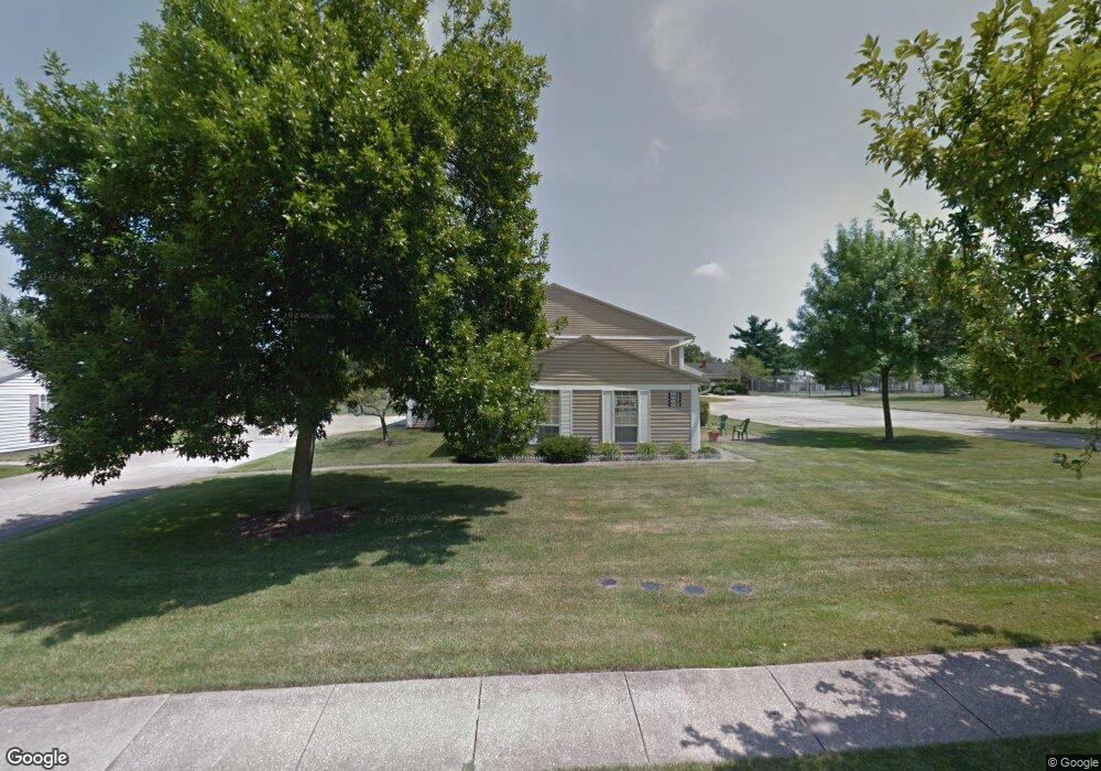
This home is located at 4923 Friar Rd Unit D, Stow, OH 44224 and is currently estimated at $160,439, approximately $136 per square foot. 4923 Friar Rd Unit D is a home located in Summit County with nearby schools including Stow-Munroe Falls High School, Primrose School of Hudson, and Holy Family Elementary School.
Ownership History
Date
Name
Owned For
Owner Type
Purchase Details
Closed on
Jul 12, 2003
Sold by
Best Relocations Ltd
Bought by
Trier David W
Current Estimated Value
Home Financials for this Owner
Home Financials are based on the most recent Mortgage that was taken out on this home.
Original Mortgage
$79,000
Interest Rate
5%
Mortgage Type
Unknown
Create a Home Valuation Report for This Property
The Home Valuation Report is an in-depth analysis detailing your home's value as well as a comparison with similar homes in the area
Home Values in the Area
Average Home Value in this Area
Purchase History
| Date | Buyer | Sale Price | Title Company |
|---|---|---|---|
| Trier David W | $79,000 | Chicago Title Insurance Comp | |
| Best Relocations Ltd | $79,000 | Chicago Title Insurance Comp |
Source: Public Records
Mortgage History
| Date | Status | Borrower | Loan Amount |
|---|---|---|---|
| Previous Owner | Trier David W | $79,000 |
Source: Public Records
Tax History Compared to Growth
Tax History
| Year | Tax Paid | Tax Assessment Tax Assessment Total Assessment is a certain percentage of the fair market value that is determined by local assessors to be the total taxable value of land and additions on the property. | Land | Improvement |
|---|---|---|---|---|
| 2025 | $3,473 | $42,344 | $4,372 | $37,972 |
| 2024 | $2,419 | $42,344 | $4,372 | $37,972 |
| 2023 | $3,473 | $42,344 | $4,372 | $37,972 |
| 2022 | $2,009 | $30,906 | $3,189 | $27,717 |
| 2021 | $1,802 | $30,906 | $3,189 | $27,717 |
| 2020 | $1,772 | $30,910 | $3,190 | $27,720 |
| 2019 | $1,344 | $21,690 | $3,160 | $18,530 |
| 2018 | $1,323 | $21,680 | $2,910 | $18,770 |
| 2017 | $1,210 | $21,680 | $2,910 | $18,770 |
| 2016 | $1,244 | $19,190 | $2,910 | $16,280 |
| 2015 | $1,210 | $19,190 | $2,910 | $16,280 |
| 2014 | $1,211 | $19,190 | $2,910 | $16,280 |
| 2013 | $1,523 | $24,560 | $2,910 | $21,650 |
Source: Public Records
Map
Nearby Homes
- 4901 Independence Cir Unit B
- 4917 Independence Cir Unit B
- 4621 Graford Ln
- 2444 Port Charles Dr
- 2418 Wrens Dr S Unit G
- 2380 Port Williams Dr Unit 2380
- 4901 Pebblehurst Dr
- 4903 Fishcreek Rd Unit 11B
- 0 Stow Rd Unit 5102979
- 4731 Haughton Ct
- 2327 Crockett Cir
- 2140 Woodlawn Cir Unit 2144
- 4227 Baird Rd
- 4131 Burton Dr
- 5465 Park Vista Ct
- 2028 Willowdale Dr
- 3165 Peterboro Dr
- 4120 Klein Ave
- 1995 Willowdale Dr
- 1627 Cypress Ct
- 4923 Friar Rd Unit 26C
- 4923 Friar Rd
- 4923 Friar Rd Unit 26A
- 4923 Friar Rd
- 4923 Friar Rd Unit A
- 4923 Friar Rd Unit B
- 4923 Friar Rd Unit C
- 4927 Friar Rd Unit 27A
- 4927 Friar Rd Unit 27C
- 4927 Friar Rd
- 4927 Friar Rd
- 4927 Friar Rd Unit C
- 4927 Friar Rd Unit B
- 4927 Friar Rd Unit A
- 4919 Friar Rd Unit 25C
- 4919 Friar Rd Unit 25B
- 4919 Friar Rd
- 4919 Friar Rd Unit 25D
- 4919 Friar Rd Unit B
- 4919 Friar Rd Unit A