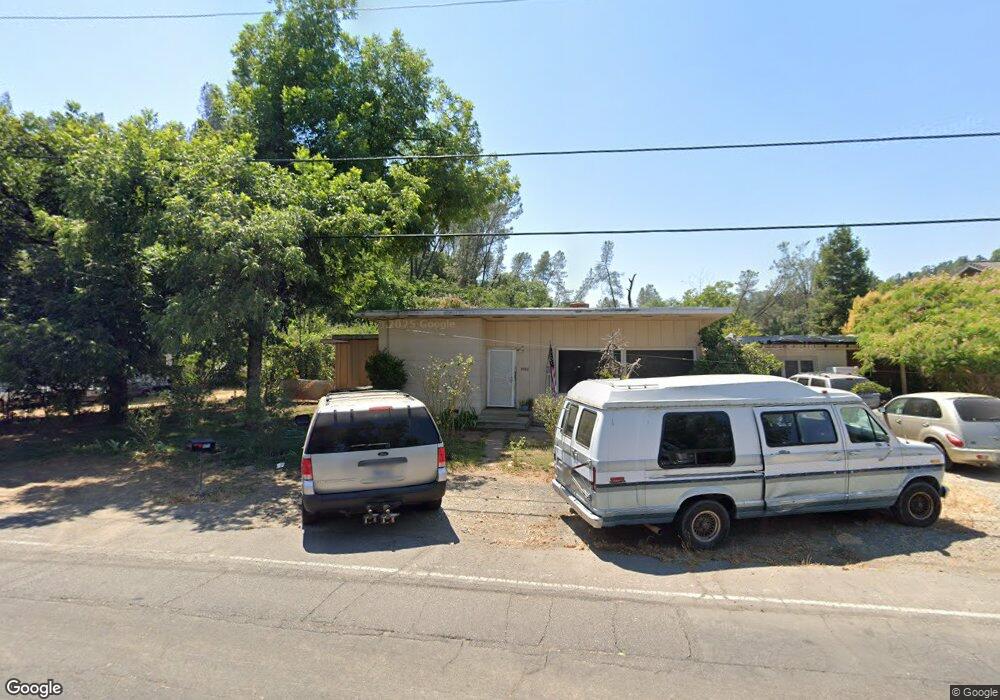
4926 Cedars Rd Redding, CA 96001
Branstetter NeighborhoodEstimated Value: $237,000 - $328,000
3
Beds
2
Baths
1,540
Sq Ft
$177/Sq Ft
Est. Value
About This Home
This home is located at 4926 Cedars Rd, Redding, CA 96001 and is currently estimated at $273,155, approximately $177 per square foot. 4926 Cedars Rd is a home located in Shasta County with nearby schools including Sycamore Elementary School, Sequoia Middle School, and Shasta High School.
Ownership History
Date
Name
Owned For
Owner Type
Purchase Details
Closed on
Aug 17, 1999
Sold by
Medley Michael J
Bought by
Proctor Robert W and Proctor Lynn
Current Estimated Value
Home Financials for this Owner
Home Financials are based on the most recent Mortgage that was taken out on this home.
Original Mortgage
$108,120
Outstanding Balance
$31,094
Interest Rate
7.66%
Mortgage Type
VA
Estimated Equity
$242,061
Create a Home Valuation Report for This Property
The Home Valuation Report is an in-depth analysis detailing your home's value as well as a comparison with similar homes in the area
Home Values in the Area
Average Home Value in this Area
Purchase History
| Date | Buyer | Sale Price | Title Company |
|---|---|---|---|
| Proctor Robert W | $106,000 | Fidelity National Title Co |
Source: Public Records
Mortgage History
| Date | Status | Borrower | Loan Amount |
|---|---|---|---|
| Open | Proctor Robert W | $108,120 |
Source: Public Records
Tax History
| Year | Tax Paid | Tax Assessment Tax Assessment Total Assessment is a certain percentage of the fair market value that is determined by local assessors to be the total taxable value of land and additions on the property. | Land | Improvement |
|---|---|---|---|---|
| 2025 | $1,633 | $162,891 | $61,465 | $101,426 |
| 2024 | $1,607 | $159,698 | $60,260 | $99,438 |
| 2023 | $1,607 | $156,568 | $59,079 | $97,489 |
| 2022 | $1,578 | $153,499 | $57,921 | $95,578 |
| 2021 | $1,569 | $150,490 | $56,786 | $93,704 |
| 2020 | $1,588 | $148,948 | $56,204 | $92,744 |
| 2019 | $1,507 | $146,028 | $55,102 | $90,926 |
| 2018 | $1,518 | $143,166 | $54,022 | $89,144 |
| 2017 | $1,509 | $140,360 | $52,963 | $87,397 |
| 2016 | $1,459 | $137,609 | $51,925 | $85,684 |
| 2015 | $1,440 | $135,543 | $51,146 | $84,397 |
| 2014 | $1,429 | $132,889 | $50,145 | $82,744 |
Source: Public Records
Map
Nearby Homes
- 2340 Wilsey Dr
- 4920 Bonnyview Ave
- 2230 El Reno Ln
- 4540 Cerro Ln
- 2350 Puma Trail
- 2415 Marion Ct
- 2752 Summerbreeze Place
- 0 Lot4 Unit 2 Ph 2 Stillwater Unit 25-4962
- 0 Lot3 Unit 2 Ph 2 Stillwater Unit 25-4961
- 0 Lot6 Unit 2 Ph 2 Stillwater Unit 25-4964
- 0 Lot5 Unit 2 Ph 2 Stillwater Unit 25-4963
- 0 Lot16 Unit 2 Ph 2 Stillwater Unit 25-4958
- 0 Lot9 Unit 2 Ph 2 Stillwater Unit 25-4967
- 0 Lot2 Unit 2 Ph 2 Stillwater Unit 25-4960
- 0 Lot11 Unit 2 Ph 2 Stillwater Unit 25-4953
- 0 Lot10 Unit 2 Ph 2 Stillwater Unit 25-4952
- 0 Lot7 Unit 2 Ph 2 Stillwater Unit 25-4965
- 1400 Riviera Dr
- 2794 Summerbreeze Place
- 3232 Nicolet Ln
- 4912 Cedars Rd
- 4935 Cedars Rd
- 4945 Cedars Rd
- 2091 Kenyon Dr
- 4925 Cedars Rd
- 4956 Cedars Rd
- 4963 Cedars Rd
- 2081 Kenyon Dr
- 2151 Kenyon Dr
- 2071 Kenyon Dr
- 4975 Cedars Rd Unit 1 OF 2
- 4975 Cedars Rd Unit 2
- 4975 Cedars Rd
- 2175 Kenyon Dr
- 2185 Kenyon Dr
- 2071/2061 Kenyon Rd
- 2061 Kenyon Dr
- 2150 Kenyon Dr
- 2195 Kenyon Dr
- 4980 Cedars Rd
Your Personal Tour Guide
Ask me questions while you tour the home.