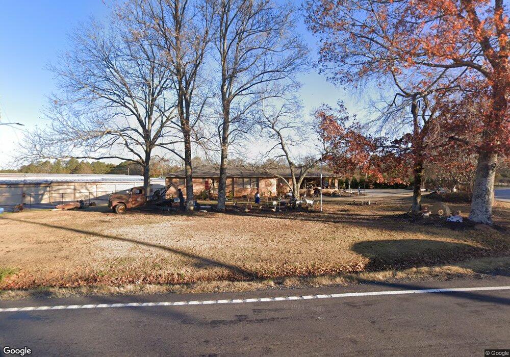
4926 Highway 81 Loganville, GA 30052
Estimated Value: $391,000 - $3,684,510
--
Bed
--
Bath
1,884
Sq Ft
$1,082/Sq Ft
Est. Value
About This Home
This home is located at 4926 Highway 81, Loganville, GA 30052 and is currently estimated at $2,037,755, approximately $1,081 per square foot. 4926 Highway 81 is a home located in Walton County with nearby schools including Bay Creek Elementary School, Loganville Middle School, and Loganville High School.
Ownership History
Date
Name
Owned For
Owner Type
Purchase Details
Closed on
Jul 30, 2019
Sold by
Watson Mark Nelson
Bought by
A Model Self Storage Llc
Current Estimated Value
Purchase Details
Closed on
Feb 25, 2016
Sold by
Watson Emily J
Bought by
Waton Mark N
Home Financials for this Owner
Home Financials are based on the most recent Mortgage that was taken out on this home.
Original Mortgage
$100,372
Interest Rate
3.79%
Mortgage Type
New Conventional
Purchase Details
Closed on
Nov 13, 1990
Bought by
Watson Emily Mrs
Create a Home Valuation Report for This Property
The Home Valuation Report is an in-depth analysis detailing your home's value as well as a comparison with similar homes in the area
Home Values in the Area
Average Home Value in this Area
Purchase History
| Date | Buyer | Sale Price | Title Company |
|---|---|---|---|
| A Model Self Storage Llc | -- | -- | |
| Waton Mark N | $67,500 | -- | |
| Watson Emily Mrs | -- | -- |
Source: Public Records
Mortgage History
| Date | Status | Borrower | Loan Amount |
|---|---|---|---|
| Previous Owner | Waton Mark N | $100,372 |
Source: Public Records
Tax History Compared to Growth
Tax History
| Year | Tax Paid | Tax Assessment Tax Assessment Total Assessment is a certain percentage of the fair market value that is determined by local assessors to be the total taxable value of land and additions on the property. | Land | Improvement |
|---|---|---|---|---|
| 2024 | $36,608 | $1,241,840 | $187,960 | $1,053,880 |
| 2023 | $41,591 | $1,036,894 | $77,120 | $959,774 |
| 2022 | $43,357 | $998,614 | $41,880 | $956,734 |
| 2021 | $8,141 | $249,880 | $39,440 | $210,440 |
| 2020 | $2,914 | $87,200 | $39,440 | $47,760 |
| 2019 | $2,503 | $74,760 | $33,080 | $41,680 |
| 2018 | $2,500 | $74,760 | $33,080 | $41,680 |
| 2017 | $2,131 | $61,840 | $16,440 | $45,400 |
| 2016 | $1,828 | $53,840 | $14,520 | $39,320 |
| 2015 | $533 | $50,600 | $14,520 | $36,080 |
| 2014 | $517 | $46,120 | $0 | $0 |
Source: Public Records
Map
Nearby Homes
- 209 Birchwood Dr
- 207 Birchwood Dr
- 4500 Bay Creek Rd
- 4031 Dean Grove Way
- 2524 Lois Ct
- 3971 Dean Grove Way
- 4885 Watson Mill Ct
- 503 Starmist Ct
- 204 Misty Grove Dr
- 501 Bay Stand Ln
- 5363 Forest Dr
- 612 Baymist Ct
- 969 Spanish Moss Trail
- 972 Spanish Moss Trail
- 5474 Forest Dr Unit 4
- 606 Amanda Leigh Ct
- 903 Creek Bottom Rd
- 4931 Highway 81
- 4876 Highway 81
- 4897 Highway 81
- 4866 Highway 81
- 202 Lake Vista Dr
- 200 Lake Vista Dr
- 430 Armor Dr
- 432 Armor Dr
- 204 Lake Vista Dr
- 3263 Watson Mill Dr
- 206 Lake Vista Dr
- 4886 Highway 81
- 431 Armor Dr
- 428 Armor Dr
- 203 Lake Vista Dr
- 4781 Shannon Rd
- 4781 Shannon Rd
- 307 Kings Way
- 210 Lake Vista Dr
- 208 Lake Vista Dr