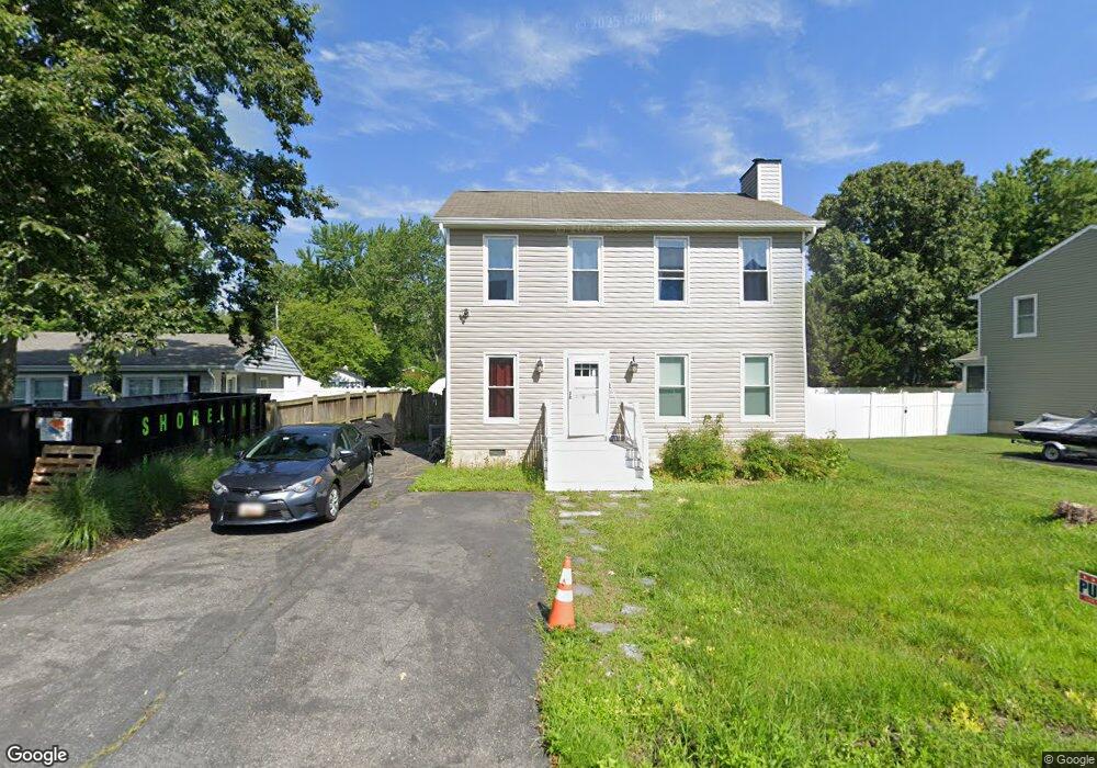
4926 Thomas Drive A Shady Side, MD 20764
Estimated Value: $412,748 - $445,000
--
Bed
3
Baths
1,500
Sq Ft
$283/Sq Ft
Est. Value
About This Home
This home is located at 4926 Thomas Drive A, Shady Side, MD 20764 and is currently estimated at $425,187, approximately $283 per square foot. 4926 Thomas Drive A is a home located in Anne Arundel County with nearby schools including Shady Side Elementary School, Southern Middle School, and Southern High School.
Ownership History
Date
Name
Owned For
Owner Type
Purchase Details
Closed on
Jul 14, 2016
Sold by
Glick Ronald E and Glick Deborah W
Bought by
Martinucci Delonce A
Current Estimated Value
Home Financials for this Owner
Home Financials are based on the most recent Mortgage that was taken out on this home.
Original Mortgage
$275,000
Interest Rate
3.54%
Mortgage Type
VA
Purchase Details
Closed on
Jun 9, 1999
Sold by
Ayerle Peter J
Bought by
Warren Deborah Y
Create a Home Valuation Report for This Property
The Home Valuation Report is an in-depth analysis detailing your home's value as well as a comparison with similar homes in the area
Home Values in the Area
Average Home Value in this Area
Purchase History
| Date | Buyer | Sale Price | Title Company |
|---|---|---|---|
| Martinucci Delonce A | $275,000 | Terrain Title & Escrow Co Ll | |
| Warren Deborah Y | $149,900 | -- |
Source: Public Records
Mortgage History
| Date | Status | Borrower | Loan Amount |
|---|---|---|---|
| Previous Owner | Martinucci Delonce A | $275,000 | |
| Closed | Warren Deborah Y | -- |
Source: Public Records
Tax History Compared to Growth
Tax History
| Year | Tax Paid | Tax Assessment Tax Assessment Total Assessment is a certain percentage of the fair market value that is determined by local assessors to be the total taxable value of land and additions on the property. | Land | Improvement |
|---|---|---|---|---|
| 2025 | $3,682 | $308,933 | -- | -- |
| 2024 | $3,682 | $290,367 | $0 | $0 |
| 2023 | $3,442 | $271,800 | $130,600 | $141,200 |
| 2022 | $3,243 | $269,133 | $0 | $0 |
| 2021 | $6,430 | $266,467 | $0 | $0 |
| 2020 | $3,147 | $263,800 | $130,600 | $133,200 |
| 2019 | $3,019 | $251,367 | $0 | $0 |
| 2018 | $2,423 | $238,933 | $0 | $0 |
| 2017 | $2,691 | $226,500 | $0 | $0 |
| 2016 | $132 | $224,467 | $0 | $0 |
| 2015 | $132 | $222,433 | $0 | $0 |
| 2014 | -- | $220,400 | $0 | $0 |
Source: Public Records
Map
Nearby Homes
- 4900 Thomas Dr
- 4908 Aspen St
- 4907 Quince St
- 4912 Beech St
- 4938 Rullman Rd
- 4992 Lerch Dr
- 4913 Chestnut St
- 1133 Steamboat Rd
- 6508 Shady Side Rd
- 6512 Shady Side Rd
- 1302 Spruce St
- 1419 Shady Rest Rd
- 4846 Woods Wharf Rd
- 0 Riverside Dr Unit B43 MDAA2117960
- 0 Riverside Dr Unit C4 MDAA2119968
- 1037 Biltmore Ave
- 6152 Shady Side Rd
- 6118 Shady Side Rd
- 0 Shady Side Rd Unit MDAA2113156
- 0 Shady Side Rd Unit MDAA2113166
- 4928 Thomas Dr
- 4926A Thomas Dr
- 4926 Thomas Dr
- 4911 Magnolia St
- 4924 Thomas Dr
- 4927 Thomas Dr
- 4925 Thomas Dr
- 4909 Magnolia St
- 4912 Magnolia St
- 4931 Thomas Dr
- 4938 Thomas Dr
- 4933 Thomas Dr
- 4910 Magnolia St
- 4907 Magnolia St
- 4922 Thomas Dr
- 4906 Magnolia St
- 4921 Thomas Dr
- 4935 Thomas Dr
- 4905 Magnolia St
- 4919 Olive St