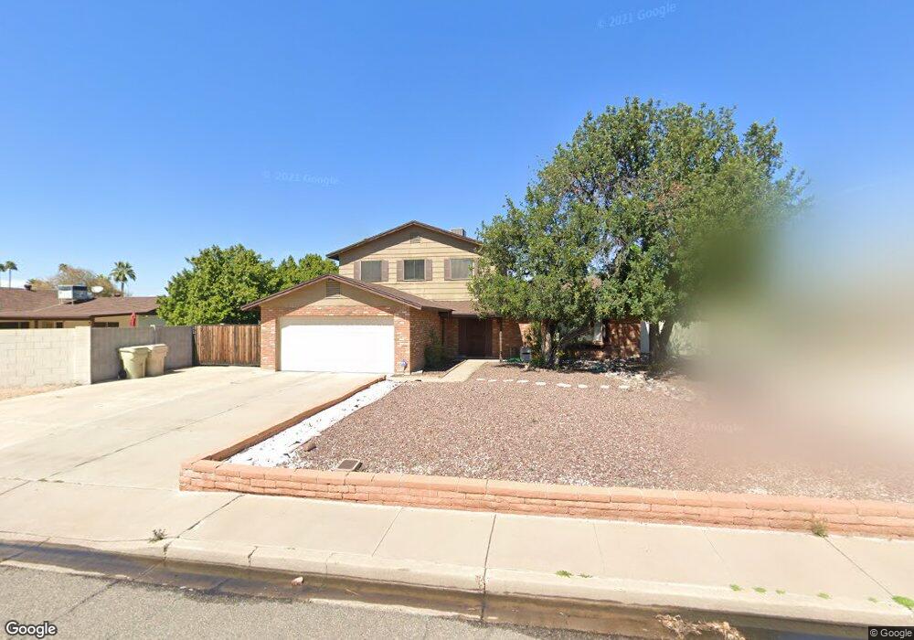
4926 W Mountain View Rd Glendale, AZ 85302
Estimated Value: $357,454 - $440,000
--
Bed
3
Baths
2,140
Sq Ft
$194/Sq Ft
Est. Value
About This Home
This home is located at 4926 W Mountain View Rd, Glendale, AZ 85302 and is currently estimated at $414,114, approximately $193 per square foot. 4926 W Mountain View Rd is a home located in Maricopa County with nearby schools including Sunset School, Cholla Middle School, and Apollo High School.
Ownership History
Date
Name
Owned For
Owner Type
Purchase Details
Closed on
Jul 18, 2005
Sold by
Timm David R and Timm Valerie Y
Bought by
Timmm David R and Timm Valerie Y
Current Estimated Value
Home Financials for this Owner
Home Financials are based on the most recent Mortgage that was taken out on this home.
Original Mortgage
$162,500
Outstanding Balance
$84,004
Interest Rate
5.51%
Mortgage Type
New Conventional
Estimated Equity
$330,111
Purchase Details
Closed on
May 7, 2002
Sold by
Hans Douglas R
Bought by
Timm David R and Hodge Valerie Y
Home Financials for this Owner
Home Financials are based on the most recent Mortgage that was taken out on this home.
Original Mortgage
$131,575
Interest Rate
7.13%
Mortgage Type
New Conventional
Create a Home Valuation Report for This Property
The Home Valuation Report is an in-depth analysis detailing your home's value as well as a comparison with similar homes in the area
Home Values in the Area
Average Home Value in this Area
Purchase History
| Date | Buyer | Sale Price | Title Company |
|---|---|---|---|
| Timmm David R | -- | Pioneer Title Agency Inc | |
| Timm David R | $138,500 | Grand Canyon Title Agency In |
Source: Public Records
Mortgage History
| Date | Status | Borrower | Loan Amount |
|---|---|---|---|
| Open | Timmm David R | $162,500 | |
| Closed | Timm David R | $131,575 |
Source: Public Records
Tax History Compared to Growth
Tax History
| Year | Tax Paid | Tax Assessment Tax Assessment Total Assessment is a certain percentage of the fair market value that is determined by local assessors to be the total taxable value of land and additions on the property. | Land | Improvement |
|---|---|---|---|---|
| 2025 | $1,425 | $13,546 | -- | -- |
| 2024 | $1,357 | $12,901 | -- | -- |
| 2023 | $1,357 | $30,460 | $6,090 | $24,370 |
| 2022 | $1,321 | $23,350 | $4,670 | $18,680 |
| 2021 | $1,364 | $22,400 | $4,480 | $17,920 |
| 2020 | $1,335 | $20,060 | $4,010 | $16,050 |
| 2019 | $1,317 | $17,950 | $3,590 | $14,360 |
| 2018 | $1,291 | $16,960 | $3,390 | $13,570 |
| 2017 | $1,295 | $16,630 | $3,320 | $13,310 |
| 2016 | $1,278 | $15,750 | $3,150 | $12,600 |
| 2015 | $1,218 | $15,820 | $3,160 | $12,660 |
Source: Public Records
Map
Nearby Homes
- 9441 N 49th Dr
- 4831 W Turquoise Ave
- 4831 W Brown St
- 4924 W Brown St
- 4942 W Brown St
- 4939 W Cheryl Dr
- 4933 W Cheryl Dr
- 4945 W Cheryl Dr
- 9827 N 47th Dr
- 9646 N 47th Ave
- 4932 W Cheryl Dr
- 4938 W Cheryl Dr
- 4930 W Beryl Ave
- 10044 N 47th Ave
- 9221 N 48th Dr
- 5209 W Palo Verde Ave
- 4775 W Mission Ln
- 5249 W Mountain View Rd
- 9060 N 47th Ln
- 9044 N 47th Ct
- 4920 W Mountain View Rd
- 9801 N 49th Ln
- 9807 N 49th Ln
- 4921 W Turquoise Ave
- 9818 N 49th Dr
- 4914 W Mountain View Rd
- 4915 W Turquoise Ave
- 4925 W Mountain View Rd
- 9813 N 49th Ln
- 4919 W Mountain View Rd
- 4931 W Mountain View Rd
- 4908 W Mountain View Rd
- 9824 N 49th Dr
- 4913 W Mountain View Rd
- 4937 W Mountain View Rd
- 4909 W Turquoise Ave
- 4907 W Mountain View Rd
- 4902 W Mountain View Rd Unit 5
- 9814 N 49th Ln
- 9808 N 49th Ln