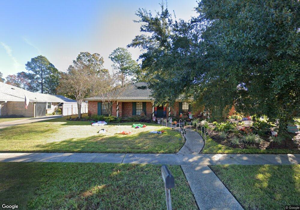
4927 Parkhurst Dr Baton Rouge, LA 70816
Shenandoah NeighborhoodEstimated Value: $258,000 - $292,000
4
Beds
3
Baths
2,664
Sq Ft
$102/Sq Ft
Est. Value
About This Home
This home is located at 4927 Parkhurst Dr, Baton Rouge, LA 70816 and is currently estimated at $271,214, approximately $101 per square foot. 4927 Parkhurst Dr is a home located in East Baton Rouge Parish with nearby schools including Parkview Elementary School, Woodlawn Middle School, and Woodlawn High School.
Ownership History
Date
Name
Owned For
Owner Type
Purchase Details
Closed on
Jun 27, 2005
Sold by
Mancuso Edward J
Bought by
Menou Ann P
Current Estimated Value
Home Financials for this Owner
Home Financials are based on the most recent Mortgage that was taken out on this home.
Original Mortgage
$166,355
Outstanding Balance
$87,400
Interest Rate
5.76%
Mortgage Type
New Conventional
Estimated Equity
$183,814
Create a Home Valuation Report for This Property
The Home Valuation Report is an in-depth analysis detailing your home's value as well as a comparison with similar homes in the area
Home Values in the Area
Average Home Value in this Area
Purchase History
| Date | Buyer | Sale Price | Title Company |
|---|---|---|---|
| Menou Ann P | $171,500 | -- |
Source: Public Records
Mortgage History
| Date | Status | Borrower | Loan Amount |
|---|---|---|---|
| Open | Menou Ann P | $166,355 |
Source: Public Records
Tax History Compared to Growth
Tax History
| Year | Tax Paid | Tax Assessment Tax Assessment Total Assessment is a certain percentage of the fair market value that is determined by local assessors to be the total taxable value of land and additions on the property. | Land | Improvement |
|---|---|---|---|---|
| 2024 | $2,174 | $25,300 | $2,400 | $22,900 |
| 2023 | $2,174 | $20,800 | $2,400 | $18,400 |
| 2022 | $2,484 | $20,800 | $2,400 | $18,400 |
| 2021 | $2,427 | $20,800 | $2,400 | $18,400 |
| 2020 | $2,457 | $20,800 | $2,400 | $18,400 |
| 2019 | $2,569 | $20,800 | $2,400 | $18,400 |
| 2018 | $2,538 | $20,800 | $2,400 | $18,400 |
| 2017 | $2,538 | $20,800 | $2,400 | $18,400 |
| 2016 | $1,680 | $20,800 | $2,400 | $18,400 |
| 2015 | $1,666 | $20,650 | $2,400 | $18,250 |
| 2014 | $1,661 | $20,650 | $2,400 | $18,250 |
| 2013 | -- | $20,650 | $2,400 | $18,250 |
Source: Public Records
Map
Nearby Homes
- 4726 Parkoaks Dr
- 12032 Mulberry Hill Ave
- 4624 Parkoaks Dr Unit 11
- 4624 Parkoaks Dr Unit 10
- 4625 Parkoaks Dr Unit 37
- 4412 Lake Lawford Ct
- 4412 Lake Larto Cir
- 5415 Heron Nest Dr
- 5402 Heron Landing Dr
- 12326 Lake Sherwood Ave S
- 4637 Tartan Dr
- 4920 Woodlyn Dr
- 4220 Lake Sherwood Ave E
- 4808 Doral Dr
- 12111 Lake Sherwood Ave N
- 5130 Stumberg Ln
- 12028 Lake Sherwood Ave N
- 12525 Parkknoll Ave
- 11834 Parkview Ct Unit D
- 5224 Stumberg Ln Unit B
- 4931 Parkhurst Dr
- 4916 Parkhollow Dr
- 4901 Parkhurst Dr
- 11974 Parkmount Blvd
- 4924 Parkhollow Dr
- 4937 Parkhurst Dr
- 4902 Parkhollow Dr
- 11995 Parkbrook Ave
- 4944 Parkhollow Dr
- 11962 Parkmount Blvd
- 4871 Parkhurst Dr
- 5013 Parkhurst Dr
- 11975 Parkbrook Ave
- 4961 Sweet Birch Dr
- 4966 Parkhollow Dr
- 4955 Sweet Birch Dr
- 11959 Parkmount Blvd
- 11952 Parkmount Blvd
- 4949 Sweet Birch Dr
- 4911 Parkhollow Dr