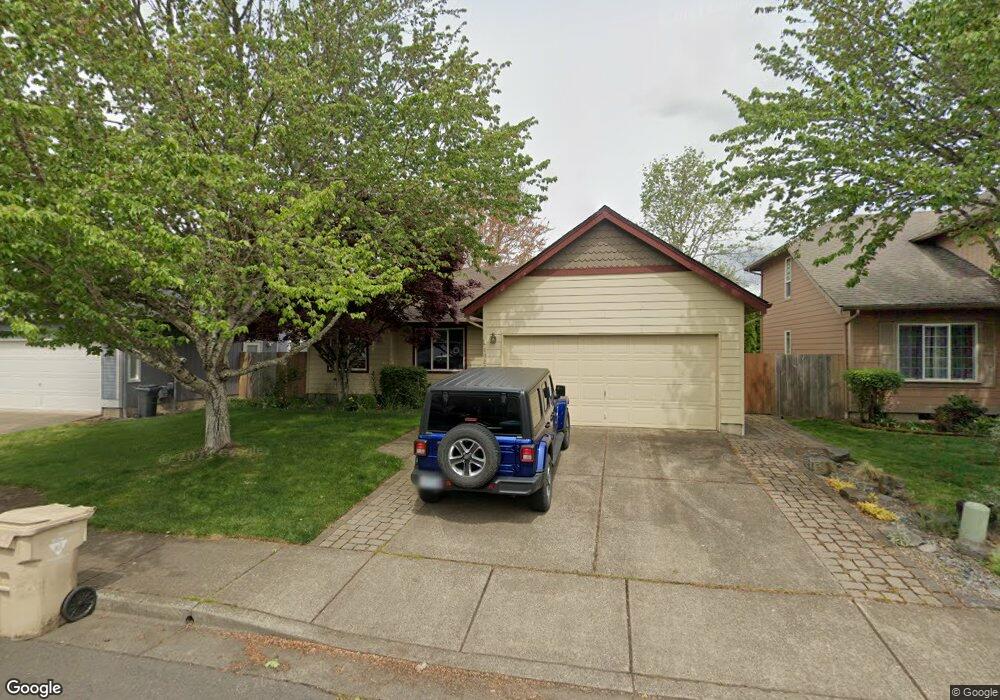
4927 SW Aster St Corvallis, OR 97333
Southwest Corvallis NeighborhoodEstimated Value: $476,000 - $516,000
3
Beds
2
Baths
1,386
Sq Ft
$360/Sq Ft
Est. Value
About This Home
This home is located at 4927 SW Aster St, Corvallis, OR 97333 and is currently estimated at $498,327, approximately $359 per square foot. 4927 SW Aster St is a home located in Benton County with nearby schools including Adams Elementary School, Linus Pauling Middle School, and Corvallis High School.
Ownership History
Date
Name
Owned For
Owner Type
Purchase Details
Closed on
Sep 17, 2003
Sold by
Robinson Michael F and Robinson Nancy K
Bought by
King Shawn K
Current Estimated Value
Home Financials for this Owner
Home Financials are based on the most recent Mortgage that was taken out on this home.
Original Mortgage
$143,500
Outstanding Balance
$66,307
Interest Rate
6.3%
Mortgage Type
Purchase Money Mortgage
Estimated Equity
$432,020
Purchase Details
Closed on
Mar 20, 2001
Sold by
Leno Janice R
Bought by
Robinson Michael F and Robinson Nancy K
Create a Home Valuation Report for This Property
The Home Valuation Report is an in-depth analysis detailing your home's value as well as a comparison with similar homes in the area
Home Values in the Area
Average Home Value in this Area
Purchase History
| Date | Buyer | Sale Price | Title Company |
|---|---|---|---|
| King Shawn K | $159,500 | Fidelity Natl Title Co Of Or | |
| Robinson Michael F | $159,000 | Ticor Title Insurance Compan |
Source: Public Records
Mortgage History
| Date | Status | Borrower | Loan Amount |
|---|---|---|---|
| Open | King Shawn K | $143,500 |
Source: Public Records
Tax History Compared to Growth
Tax History
| Year | Tax Paid | Tax Assessment Tax Assessment Total Assessment is a certain percentage of the fair market value that is determined by local assessors to be the total taxable value of land and additions on the property. | Land | Improvement |
|---|---|---|---|---|
| 2025 | $5,098 | $273,323 | -- | -- |
| 2024 | $5,098 | $265,362 | -- | -- |
| 2023 | $4,800 | $257,633 | $0 | $0 |
| 2022 | $4,660 | $250,129 | $0 | $0 |
| 2021 | $4,505 | $242,844 | $0 | $0 |
| 2020 | $4,481 | $235,771 | $0 | $0 |
| 2019 | $4,118 | $228,904 | $0 | $0 |
| 2018 | $4,152 | $222,237 | $0 | $0 |
| 2017 | $3,710 | $215,764 | $0 | $0 |
| 2016 | $3,648 | $209,480 | $0 | $0 |
| 2015 | $3,541 | $203,379 | $0 | $0 |
| 2014 | $3,440 | $197,455 | $0 | $0 |
| 2012 | -- | $186,120 | $0 | $0 |
Source: Public Records
Map
Nearby Homes
- 4900 SW Hollyhock Cir
- 4651 SW 47th Place
- 4942 SW Hollyhock Cir
- 5300 SW Whitby Ave
- 5636 SW Avena Place
- 4968 SW Kara Ave
- 5935 SW Philomath Bl
- Parcel #142681 SW Gerold St
- 0 SW Gerold St
- 1140 SW Sylvia St
- 1045 SW 53rd St
- 4525 SW Nash Ave
- 1124 SW Sylvia St
- 1050 SW Timian St
- 1123 SW Sylvia St
- 4530 SW Nash (Next To) Ave
- 4149 SW Research Way
- 2520 SW Whiteside Dr
- 3475 SW Buckeye Place
- 2829 SW Wolverine Dr
- 4919 SW Aster St
- 4935 SW Aster St
- 4928 SW Roseberry St
- 4920 SW Roseberry St
- 4911 SW Aster St
- 4941 SW Aster St
- 4926 SW Aster St
- 4918 SW Aster St
- 4912 SW Roseberry St
- 4934 SW Aster St
- 4942 SW Roseberry St
- 4949 SW Aster St
- 4901 SW Aster St
- 4910 SW Aster St
- 4940 SW Aster St
- 4904 SW Roseberry St
- 4948 SW Aster St
- 4902 SW Aster St
- 4929 SW Roseberry St
- 4957 SW Aster St