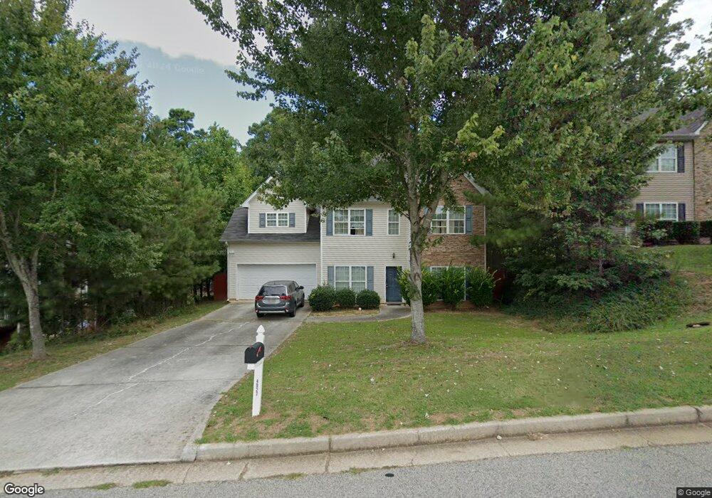
4927 Wexford Trail Atlanta, GA 30349
Estimated Value: $271,000 - $336,000
4
Beds
3
Baths
1,976
Sq Ft
$149/Sq Ft
Est. Value
About This Home
This home is located at 4927 Wexford Trail, Atlanta, GA 30349 and is currently estimated at $294,861, approximately $149 per square foot. 4927 Wexford Trail is a home located in Fulton County with nearby schools including Liberty Point Elementary School, Camp Creek Middle School, and Langston Hughes High School.
Ownership History
Date
Name
Owned For
Owner Type
Purchase Details
Closed on
Jun 4, 2010
Sold by
Demetrius Nick C
Bought by
Crystal Sarah R
Current Estimated Value
Home Financials for this Owner
Home Financials are based on the most recent Mortgage that was taken out on this home.
Original Mortgage
$80,910
Outstanding Balance
$54,624
Interest Rate
5.12%
Mortgage Type
FHA
Estimated Equity
$240,237
Purchase Details
Closed on
Nov 18, 2009
Sold by
Morgan Stanle Trust 2006 & Nc2
Bought by
Demetrius Nick C
Purchase Details
Closed on
Nov 4, 2008
Sold by
Cornelius Dorothea
Bought by
Morgan Stanley Trust 2006 & Nc2
Create a Home Valuation Report for This Property
The Home Valuation Report is an in-depth analysis detailing your home's value as well as a comparison with similar homes in the area
Home Values in the Area
Average Home Value in this Area
Purchase History
| Date | Buyer | Sale Price | Title Company |
|---|---|---|---|
| Crystal Sarah R | $82,000 | -- | |
| Demetrius Nick C | $40,000 | -- | |
| Morgan Stanley Trust 2006 & Nc2 | $100,000 | -- |
Source: Public Records
Mortgage History
| Date | Status | Borrower | Loan Amount |
|---|---|---|---|
| Open | Crystal Sarah R | $80,910 |
Source: Public Records
Tax History Compared to Growth
Tax History
| Year | Tax Paid | Tax Assessment Tax Assessment Total Assessment is a certain percentage of the fair market value that is determined by local assessors to be the total taxable value of land and additions on the property. | Land | Improvement |
|---|---|---|---|---|
| 2025 | $1,040 | $110,200 | $31,720 | $78,480 |
| 2023 | $3,111 | $110,200 | $31,720 | $78,480 |
| 2022 | $951 | $85,160 | $18,720 | $66,440 |
| 2021 | $924 | $69,880 | $15,040 | $54,840 |
| 2020 | $923 | $67,080 | $14,600 | $52,480 |
| 2019 | $1,117 | $54,440 | $8,880 | $45,560 |
| 2018 | $2,116 | $53,160 | $8,680 | $44,480 |
| 2017 | $1,381 | $33,880 | $3,600 | $30,280 |
| 2016 | $1,381 | $33,880 | $3,600 | $30,280 |
| 2015 | $1,385 | $33,880 | $3,600 | $30,280 |
| 2014 | $1,183 | $27,440 | $4,760 | $22,680 |
Source: Public Records
Map
Nearby Homes
- 4830 Station Ln
- 4832 Station Ln Unit 12
- 4861 Wexford Trail
- 4834 Station Ln Unit 13
- 4834 Station Ln
- 4836 Station Ln Unit 14
- 5565 Mason Rd Unit REAR
- 4838 Station Ln
- 4838 Station Ln Unit 15
- 4840 Station Ln
- 4822 Station Ln
- 4818 Station Ln
- 4817 Station Ln Unit 32
- 4814 Station Ln
- 4813 Station Ln
- 4811 Station Ln
- 310 Wolf Downs Way
- Nelson Plan at The Enclave at Stonewall Station
- Cecil Plan at The Enclave at Stonewall Station
- 5435 Forest Downs Cir
- 4921 Wexford Trail
- 4933 Wexford Trail
- 4939 Wexford Trail
- 4925 Sierra Way Unit Room 1
- 4925 Sierra Way Unit Room 3
- 4925 Sierra Way
- 4925 Sierra Way Unit 4925
- 4828 Station Ln Unit 29
- 4921 Sierra Way
- 4926 Wexford Trail
- 4917 Sierra Way
- 4932 Wexford Trail Unit 1
- 4932 Wexford Trail
- 4913 Sierra Way
- 4945 Wexford Trail
- 4909 Wexford Trail
- 4938 Wexford Trail
- 4826 Station Ln Unit 9
- 4830 Station Ln Unit 11
- 4944 Wexford Trail
