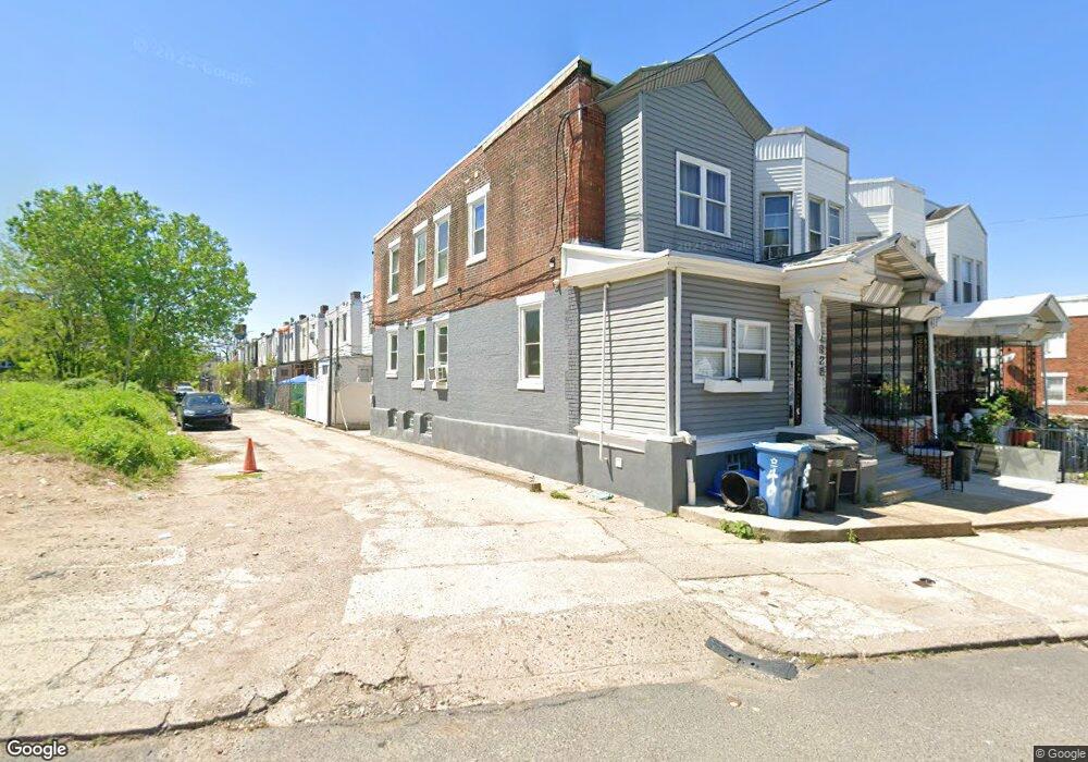
4928 N Front St Philadelphia, PA 19120
Olney NeighborhoodEstimated Value: $157,226 - $195,000
--
Bed
--
Bath
1,302
Sq Ft
$133/Sq Ft
Est. Value
About This Home
This home is located at 4928 N Front St, Philadelphia, PA 19120 and is currently estimated at $173,557, approximately $133 per square foot. 4928 N Front St is a home located in Philadelphia County with nearby schools including Olney Elementary School, Olney Charter High School, and Olney Christian School.
Ownership History
Date
Name
Owned For
Owner Type
Purchase Details
Closed on
Jul 30, 2003
Sold by
Mermelstein Soloman and Active Realty Co Profit Sharin
Bought by
Wakefield Courtney
Current Estimated Value
Home Financials for this Owner
Home Financials are based on the most recent Mortgage that was taken out on this home.
Original Mortgage
$47,096
Outstanding Balance
$20,225
Interest Rate
5.28%
Mortgage Type
FHA
Estimated Equity
$153,332
Create a Home Valuation Report for This Property
The Home Valuation Report is an in-depth analysis detailing your home's value as well as a comparison with similar homes in the area
Home Values in the Area
Average Home Value in this Area
Purchase History
| Date | Buyer | Sale Price | Title Company |
|---|---|---|---|
| Wakefield Courtney | $47,000 | -- |
Source: Public Records
Mortgage History
| Date | Status | Borrower | Loan Amount |
|---|---|---|---|
| Open | Wakefield Courtney | $47,096 |
Source: Public Records
Tax History Compared to Growth
Tax History
| Year | Tax Paid | Tax Assessment Tax Assessment Total Assessment is a certain percentage of the fair market value that is determined by local assessors to be the total taxable value of land and additions on the property. | Land | Improvement |
|---|---|---|---|---|
| 2025 | $1,400 | $132,100 | $26,420 | $105,680 |
| 2024 | $1,400 | $132,100 | $26,420 | $105,680 |
| 2023 | $1,400 | $100,000 | $20,000 | $80,000 |
| 2022 | $412 | $55,000 | $20,000 | $35,000 |
| 2021 | $1,041 | $0 | $0 | $0 |
| 2020 | $1,041 | $0 | $0 | $0 |
| 2019 | $969 | $0 | $0 | $0 |
| 2018 | $966 | $0 | $0 | $0 |
| 2017 | $966 | $0 | $0 | $0 |
| 2016 | $546 | $0 | $0 | $0 |
| 2015 | $523 | $0 | $0 | $0 |
| 2014 | -- | $69,000 | $6,003 | $62,997 |
| 2012 | -- | $7,168 | $1,741 | $5,427 |
Source: Public Records
Map
Nearby Homes
- 4941 N Front St
- 156 W Albanus St
- 124 E Ruscomb St
- 149 W Roosevelt Blvd
- 151 W Roosevelt Blvd
- 153 W Roosevelt Blvd
- 155 W Roosevelt Blvd
- 157 W Roosevelt Blvd
- 159 W Roosevelt Blvd
- 161 W Roosevelt Blvd
- 4844 N Front St
- 163 W Roosevelt Blvd
- 218 E Roosevelt Blvd
- 216 E Roosevelt Blvd
- 252 E Albanus St
- 151 E Duncannon Ave
- 4916 B St
- 207 W Albanus St
- 239 E Eleanor St
- 5002 Ormes St
- 4930 N Front St
- 4932 N Front St
- 112 W Albanus St
- 4934 N Front St
- 114 W Albanus St
- 116 W Albanus St
- 118 W Albanus St
- 120 W Albanus St
- 4936 N Front St
- 122 W Albanus St
- 95 E Roosevelt Blvd
- 109 W Albanus St
- 124 W Albanus St
- 101 E Roosevelt Blvd
- 113 W Albanus St
- 111 W Albanus St
- 4938 N Front St
- 126 W Albanus St
- 115 W Albanus St
- 117 W Albanus St