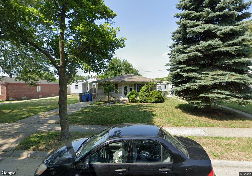
4928 Westpoint St Dearborn Heights, MI 48125
Estimated Value: $153,000 - $177,000
3
Beds
1
Bath
1,020
Sq Ft
$160/Sq Ft
Est. Value
About This Home
This home is located at 4928 Westpoint St, Dearborn Heights, MI 48125 and is currently estimated at $162,827, approximately $159 per square foot. 4928 Westpoint St is a home located in Wayne County with nearby schools including Polk Elementary School, Bedford School, and Pardee School.
Ownership History
Date
Name
Owned For
Owner Type
Purchase Details
Closed on
Sep 7, 2023
Sold by
Paquin Edward Joseph
Bought by
Paquin Dennis Ray
Current Estimated Value
Purchase Details
Closed on
Nov 12, 2015
Sold by
Djerisilo Marjan
Bought by
Mmd Llc
Purchase Details
Closed on
Oct 11, 2013
Sold by
Wayne County Treasurer
Bought by
Djerisilo Marjan
Purchase Details
Closed on
Aug 7, 2003
Sold by
Borg Joseph V and Borg Diane
Bought by
Lazarski Ryan
Purchase Details
Closed on
Jun 18, 2002
Sold by
Folo Suzanne P
Bought by
Borg Joseph
Home Financials for this Owner
Home Financials are based on the most recent Mortgage that was taken out on this home.
Original Mortgage
$116,176
Interest Rate
6.32%
Mortgage Type
Purchase Money Mortgage
Purchase Details
Closed on
Mar 30, 1998
Sold by
Goike Debbie A and Goike John C
Bought by
Follo Suzanne P
Create a Home Valuation Report for This Property
The Home Valuation Report is an in-depth analysis detailing your home's value as well as a comparison with similar homes in the area
Home Values in the Area
Average Home Value in this Area
Purchase History
| Date | Buyer | Sale Price | Title Company |
|---|---|---|---|
| Paquin Dennis Ray | -- | None Listed On Document | |
| Mmd Llc | -- | Attorney | |
| Djerisilo Marjan | $41,000 | None Available | |
| Lazarski Ryan | $112,000 | Multiple | |
| Borg Joseph | $118,000 | -- | |
| Follo Suzanne P | $77,000 | -- |
Source: Public Records
Mortgage History
| Date | Status | Borrower | Loan Amount |
|---|---|---|---|
| Previous Owner | Borg Joseph | $116,176 |
Source: Public Records
Tax History Compared to Growth
Tax History
| Year | Tax Paid | Tax Assessment Tax Assessment Total Assessment is a certain percentage of the fair market value that is determined by local assessors to be the total taxable value of land and additions on the property. | Land | Improvement |
|---|---|---|---|---|
| 2025 | $1,504 | $66,000 | $0 | $0 |
| 2024 | $1,504 | $60,400 | $0 | $0 |
| 2023 | $1,424 | $52,800 | $0 | $0 |
| 2022 | $2,127 | $46,600 | $0 | $0 |
| 2021 | $2,113 | $42,500 | $0 | $0 |
| 2019 | $2,030 | $35,600 | $0 | $0 |
| 2018 | $1,277 | $31,500 | $0 | $0 |
| 2017 | $1,414 | $28,700 | $0 | $0 |
| 2016 | $2,178 | $27,500 | $0 | $0 |
| 2015 | $2,620 | $26,200 | $0 | $0 |
| 2013 | $2,720 | $27,800 | $0 | $0 |
| 2010 | -- | $35,900 | $0 | $0 |
Source: Public Records
Map
Nearby Homes
- 4901 Cornell St
- 4665 Syracuse St
- 24117 Eton Ave
- 24035 Currier St
- 4489 Westpoint St
- 4506 Syracuse St
- 4474 Syracuse St
- 5689 Cornell St
- 5671 Syracuse St
- 24339 Eton Ave
- 24360 Pennie St
- 4193 Cornell St
- 4449 Academy St
- 24443 Powers Ave
- 23214 S Brookside Dr
- 5908 Pine St
- 24426 Lehigh St
- 4459 Parker St
- 24409 Stanford St
- 5954 Pine St
- 4918 Westpoint St
- 4944 Westpoint St
- 4910 Westpoint St
- 4936 Westpoint St
- 4970 Westpoint St
- 4902 Westpoint St
- 4996 Westpoint St
- 4929 S Telegraph Rd
- 5106 Westpoint St
- 4927 Westpoint St
- 4945 Westpoint St
- 5116 Westpoint St
- 4971 Westpoint St
- 4903 Westpoint St
- 5079 Westpoint St
- 4706 Westpoint St
- 0 Pennie St
- 5117 Westpoint St
- 4715 Westpoint St
- 4698 Westpoint St