Estimated Value: $297,000 - $319,853
1
Bed
2
Baths
1,776
Sq Ft
$173/Sq Ft
Est. Value
About This Home
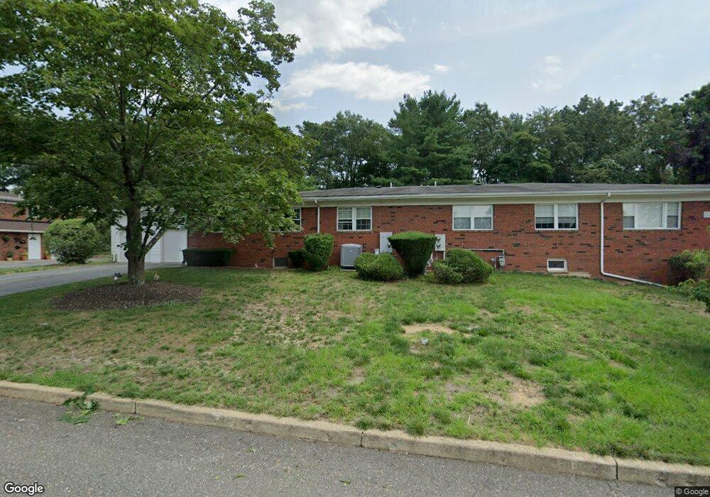
This home is located at 492D Laurel Brook Dr Unit D, Brick, NJ 08724 and is currently estimated at $307,713, approximately $173 per square foot. 492D Laurel Brook Dr Unit D is a home located in Ocean County with nearby schools including Emma Havens Young Elementary School, Lake Riviera Middle School, and Brick Township High School.
Ownership History
Date
Name
Owned For
Owner Type
Purchase Details
Closed on
Sep 1, 2015
Sold by
Kehoe Deborah A
Bought by
Weekes Sinclair and Weekes Dane
Current Estimated Value
Purchase Details
Closed on
Apr 15, 2011
Sold by
Smith Thomas J
Bought by
Kehoe Deborah A
Home Financials for this Owner
Home Financials are based on the most recent Mortgage that was taken out on this home.
Original Mortgage
$122,400
Interest Rate
4.9%
Mortgage Type
New Conventional
Purchase Details
Closed on
Oct 30, 2001
Sold by
Holoway John
Bought by
Smith Thomas
Home Financials for this Owner
Home Financials are based on the most recent Mortgage that was taken out on this home.
Original Mortgage
$91,900
Interest Rate
6.66%
Create a Home Valuation Report for This Property
The Home Valuation Report is an in-depth analysis detailing your home's value as well as a comparison with similar homes in the area
Home Values in the Area
Average Home Value in this Area
Purchase History
| Date | Buyer | Sale Price | Title Company |
|---|---|---|---|
| Weekes Sinclair | $135,000 | Agent For Westcor Land Title | |
| Kehoe Deborah A | $155,000 | None Available | |
| Smith Thomas | $114,900 | -- |
Source: Public Records
Mortgage History
| Date | Status | Borrower | Loan Amount |
|---|---|---|---|
| Previous Owner | Kehoe Deborah A | $122,400 | |
| Previous Owner | Smith Thomas | $91,900 |
Source: Public Records
Tax History
| Year | Tax Paid | Tax Assessment Tax Assessment Total Assessment is a certain percentage of the fair market value that is determined by local assessors to be the total taxable value of land and additions on the property. | Land | Improvement |
|---|---|---|---|---|
| 2025 | $4,309 | $165,100 | $85,000 | $80,100 |
| 2024 | $4,090 | $165,100 | $85,000 | $80,100 |
Source: Public Records
Map
Nearby Homes
- 470A Laurel Brook Dr Unit 4401
- 470 Laurel Brook Dr
- 6B Court M Unit 5902
- 12 D Trail
- 1595 Forge Pond Rd
- 1635 Forge Pond Rd
- 1651 Forge Pond Rd
- 1648 Harvard Ave
- 6 Lisa Dr
- 55 Tony Ct
- 39 Marlow Ave
- 42 Sidney Ct
- 37 Central Blvd
- 53 Albert Cucci Dr
- 1418 Forest Ave
- 25 Whitman St
- 56 Joseph Byrne Dr
- 19 Ashwood Dr
- 159 Clay Cir
- 305 Spirit Way
- 492D Laurel Brook Dr Unit 4004
- 492C Laurel Brook Dr
- 486A Laurel Brook Dr Unit 40A
- 486B Laurel Brook Dr
- 494B Laurel Brook Dr
- 494B Laurel Brook Dr Unit 3802
- 494A Laurel Brook Dr
- 15 Court E Unit A
- 15 Court E Unit A
- 15 Court E Unit A
- 15 Court E Unit F
- 482C Laurel Brook Dr Unit 42C
- 482D Laurel Brook Dr
- 498D Laurel Brook Dr
- 489B Laurel Brook Dr
- 489A Laurel Brook Dr Unit 37A
- 489A Laurel Brook Dr Unit 3701
- 478B Laurel Brook Dr
- 478B Laurel Brook Dr Unit 4202
- 478A Laurel Brook Dr Unit A42
Your Personal Tour Guide
Ask me questions while you tour the home.