Estimated Value: $424,000 - $476,000
2
Beds
1
Bath
1,077
Sq Ft
$413/Sq Ft
Est. Value
About This Home
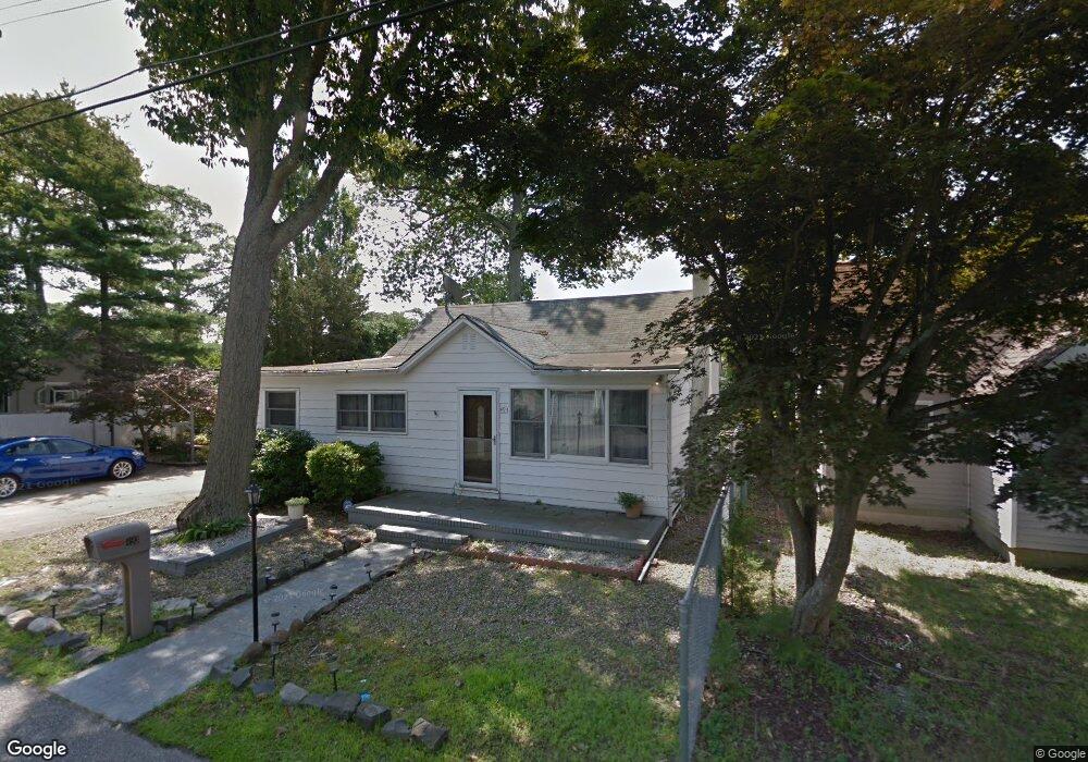
This home is located at 493 Riverside Dr S, Brick, NJ 08723 and is currently estimated at $444,913, approximately $413 per square foot. 493 Riverside Dr S is a home located in Ocean County with nearby schools including Emma Havens Young Elementary School, Lake Riviera Middle School, and Brick Township High School.
Ownership History
Date
Name
Owned For
Owner Type
Purchase Details
Closed on
Nov 30, 2011
Sold by
Scheidt Frank R and Scheidt Elaine
Bought by
Kannheiser Kristina L
Current Estimated Value
Home Financials for this Owner
Home Financials are based on the most recent Mortgage that was taken out on this home.
Original Mortgage
$180,310
Outstanding Balance
$123,344
Interest Rate
4.01%
Mortgage Type
FHA
Estimated Equity
$321,569
Create a Home Valuation Report for This Property
The Home Valuation Report is an in-depth analysis detailing your home's value as well as a comparison with similar homes in the area
Home Values in the Area
Average Home Value in this Area
Purchase History
| Date | Buyer | Sale Price | Title Company |
|---|---|---|---|
| Kannheiser Kristina L | $185,000 | None Available |
Source: Public Records
Mortgage History
| Date | Status | Borrower | Loan Amount |
|---|---|---|---|
| Open | Kannheiser Kristina L | $180,310 |
Source: Public Records
Tax History Compared to Growth
Tax History
| Year | Tax Paid | Tax Assessment Tax Assessment Total Assessment is a certain percentage of the fair market value that is determined by local assessors to be the total taxable value of land and additions on the property. | Land | Improvement |
|---|---|---|---|---|
| 2025 | $5,739 | $222,200 | $140,500 | $81,700 |
| 2024 | $5,455 | $222,200 | $140,500 | $81,700 |
| 2023 | $5,384 | $222,200 | $140,500 | $81,700 |
| 2022 | $5,384 | $222,200 | $140,500 | $81,700 |
| 2021 | $5,271 | $222,200 | $140,500 | $81,700 |
| 2020 | $5,204 | $222,200 | $140,500 | $81,700 |
| 2019 | $5,117 | $222,200 | $140,500 | $81,700 |
| 2018 | $5,000 | $222,200 | $140,500 | $81,700 |
| 2017 | $4,864 | $222,200 | $140,500 | $81,700 |
| 2016 | $4,840 | $222,200 | $140,500 | $81,700 |
| 2015 | $4,713 | $222,200 | $140,500 | $81,700 |
| 2014 | $4,675 | $222,200 | $140,500 | $81,700 |
Source: Public Records
Map
Nearby Homes
- 495 Pinecroft Dr
- 0 Mantoloking Rd Unit 11584872
- 507 Riverside Dr S
- 474 Burnt Bark Rd
- 470 Mantoloking Rd
- 10 Riverside Dr W
- 484 Bara St
- 82 E View Dr
- 553 Kingfisher Cr
- 553 Kingfisher Cir
- 53 Country Club Ct
- 570 Mantoloking Rd
- 15 Hulse Landing Rd
- 417 Mamie Dr
- 00 Mantoloking Rd
- VZ0 Mantoloking Rd
- 463 Mamie Dr
- 455 Mamie Dr
- 42 Arbutus Ave
- 595 Kingfisher Cir
- 495 Riverside Dr S
- 489 Riverside Dr S
- 492 Pinecroft Dr
- 497 Riverside Dr S
- 496 Pinecroft Dr
- 494 Riverside Dr S
- 498 Pinecroft Dr
- 492 Riverside Dr S
- 490 Pinecroft Dr
- 485 Riverside Dr S
- 499 Riverside Dr S
- 498 Riverside Dr S
- 486 Pinecroft Dr
- 19 Vanada Dr
- 23 Riverside Dr E
- 500 Riverside Dr S
- 30 Riverside Dr E
- 22 Tall Timber Dr
- 491 Pinecroft Dr
- 493 Pinecroft Dr