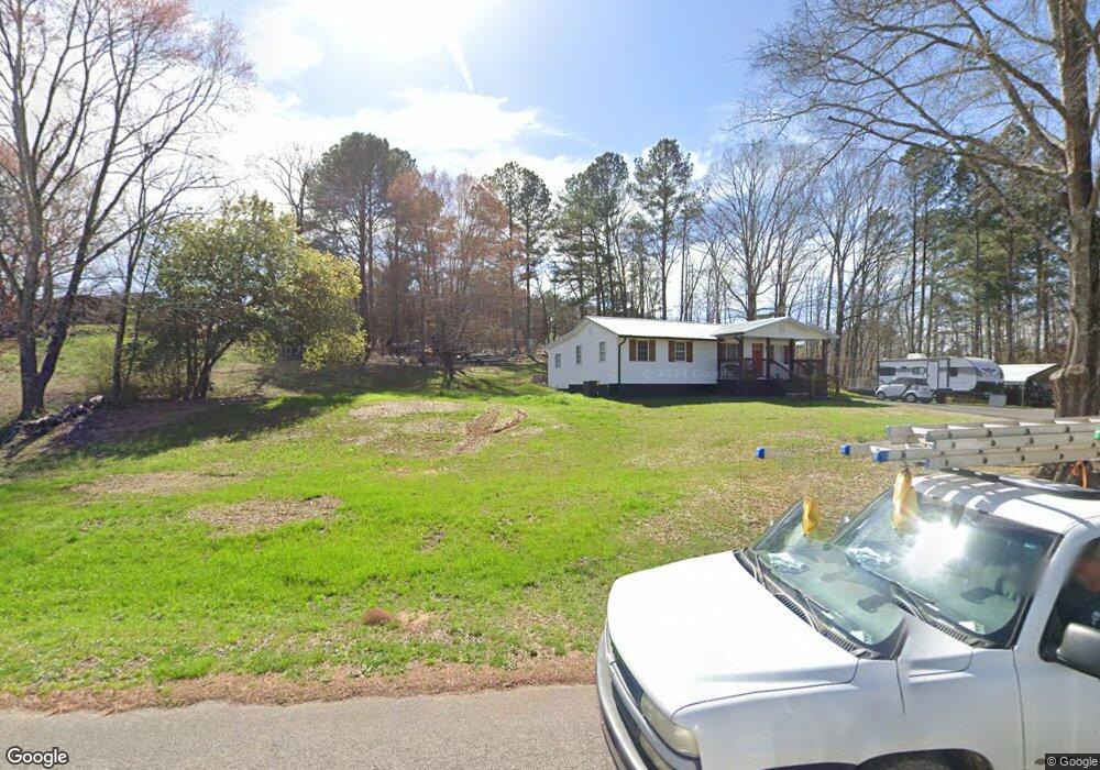
493 Runyon Rd Cedartown, GA 30125
Estimated Value: $176,146 - $213,000
3
Beds
1
Bath
1,260
Sq Ft
$158/Sq Ft
Est. Value
About This Home
This home is located at 493 Runyon Rd, Cedartown, GA 30125 and is currently estimated at $199,037, approximately $157 per square foot. 493 Runyon Rd is a home.
Ownership History
Date
Name
Owned For
Owner Type
Purchase Details
Closed on
Oct 1, 2020
Sold by
Ashley Brenda
Bought by
Ashley Jeffrey Brenton
Current Estimated Value
Purchase Details
Closed on
Aug 31, 2012
Sold by
Stubbs Leonard J
Bought by
Ashley Brenda
Purchase Details
Closed on
Dec 31, 2009
Sold by
Lackey Diane
Bought by
Stubbs Leonard
Purchase Details
Closed on
Oct 2, 2009
Sold by
Stubbs Ruth G
Bought by
Stubbs Leonard
Purchase Details
Closed on
Nov 6, 1980
Sold by
Stubbs John and Stubbs Ruth
Bought by
Stubbs Ruth
Purchase Details
Closed on
May 1, 1969
Bought by
Stubbs John and Stubbs Ruth
Create a Home Valuation Report for This Property
The Home Valuation Report is an in-depth analysis detailing your home's value as well as a comparison with similar homes in the area
Home Values in the Area
Average Home Value in this Area
Purchase History
| Date | Buyer | Sale Price | Title Company |
|---|---|---|---|
| Ashley Jeffrey Brenton | -- | -- | |
| Ashley Brenda | $70,000 | -- | |
| Stubbs Leonard | -- | -- | |
| Stubbs Leonard | -- | -- | |
| Stubbs Ruth | -- | -- | |
| Stubbs John | -- | -- |
Source: Public Records
Tax History Compared to Growth
Tax History
| Year | Tax Paid | Tax Assessment Tax Assessment Total Assessment is a certain percentage of the fair market value that is determined by local assessors to be the total taxable value of land and additions on the property. | Land | Improvement |
|---|---|---|---|---|
| 2024 | $783 | $37,471 | $5,223 | $32,248 |
| 2023 | $606 | $25,555 | $5,223 | $20,332 |
| 2022 | $495 | $20,844 | $3,482 | $17,362 |
| 2021 | $501 | $20,844 | $3,482 | $17,362 |
| 2020 | $502 | $20,844 | $3,482 | $17,362 |
| 2019 | $418 | $15,569 | $3,482 | $12,087 |
| 2018 | $418 | $15,159 | $3,482 | $11,677 |
| 2017 | $413 | $15,159 | $3,482 | $11,677 |
| 2016 | $388 | $14,256 | $2,579 | $11,677 |
| 2015 | $392 | $14,371 | $2,579 | $11,792 |
| 2014 | $395 | $14,371 | $2,579 | $11,792 |
Source: Public Records
Map
Nearby Homes
- 0 Runyon Loop Unit 10606366
- 0 Runyon Loop Unit 7650113
- 176 Runyon Loop
- 0 Everett Mtn Rd
- 600 Grady Rd
- 470 Knight Rd
- 394 Knight Rd
- 0 Hightower Rd Unit 10584768
- 0 Hightower Rd Unit 7633002
- 0 Hightower Rd Unit 10584778
- 0 Hightower Rd Unit 7632982
- 1838 Antioch Rd
- 160 Tate Rd
- 3323 Rockmart Hwy
- 1912 Hightower Rd
- 94 Wimberly Hill Loop
- 728 Hutto Rd
- 1907 Old Cedartown Rd
- 200 Kelly Rd
- 2020 Old Cedartown Rd
- 469 Runyon Rd
- 571 Runyon Rd
- 429 Runyon Rd
- 370 Runyon Rd
- 329 Runyon Rd
- 383 Runyon Rd
- 382 Runyon Loop
- 406 Runyon Rd
- 409 Runyon Rd
- 2 Runyon Loop
- 0 Runyon Loop Unit 4 7151281
- 0 Runyon Loop Unit 5 7151282
- 0 Runyon Loop Unit 3 7151248
- 0 Runyon Loop Unit 5 3188672
- 0 Runyon Loop Unit 3 3188670
- 0 Runyon Loop Unit 1 3188658
- 0 Runyon Loop Unit 4 3188671
- 0 Runyon Loop Unit 7073868
- 0 Runyon Loop Unit 1 7150769
- 0 Runyon Loop