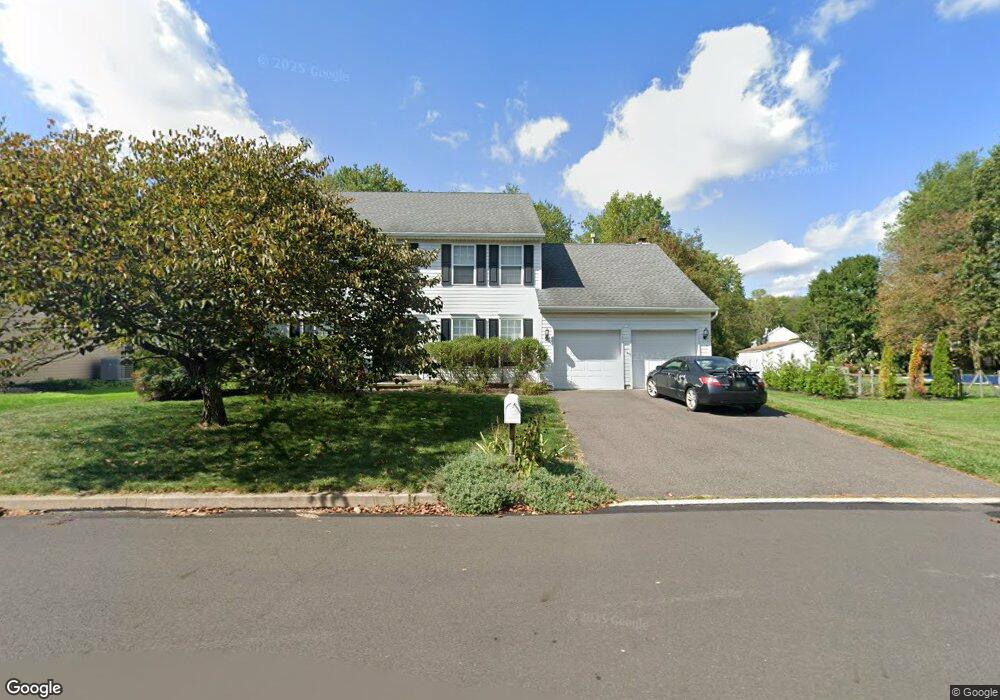
4930 Crosspoint Dr Doylestown, PA 18902
Estimated Value: $797,753 - $860,000
4
Beds
3
Baths
2,596
Sq Ft
$320/Sq Ft
Est. Value
About This Home
This home is located at 4930 Crosspoint Dr, Doylestown, PA 18902 and is currently estimated at $829,438, approximately $319 per square foot. 4930 Crosspoint Dr is a home located in Bucks County with nearby schools including Cold Spring Elementary School, Holicong Middle School, and Central Bucks High School - East.
Ownership History
Date
Name
Owned For
Owner Type
Purchase Details
Closed on
Jul 15, 1996
Sold by
Barnside Development Company Lp
Bought by
Wenick Barry R and Wenick Lisa G
Current Estimated Value
Home Financials for this Owner
Home Financials are based on the most recent Mortgage that was taken out on this home.
Original Mortgage
$200,700
Interest Rate
8.37%
Mortgage Type
Balloon
Create a Home Valuation Report for This Property
The Home Valuation Report is an in-depth analysis detailing your home's value as well as a comparison with similar homes in the area
Home Values in the Area
Average Home Value in this Area
Purchase History
| Date | Buyer | Sale Price | Title Company |
|---|---|---|---|
| Wenick Barry R | -- | -- |
Source: Public Records
Mortgage History
| Date | Status | Borrower | Loan Amount |
|---|---|---|---|
| Closed | Wenick Barry R | $200,700 |
Source: Public Records
Tax History Compared to Growth
Tax History
| Year | Tax Paid | Tax Assessment Tax Assessment Total Assessment is a certain percentage of the fair market value that is determined by local assessors to be the total taxable value of land and additions on the property. | Land | Improvement |
|---|---|---|---|---|
| 2025 | $7,268 | $44,640 | $10,280 | $34,360 |
| 2024 | $7,268 | $44,640 | $10,280 | $34,360 |
| 2023 | $7,021 | $44,640 | $10,280 | $34,360 |
| 2022 | $6,938 | $44,640 | $10,280 | $34,360 |
| 2021 | $6,854 | $44,640 | $10,280 | $34,360 |
| 2020 | $6,854 | $44,640 | $10,280 | $34,360 |
| 2019 | $6,810 | $44,640 | $10,280 | $34,360 |
| 2018 | $6,810 | $44,640 | $10,280 | $34,360 |
| 2017 | $6,754 | $44,640 | $10,280 | $34,360 |
| 2016 | $6,821 | $44,640 | $10,280 | $34,360 |
| 2015 | -- | $44,640 | $10,280 | $34,360 |
| 2014 | -- | $44,640 | $10,280 | $34,360 |
Source: Public Records
Map
Nearby Homes
- 5063 Sagewood Ct
- 5115 Sugar Hill Ct
- 3689 Hancock Ln
- 3975 Amberton Ct
- 3479 Durham Rd
- 3455 Durham Rd
- 4928 Edgewood Rd
- 3468 Holicong Rd
- 4936 Davis Dr
- 5281 Harrington Ct
- 4605 Twinbrook Cir
- 4925 Redfield Rd
- 3865 Burnt House Hill Rd
- 4250 Aly Dr
- 4542 Deep Creek Way
- 5491 Long Ln
- 5110 Harmony Ct W
- 4871 E Blossom Dr
- 4201 Sir Andrew Cir
- 3555 Northview Ln
- 4924 Crosspoint Dr
- 4940 Crosspoint Dr
- 4916 Crosspoint Dr
- 3711 Seneca Ct
- 4910 Crosspoint Dr
- 4957 Melissa Ct
- 4948 Crosspoint Dr
- 3705 Seneca Ct
- 4902 Crosspoint Dr
- 4963 Melissa Ct
- 3755 E Brandon Way
- 3706 Seneca Ct
- 3747 E Brandon Way
- 4955 Melissa Ct
- 3695 Seneca Ct
- 3763 E Brandon Way
- 4958 Crosspoint Dr
- 4953 Crosspoint Dr
- 3769 E Brandon Way
- 4898 Crosspoint Dr