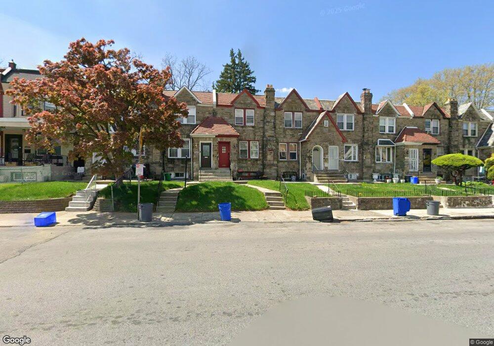
4932 Pulaski Ave Philadelphia, PA 19144
Germantown NeighborhoodEstimated Value: $251,000 - $291,975
4
Beds
1
Bath
1,768
Sq Ft
$152/Sq Ft
Est. Value
About This Home
This home is located at 4932 Pulaski Ave, Philadelphia, PA 19144 and is currently estimated at $268,744, approximately $152 per square foot. 4932 Pulaski Ave is a home located in Philadelphia County with nearby schools including John B. Kelly School, Roosevelt Theodore Middle School, and Martin Luther King High School.
Ownership History
Date
Name
Owned For
Owner Type
Purchase Details
Closed on
Feb 18, 2003
Sold by
Fairbanks Capital Corp
Bought by
Atterbury Antoinette
Current Estimated Value
Purchase Details
Closed on
Dec 16, 2002
Sold by
Brown Pauline and Chase Manhattan Bank
Bought by
Fairbanks Capital Corp and Dlj Mortgage Capital Inc
Purchase Details
Closed on
Oct 3, 2000
Sold by
Oldacre Ernell
Bought by
Brown Pauline
Create a Home Valuation Report for This Property
The Home Valuation Report is an in-depth analysis detailing your home's value as well as a comparison with similar homes in the area
Home Values in the Area
Average Home Value in this Area
Purchase History
| Date | Buyer | Sale Price | Title Company |
|---|---|---|---|
| Atterbury Antoinette | $45,000 | -- | |
| Fairbanks Capital Corp | $3,700 | -- | |
| Brown Pauline | -- | -- |
Source: Public Records
Tax History Compared to Growth
Tax History
| Year | Tax Paid | Tax Assessment Tax Assessment Total Assessment is a certain percentage of the fair market value that is determined by local assessors to be the total taxable value of land and additions on the property. | Land | Improvement |
|---|---|---|---|---|
| 2025 | $2,226 | $203,600 | $40,720 | $162,880 |
| 2024 | $2,226 | $203,600 | $40,720 | $162,880 |
| 2023 | $2,226 | $159,000 | $31,800 | $127,200 |
| 2022 | $1,726 | $159,000 | $31,800 | $127,200 |
| 2021 | $1,726 | $0 | $0 | $0 |
| 2020 | $1,726 | $0 | $0 | $0 |
| 2019 | $1,802 | $0 | $0 | $0 |
| 2018 | $1,631 | $0 | $0 | $0 |
| 2017 | $1,631 | $0 | $0 | $0 |
| 2016 | $1,614 | $0 | $0 | $0 |
| 2015 | $1,601 | $0 | $0 | $0 |
| 2014 | -- | $119,500 | $12,617 | $106,883 |
| 2012 | -- | $15,776 | $2,069 | $13,707 |
Source: Public Records
Map
Nearby Homes
- 4845 Pulaski Ave
- 228 W Seymour St
- 5027 Morris St
- 4641 Fernhill Rd
- 4634 Fernhill Rd
- 419 W Clapier St
- 4623 Pulaski Ave
- 214 W Abbottsford Ave
- 178 W Manheim St
- 5125 Newhall St
- 173 W Wyneva St
- 5128 Newhall St
- 4551 Pulaski Ave
- 5037 Keyser St
- 4545 Morris St
- 4544 Fernhill Rd
- 5138 Newhall St
- 4545 Pulaski Ave
- 5044 Erringer Place
- 4534 Fernhill Rd
- 4934 Pulaski Ave
- 4930 Pulaski Ave
- 4936 Pulaski Ave
- 4928 Pulaski Ave
- 4938 Pulaski Ave
- 4926 Pulaski Ave
- 4940 Pulaski Ave
- 4924 Pulaski Ave
- 4942 Pulaski Ave
- 4922 Pulaski Ave
- 4944 Pulaski Ave
- 4920 Pulaski Ave
- 4946 Pulaski Ave
- 4918 Pulaski Ave
- 314 W Seymour St
- 312 W Seymour St Unit 3
- 312 W Seymour St
- 312 W Seymour St Unit 1
- 312 W Seymour St Unit 2
- 4948 Pulaski Ave