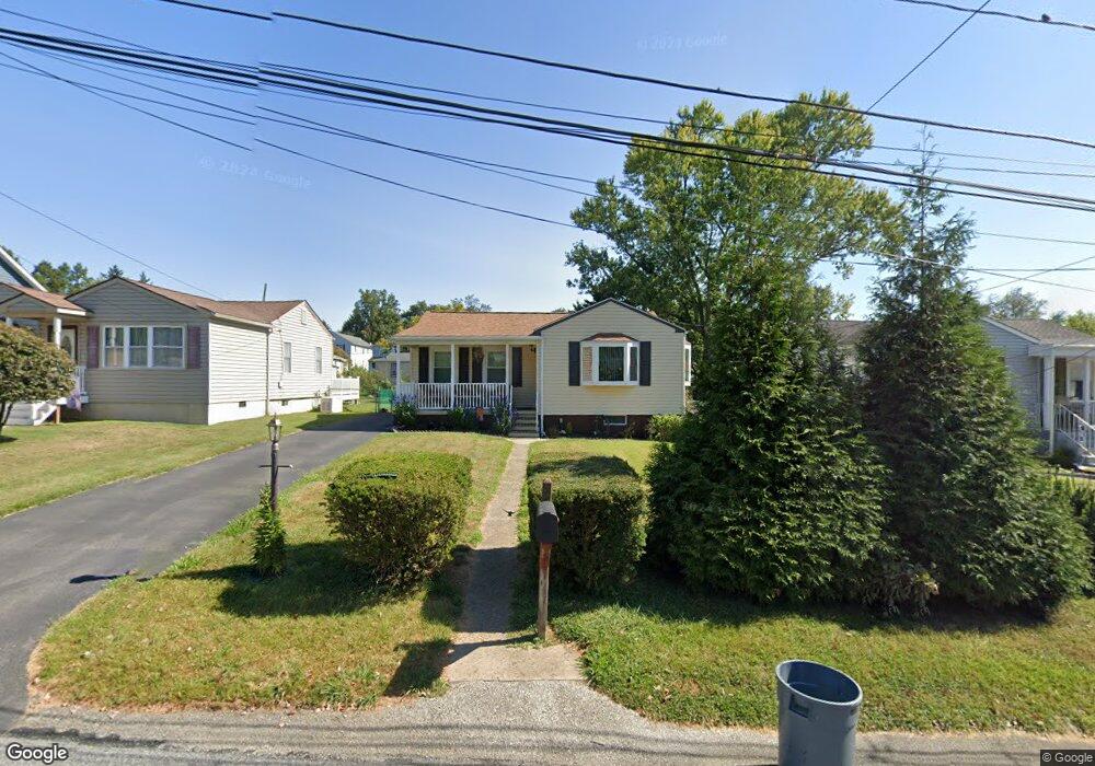
4933 Demaio Dr Unit 16 Brookhaven, PA 19015
Estimated Value: $228,927 - $302,000
2
Beds
2
Baths
768
Sq Ft
$356/Sq Ft
Est. Value
About This Home
This home is located at 4933 Demaio Dr Unit 16, Brookhaven, PA 19015 and is currently estimated at $273,232, approximately $355 per square foot. 4933 Demaio Dr Unit 16 is a home located in Delaware County with nearby schools including The Christian Academy.
Ownership History
Date
Name
Owned For
Owner Type
Purchase Details
Closed on
Aug 22, 2017
Sold by
Good Linda M
Bought by
Brown Michael T
Current Estimated Value
Home Financials for this Owner
Home Financials are based on the most recent Mortgage that was taken out on this home.
Original Mortgage
$100,000
Outstanding Balance
$83,599
Interest Rate
4.03%
Mortgage Type
New Conventional
Estimated Equity
$189,633
Purchase Details
Closed on
Jul 17, 2006
Sold by
Skoronski Joseph
Bought by
Good Linda M
Home Financials for this Owner
Home Financials are based on the most recent Mortgage that was taken out on this home.
Original Mortgage
$148,500
Interest Rate
6.7%
Mortgage Type
Purchase Money Mortgage
Create a Home Valuation Report for This Property
The Home Valuation Report is an in-depth analysis detailing your home's value as well as a comparison with similar homes in the area
Home Values in the Area
Average Home Value in this Area
Purchase History
| Date | Buyer | Sale Price | Title Company |
|---|---|---|---|
| Brown Michael T | $147,000 | None Available | |
| Good Linda M | $165,000 | None Available |
Source: Public Records
Mortgage History
| Date | Status | Borrower | Loan Amount |
|---|---|---|---|
| Open | Brown Michael T | $100,000 | |
| Previous Owner | Good Linda M | $148,500 |
Source: Public Records
Tax History Compared to Growth
Tax History
| Year | Tax Paid | Tax Assessment Tax Assessment Total Assessment is a certain percentage of the fair market value that is determined by local assessors to be the total taxable value of land and additions on the property. | Land | Improvement |
|---|---|---|---|---|
| 2025 | $3,635 | $141,010 | $62,410 | $78,600 |
| 2024 | $3,635 | $141,010 | $62,410 | $78,600 |
| 2023 | $3,487 | $141,010 | $62,410 | $78,600 |
| 2022 | $3,283 | $141,010 | $62,410 | $78,600 |
| 2021 | $5,126 | $141,010 | $62,410 | $78,600 |
| 2020 | $3,346 | $83,670 | $37,930 | $45,740 |
| 2019 | $3,281 | $83,670 | $37,930 | $45,740 |
| 2018 | $3,180 | $83,670 | $0 | $0 |
| 2017 | $3,112 | $83,670 | $0 | $0 |
| 2016 | $459 | $83,670 | $0 | $0 |
| 2015 | $469 | $83,670 | $0 | $0 |
| 2014 | $459 | $83,670 | $0 | $0 |
Source: Public Records
Map
Nearby Homes
- 4948 Madison Dr
- 4920 Jackson Dr
- 423 Sir Galahad Dr
- 93 Patricia Place
- 40 Bunting Ln
- 409 Melvin Dr
- 107 Cambridge Rd
- 4105 Mount Vernon Ave
- 26 Green Ln
- 333 Scola Rd
- 0 Brookhaven & Creek Rd Unit PADE2084418
- 328 Hillside Ave
- 5200 Hilltop Dr Unit S8
- 5200 Hilltop Dr Unit 42
- 5200 DD18 Hilltop Dr Unit 477
- 12 Trimble Blvd
- 7202 Hilltop Dr Unit 6
- 929 Crystle Rd
- 231 Creekside Dr Unit A21
- 113 Creekside Dr Unit 3
- 4933 Demaio Dr
- 4937 Demaio Dr
- 4931 Demaio Dr
- 4943 Demaio Dr
- 4925 Demaio Dr
- 4934 Greenwood St
- 4947 Demaio Dr
- 4938 Greenwood St
- 4930 Greenwood St
- 4934 Demaio Dr
- 4921 Demaio Dr
- 4932 Demaio Dr
- 4938 Demaio Dr
- 4944 Greenwood St
- 4924 Greenwood St
- 4930 Demaio Dr
- 531 E Dutton Mill Rd
- 4948 Greenwood St
- 4917 Demaio Dr
- 4920 Greenwood St