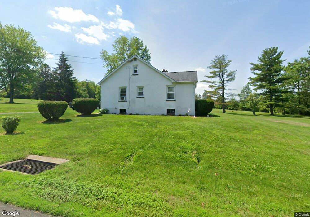
4934 Silo Hill Rd Doylestown, PA 18902
Plumstead NeighborhoodEstimated Value: $292,000 - $483,000
3
Beds
1
Bath
1,482
Sq Ft
$283/Sq Ft
Est. Value
About This Home
This home is located at 4934 Silo Hill Rd, Doylestown, PA 18902 and is currently estimated at $419,368, approximately $282 per square foot. 4934 Silo Hill Rd is a home located in Bucks County with nearby schools including Groveland Elementary School, Tohickon Middle School, and Central Bucks High School - East.
Ownership History
Date
Name
Owned For
Owner Type
Purchase Details
Closed on
Jan 31, 2013
Sold by
Smith Richard W and Smith Marlene
Bought by
Bennett Thomas E and Bennett Karen Lynn
Current Estimated Value
Home Financials for this Owner
Home Financials are based on the most recent Mortgage that was taken out on this home.
Original Mortgage
$156,120
Outstanding Balance
$110,190
Interest Rate
3.62%
Mortgage Type
FHA
Estimated Equity
$309,178
Purchase Details
Closed on
Mar 31, 1982
Bought by
Smith Richard W and Smith Marlene
Create a Home Valuation Report for This Property
The Home Valuation Report is an in-depth analysis detailing your home's value as well as a comparison with similar homes in the area
Home Values in the Area
Average Home Value in this Area
Purchase History
| Date | Buyer | Sale Price | Title Company |
|---|---|---|---|
| Bennett Thomas E | $159,000 | None Available | |
| Smith Richard W | $60,000 | -- |
Source: Public Records
Mortgage History
| Date | Status | Borrower | Loan Amount |
|---|---|---|---|
| Open | Bennett Thomas E | $156,120 |
Source: Public Records
Tax History Compared to Growth
Tax History
| Year | Tax Paid | Tax Assessment Tax Assessment Total Assessment is a certain percentage of the fair market value that is determined by local assessors to be the total taxable value of land and additions on the property. | Land | Improvement |
|---|---|---|---|---|
| 2025 | $3,614 | $20,800 | $7,720 | $13,080 |
| 2024 | $3,614 | $20,800 | $7,720 | $13,080 |
| 2023 | $3,499 | $20,800 | $7,720 | $13,080 |
| 2022 | $3,460 | $20,800 | $7,720 | $13,080 |
| 2021 | $3,421 | $20,800 | $7,720 | $13,080 |
| 2020 | $3,421 | $20,800 | $7,720 | $13,080 |
| 2019 | $3,401 | $20,800 | $7,720 | $13,080 |
| 2018 | $3,401 | $20,800 | $7,720 | $13,080 |
| 2017 | $3,354 | $20,800 | $7,720 | $13,080 |
| 2016 | $3,354 | $20,800 | $7,720 | $13,080 |
| 2015 | -- | $20,800 | $7,720 | $13,080 |
| 2014 | -- | $20,800 | $7,720 | $13,080 |
Source: Public Records
Map
Nearby Homes
- Madison Plan at Clover Hill Crossing
- Rittenhouse Plan at Clover Hill Crossing
- Harrison Plan at Clover Hill Crossing
- Chapel Hill Plan at Clover Hill Crossing
- Georgetown Plan at Clover Hill Crossing
- Fenimore Plan at Clover Hill Crossing
- 4263 Kleinot Dr
- 4317 Kleinot Dr
- 4464 Kleinot Dr
- 4330 Kleinot Dr
- 4246 Kleinot Dr
- 4306 Kleinot Dr
- 4298 Kleinot Dr
- 3923 Ferry Rd
- 3838 Jacob Stout Rd
- 4748 Bishop Cir
- 3765 William Daves Rd
- 3711 Jacob Stout Rd Unit 5
- 3723 William Daves Rd
- 3600 Jacob Stout Rd Unit 3
- 4295 Point Pleasant Pike Unit 2ND FL
- 4326 Pear Dr
- 4295 Point Pleasant Pike
- 4427 Pear St
- 5109 Roseberry St
- 1007 N Easton Rd
- 1007 N Easton Rd Unit U-2
- 4185 Ferry Rd
- 4925 Silo Hill Rd Unit 38368875
- 4925 Silo Hill Rd Unit 38368815
- 4925 Silo Hill Rd Unit 38368791
- 4925 Silo Hill Rd Unit 38368775
- 4925 Silo Hill Rd Unit 38368748
- 4925 Silo Hill Rd Unit 38368691
- 4925 Silo Hill Rd Unit 38368661
- 4165 Point Pleasant Park
- 4165 Point Pleasant Pike
- 4165 Point Pleasant Pike
- 4139 Ferry Rd
- 1019 N Easton Rd Unit A