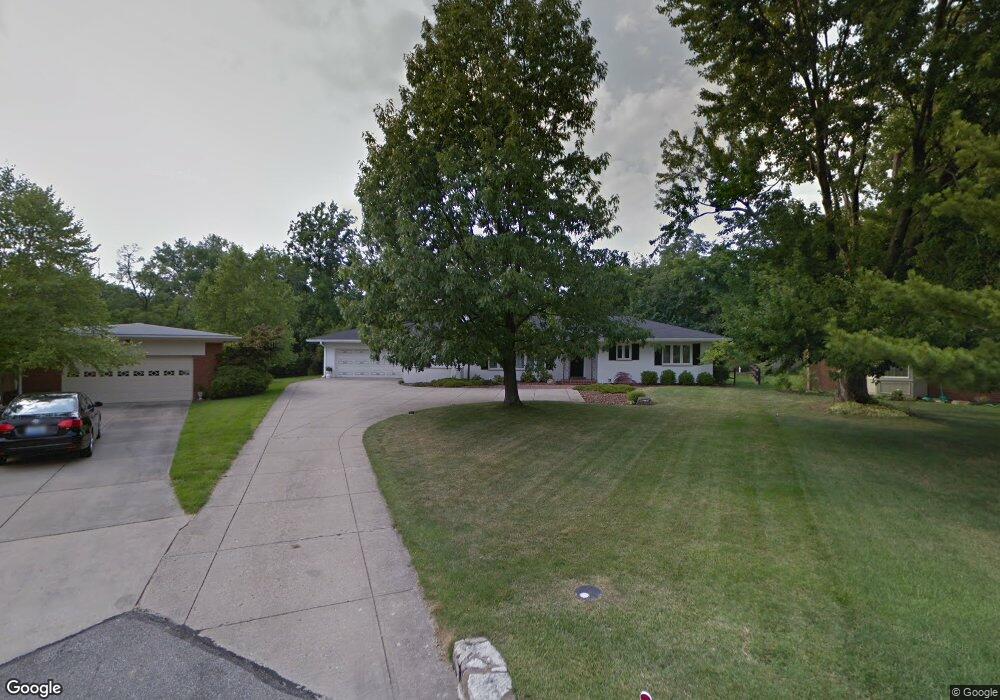
4935 N Raeburn Dr Cincinnati, OH 45223
Mount Airy NeighborhoodEstimated Value: $358,000 - $414,141
3
Beds
3
Baths
2,102
Sq Ft
$184/Sq Ft
Est. Value
About This Home
This home is located at 4935 N Raeburn Dr, Cincinnati, OH 45223 and is currently estimated at $387,285, approximately $184 per square foot. 4935 N Raeburn Dr is a home located in Hamilton County with nearby schools including Chase Elementary School, Robert A. Taft Information Technology High School, and Western Hills High School.
Ownership History
Date
Name
Owned For
Owner Type
Purchase Details
Closed on
Nov 30, 2016
Sold by
Wray Marilyn R
Bought by
Stiens Brian W and Stiens Lindsey M
Current Estimated Value
Home Financials for this Owner
Home Financials are based on the most recent Mortgage that was taken out on this home.
Original Mortgage
$123,500
Outstanding Balance
$99,786
Interest Rate
3.54%
Mortgage Type
New Conventional
Estimated Equity
$287,499
Create a Home Valuation Report for This Property
The Home Valuation Report is an in-depth analysis detailing your home's value as well as a comparison with similar homes in the area
Home Values in the Area
Average Home Value in this Area
Purchase History
| Date | Buyer | Sale Price | Title Company |
|---|---|---|---|
| Stiens Brian W | $130,000 | -- |
Source: Public Records
Mortgage History
| Date | Status | Borrower | Loan Amount |
|---|---|---|---|
| Open | Stiens Brian W | $123,500 |
Source: Public Records
Tax History Compared to Growth
Tax History
| Year | Tax Paid | Tax Assessment Tax Assessment Total Assessment is a certain percentage of the fair market value that is determined by local assessors to be the total taxable value of land and additions on the property. | Land | Improvement |
|---|---|---|---|---|
| 2024 | $7,024 | $117,779 | $18,480 | $99,299 |
| 2023 | $7,183 | $117,779 | $18,480 | $99,299 |
| 2022 | $3,811 | $55,993 | $22,547 | $33,446 |
| 2021 | $3,668 | $55,510 | $22,547 | $32,963 |
| 2020 | $3,743 | $55,510 | $22,547 | $32,963 |
| 2019 | $3,354 | $45,500 | $18,480 | $27,020 |
| 2018 | $3,359 | $45,500 | $18,480 | $27,020 |
| 2017 | $3,191 | $45,500 | $18,480 | $27,020 |
| 2016 | $4,343 | $70,140 | $19,656 | $50,484 |
| 2015 | $3,922 | $70,140 | $19,656 | $50,484 |
| 2014 | $3,951 | $70,140 | $19,656 | $50,484 |
| 2013 | $3,352 | $59,948 | $16,800 | $43,148 |
Source: Public Records
Map
Nearby Homes
- 4805 Chapel Ridge Dr
- 5425 Kirby Ave
- 2088 Raeburn Dr
- 1723 Monterey Ct
- 4650 Kirby Ave
- 1971 Kentucky Ave
- 4636 Ashtree Dr
- 4574 Kirby Ave
- 1943 Chase Ave
- 4361 Virginia Ave
- 4361 Badgeley St
- 4339 Kirby Ave
- 1722 Glen Parker Ave
- 4348 Kirby Ave
- 4307 Hays Ave
- 4667 Hamilton Ave
- 4344 Kirby Ave
- 4223 Virginia Ave
- 1910 Chase Ave
- 4411 Colerain Ave
- 4934 N Raeburn Dr
- 4929 N Raeburn Dr
- 4928 N Raeburn Dr
- 2310 Raeburn Terrace
- 4921 N Raeburn Dr
- 2314 Raeburn Terrace
- 4920 N Raeburn Dr
- 2306 Raeburn Terrace
- 4913 N Raeburn Dr
- 2302 Raeburn Terrace
- 4910 N Raeburn Dr
- 2318 Raeburn Terrace
- 4905 N Raeburn Dr
- 2315 Raeburn Terrace
- 4906 N Raeburn Dr
- 2303 Raeburn Terrace
- 2234 Raeburn Dr
- 2322 Raeburn Terrace
- 2240 Raeburn Dr
- 2325 Raeburn Terrace