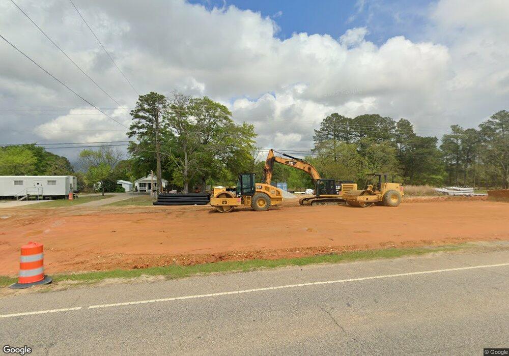
4936 Nc 55 W Angier, NC 27501
Estimated Value: $214,000 - $361,000
3
Beds
2
Baths
1,796
Sq Ft
$167/Sq Ft
Est. Value
About This Home
This home is located at 4936 Nc 55 W, Angier, NC 27501 and is currently estimated at $300,667, approximately $167 per square foot. 4936 Nc 55 W is a home located in Harnett County with nearby schools including Angier Elementary School, North Harnett Primary School, and Harnett Central Middle School.
Ownership History
Date
Name
Owned For
Owner Type
Purchase Details
Closed on
Mar 18, 2022
Sold by
Lynn Torres-Hernandez and Lynn Crystal
Bought by
Department Of Transportation
Current Estimated Value
Purchase Details
Closed on
Jun 17, 2011
Sold by
Stanley Martha C and Hamilton Pameal Y
Bought by
Hernadez Mario Torres and Torres Hernadez Crystal Lynn
Purchase Details
Closed on
Apr 14, 2011
Sold by
Stanley Martha C and Hamilton Pamela Y
Bought by
Hernandez Mario Torres and Torres Hernandez Crystal Lyn
Create a Home Valuation Report for This Property
The Home Valuation Report is an in-depth analysis detailing your home's value as well as a comparison with similar homes in the area
Home Values in the Area
Average Home Value in this Area
Purchase History
| Date | Buyer | Sale Price | Title Company |
|---|---|---|---|
| Department Of Transportation | $20,025 | None Listed On Document | |
| Hernadez Mario Torres | -- | -- | |
| Hernandez Mario Torres | $80,000 | -- |
Source: Public Records
Tax History Compared to Growth
Tax History
| Year | Tax Paid | Tax Assessment Tax Assessment Total Assessment is a certain percentage of the fair market value that is determined by local assessors to be the total taxable value of land and additions on the property. | Land | Improvement |
|---|---|---|---|---|
| 2025 | $282 | $42,400 | $0 | $0 |
| 2024 | $1,392 | $208,941 | $0 | $0 |
| 2023 | $1,013 | $208,941 | $0 | $0 |
| 2022 | $1,013 | $220,851 | $0 | $0 |
| 2021 | $1,013 | $113,190 | $0 | $0 |
| 2020 | $1,013 | $113,190 | $0 | $0 |
| 2019 | $998 | $113,190 | $0 | $0 |
| 2018 | $998 | $113,190 | $0 | $0 |
| 2017 | $998 | $113,190 | $0 | $0 |
| 2016 | $958 | $108,310 | $0 | $0 |
| 2015 | $958 | $108,310 | $0 | $0 |
| 2014 | $958 | $108,310 | $0 | $0 |
Source: Public Records
Map
Nearby Homes
- 71 Roll Tide Ct
- 24 Roll Tide Ct
- 29 Croatoke Ct
- 419 Mabry Rd
- 87 Croatoke Ct
- 54 Croatoke Ct
- 167 Bering Cir Unit Lot 10
- 467 Denali Dr
- 202 Denali Dr Unit Lot 27
- Appalachian Plan at Riverfall
- Redwood Plan at Riverfall
- Voyageur Plan at Riverfall
- Clearwater Plan at Riverfall
- Allegheny Plan at Riverfall
- 77 Mendenhall Dr
- Shenandoah Plan at Riverfall
- Sequoia Plan at Riverfall
- Teton Plan at Riverfall
- Drayton Plan at Campbell Ridge
- Norris Plan at Campbell Ridge
- 4936 N Carolina 55
- 4892 Nc 55 W
- 4970 Nc 55 W
- 4946 Nc 55 W
- 4957 Nc 55 W
- 4957 N Carolina 55
- 4994 Nc 55 W
- 5005 Nc 55 W
- 4844 Nc 55 W
- 91 Ray Hart Ln
- 4797 Nc 55 W
- 4752 Nc 55 W
- 77 Ray Hart Ln
- 291 Royster Ln
- 269 Royster Ln
- 0 Nc 55 Hwy Unit 596542
- 0 Nc 55 Hwy Unit 871114
- 0 Nc 55 Hwy Unit 535560
- 0 Nc 55 Hwy Unit TR675864
- 0 Nc 55 Hwy Unit 1 TR991305
