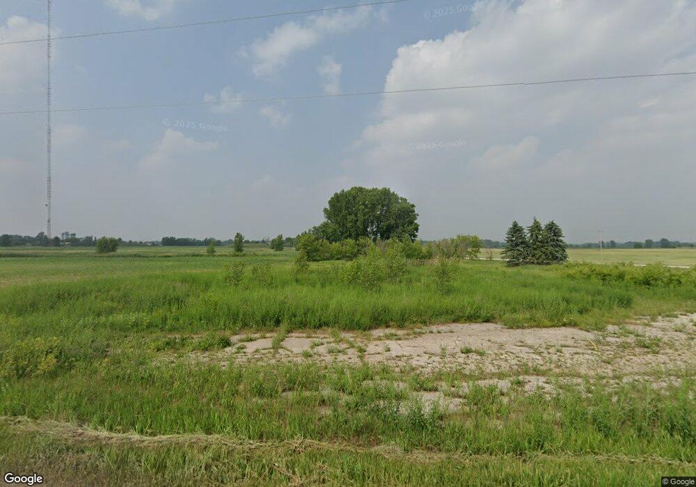
4938 Morrison Rd de Pere, WI 54115
Estimated Value: $87,000 - $425,000
--
Bed
--
Bath
--
Sq Ft
3.26
Acres
About This Home
This home is located at 4938 Morrison Rd, de Pere, WI 54115 and is currently estimated at $287,064. 4938 Morrison Rd is a home located in Brown County with nearby schools including Susie C. Altmayer Elementary School, De Pere Middle School, and Foxview Intermediate School.
Ownership History
Date
Name
Owned For
Owner Type
Purchase Details
Closed on
Feb 21, 2014
Sold by
Maurer David and Maurer David L
Bought by
Northeast Asphalt Inc
Current Estimated Value
Purchase Details
Closed on
Oct 10, 1997
Sold by
Maurer Dennis and Maurer Dean
Bought by
Maurer David
Home Financials for this Owner
Home Financials are based on the most recent Mortgage that was taken out on this home.
Original Mortgage
$36,500
Interest Rate
7.65%
Create a Home Valuation Report for This Property
The Home Valuation Report is an in-depth analysis detailing your home's value as well as a comparison with similar homes in the area
Home Values in the Area
Average Home Value in this Area
Purchase History
| Date | Buyer | Sale Price | Title Company |
|---|---|---|---|
| Northeast Asphalt Inc | $140,000 | Green Bay Title Co Inc | |
| Maurer David | $36,300 | -- |
Source: Public Records
Mortgage History
| Date | Status | Borrower | Loan Amount |
|---|---|---|---|
| Previous Owner | Maurer David | $36,500 |
Source: Public Records
Tax History Compared to Growth
Tax History
| Year | Tax Paid | Tax Assessment Tax Assessment Total Assessment is a certain percentage of the fair market value that is determined by local assessors to be the total taxable value of land and additions on the property. | Land | Improvement |
|---|---|---|---|---|
| 2024 | $746 | $49,700 | $49,700 | -- |
| 2023 | $671 | $44,700 | $44,700 | $0 |
| 2022 | $623 | $44,700 | $44,700 | $0 |
| 2021 | $631 | $44,700 | $44,700 | $0 |
| 2020 | $683 | $44,700 | $44,700 | $0 |
| 2019 | $748 | $44,700 | $44,700 | $0 |
| 2018 | $489 | $25,200 | $25,200 | $0 |
| 2017 | $488 | $25,200 | $25,200 | $0 |
| 2016 | $2,633 | $140,100 | $25,200 | $114,900 |
| 2015 | $2,815 | $140,100 | $25,200 | $114,900 |
| 2014 | $2,327 | $113,400 | $25,200 | $88,200 |
| 2013 | $2,327 | $113,400 | $25,200 | $88,200 |
Source: Public Records
Map
Nearby Homes
- 1650 Trinity Ridge Cir
- 1634 Trinity Ridge Cir
- 1750 Limestone Trail
- 1749 Hawthorne Heights Dr
- 4649 Royal Vista Trail
- 1639 Grace Garden Way
- 1631 Grace Garden Way
- 1623 Grace Garden Way
- 1756 Bobby Jones Dr
- 1780 Bobby Jones Dr
- 1769 Bobby Jones Dr
- 1679 Arnie's Ct
- 1655 Arnie's Ct
- 5108 Achates Ct
- 3629 Creekview Rd
- 3825 Dickinson Rd
- 4011 Garrett St
- 1841 Ridgemont Cir
- 2125 Dollar Rd
- 1769 Dollar Rd
- 0 Heritage Rd Unit 50079894
- 0 Heritage Rd Unit 10900418
- 5118 Cth X
- 1903 Sunnyview Rd
- 4942 Shillcox Ln
- 3285 Creekview Rd
- 3289 Creekview Rd
- 3320 Creekview Rd
- 3336 Creekview Rd
- 5307 Cth X
- 3347 Creekview Rd
- 3340 Creekview Rd
- 3359 Creekview Rd
- 3375 Creekview Rd
- 3365 Creekview Rd
- 3105 Glenrock Rd
- 4780 Tower Rd
- 3091 Glenrock Rd
- 1620 Hawthorne Heights Dr
- 4073 Heritage Rd
