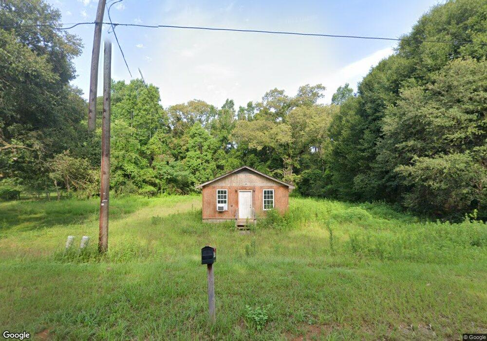
4939 Christopher Rd Wilmer, AL 36587
Outer Semmes NeighborhoodEstimated Value: $62,000 - $89,000
Studio
--
Bath
651
Sq Ft
$118/Sq Ft
Est. Value
About This Home
This home is located at 4939 Christopher Rd, Wilmer, AL 36587 and is currently estimated at $77,112, approximately $118 per square foot. 4939 Christopher Rd is a home with nearby schools including Wilmer Elementary School, Semmes Middle School, and Mary G Montgomery High School.
Ownership History
Date
Name
Owned For
Owner Type
Purchase Details
Closed on
Jun 9, 2022
Sold by
Paulk Aaron W
Bought by
Brannan Donald R
Current Estimated Value
Purchase Details
Closed on
Jan 25, 2019
Sold by
Bannan Donald R
Bought by
Paulk Aaron W
Home Financials for this Owner
Home Financials are based on the most recent Mortgage that was taken out on this home.
Original Mortgage
$33,000
Interest Rate
4.6%
Mortgage Type
Seller Take Back
Purchase Details
Closed on
Dec 30, 2008
Sold by
Estes Barbara Jauiece
Bought by
Brannan Donald R
Create a Home Valuation Report for This Property
The Home Valuation Report is an in-depth analysis detailing your home's value as well as a comparison with similar homes in the area
Home Values in the Area
Average Home Value in this Area
Purchase History
| Date | Buyer | Sale Price | Title Company |
|---|---|---|---|
| Brannan Donald R | $33,000 | None Listed On Document | |
| Paulk Aaron W | $33,000 | None Available | |
| Brannan Donald R | -- | Gtc |
Source: Public Records
Mortgage History
| Date | Status | Borrower | Loan Amount |
|---|---|---|---|
| Previous Owner | Paulk Aaron W | $33,000 |
Source: Public Records
Tax History
| Year | Tax Paid | Tax Assessment Tax Assessment Total Assessment is a certain percentage of the fair market value that is determined by local assessors to be the total taxable value of land and additions on the property. | Land | Improvement |
|---|---|---|---|---|
| 2025 | $494 | $10,180 | $4,500 | $5,680 |
| 2024 | $494 | $4,990 | $2,250 | $2,740 |
| 2023 | $157 | $4,600 | $1,670 | $2,930 |
| 2022 | $157 | $4,600 | $1,610 | $2,990 |
| 2021 | $133 | $4,100 | $1,350 | $2,750 |
| 2020 | $132 | $4,080 | $1,250 | $2,830 |
| 2019 | $404 | $4,170 | $1,250 | $2,920 |
| 2018 | $407 | $8,400 | $0 | $0 |
| 2017 | $413 | $8,520 | $0 | $0 |
| 2016 | $416 | $8,580 | $0 | $0 |
| 2013 | $73 | $1,500 | $0 | $0 |
Source: Public Records
Map
Nearby Homes
- 4819 Christopher Rd
- 0 Old Moffat Rd Unit 7402396
- 0 Old Moffat Rd Unit 32 363607
- 5183 Michael Ct
- 0 Titleist Dr
- 10724 Moffett Rd
- 11223 Old Moffat Rd
- 5165 Fairview Dr W
- 5233 Oak Crest Dr
- 11477 Moffett Rd
- 3967 W Ridge Dr
- 00000 Glenwood Farms Dr
- 0 Us Highway 98
- 10703 S Ridge Dr
- 0 Moffett Rd Unit 7724926
- 0 Moffett Rd Unit 7699200
- 11830 Old Moffat Rd
- 9800 Moffett Rd
- 9533 Stone Rd
- 9795 Winchester Dr N
- 4951 Christopher Rd
- 4925 Christopher Rd
- 4981 Christopher Rd
- 10779 Waltman Dr S
- 10794 Waltman Dr S
- 4761 Christopher Rd
- 4890 Christopher Rd
- 5000 Christopher Rd
- 5011 Christopher Rd
- 4883 Christopher Rd
- 10814 Waltman Dr S
- 4964 Waltman Dr E
- 10700 Eubanks Rd
- 4870 Christopher Rd
- 5021 Christopher Rd
- 4873 Christopher Rd
- 5036 Christopher Rd
- 10680 Eubanks Rd
- 5037 Christopher Rd
- 4851 Christopher Rd
Your Personal Tour Guide
Ask me questions while you tour the home.