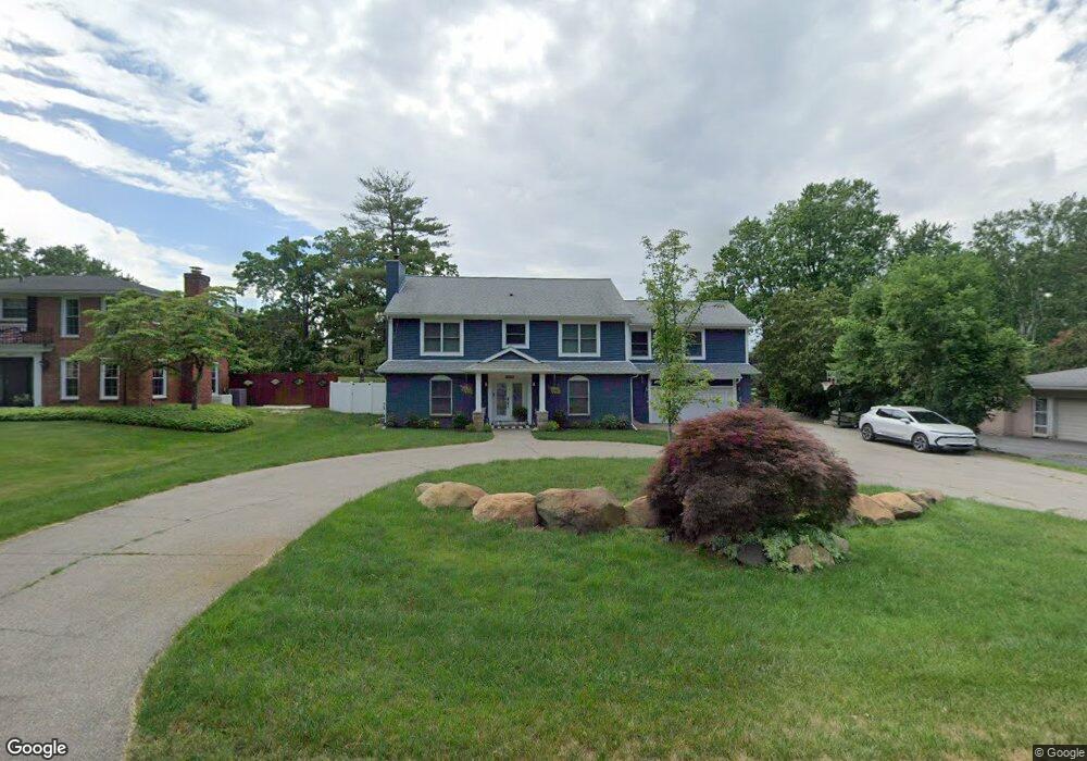
4939 Curtis Ln Unit Bldg-Unit Clarkston, MI 48346
Estimated Value: $439,000 - $601,000
5
Beds
4
Baths
3,381
Sq Ft
$158/Sq Ft
Est. Value
About This Home
This home is located at 4939 Curtis Ln Unit Bldg-Unit, Clarkston, MI 48346 and is currently estimated at $535,654, approximately $158 per square foot. 4939 Curtis Ln Unit Bldg-Unit is a home located in Oakland County with nearby schools including Schoolcraft Elementary School, Waterford Kettering High School, and Mason Middle School.
Ownership History
Date
Name
Owned For
Owner Type
Purchase Details
Closed on
Oct 23, 2024
Sold by
Stevenson John
Bought by
Stevenson John and Stevenson Paula I
Current Estimated Value
Purchase Details
Closed on
Mar 30, 2018
Sold by
Schendel Neuendorff Valerie and Schomberg Neuendorff Valerie L
Bought by
Stevenson John
Home Financials for this Owner
Home Financials are based on the most recent Mortgage that was taken out on this home.
Original Mortgage
$251,750
Interest Rate
4.43%
Mortgage Type
New Conventional
Create a Home Valuation Report for This Property
The Home Valuation Report is an in-depth analysis detailing your home's value as well as a comparison with similar homes in the area
Home Values in the Area
Average Home Value in this Area
Purchase History
| Date | Buyer | Sale Price | Title Company |
|---|---|---|---|
| Stevenson John | -- | None Listed On Document | |
| Stevenson John | $265,000 | Fideliy National Title |
Source: Public Records
Mortgage History
| Date | Status | Borrower | Loan Amount |
|---|---|---|---|
| Previous Owner | Stevenson John | $251,750 |
Source: Public Records
Tax History Compared to Growth
Tax History
| Year | Tax Paid | Tax Assessment Tax Assessment Total Assessment is a certain percentage of the fair market value that is determined by local assessors to be the total taxable value of land and additions on the property. | Land | Improvement |
|---|---|---|---|---|
| 2024 | $4,586 | $238,500 | $30,100 | $208,400 |
| 2023 | $6,207 | $210,300 | $27,900 | $182,400 |
| 2022 | $6,247 | $195,900 | $27,900 | $168,000 |
| 2021 | $6,251 | $188,700 | $27,900 | $160,800 |
| 2020 | $7,480 | $190,700 | $27,200 | $163,500 |
| 2018 | $3,619 | $153,100 | $27,100 | $126,000 |
| 2015 | -- | $146,100 | $0 | $0 |
| 2014 | -- | $122,800 | $0 | $0 |
| 2011 | -- | $95,400 | $0 | $0 |
Source: Public Records
Map
Nearby Homes
- 6788 Balmoral Terrace
- 6624 Wellesley Terrace
- 6583 Ridgeview Dr
- 4973 Parview Dr
- 4619 Curtis Ln
- 6516 Scenic Pines Ct Unit 12
- 6492 Scenic Pines Ct Unit 16
- 6723 Andersonville Rd Unit E42
- 5944 Waterford Hill Terrace
- 5336 Forest Ridge Dr Unit 55
- 4341 Barnard Rd
- 6003 Rolton Ct
- 5021 Paula Ave
- 6570 Saline Dr
- 000 Waterloo St
- 5721 Corunna Ave
- 4281 Marcus Rd
- 4209 Laforest Dr
- 5605 Kingfisher Ln
- 0 Harding Ave Harding Ave
- 4939 Curtis Ln
- 4955 Curtis Ln
- 4923 Curtis Ln
- 5011 Curtis Ln
- 6800 Wellesley Terrace
- 4992 Georgetown Ct
- 6806 Wellesley Terrace
- 6794 Wellesley Terrace
- 6812 Wellesley Terrace
- 5033 Curtis Ln
- 4924 Curtis Ln
- 6824 Leib Ct
- 4871 Curtis Ln
- 6830 Leib Ct
- 4910 Curtis Ln
- 6788 Wellesley Terrace
- 4978 Georgetown Ct
- 4954 Georgetown Ct
- 5051 Curtis Ln
- 6782 Wellesley Terrace