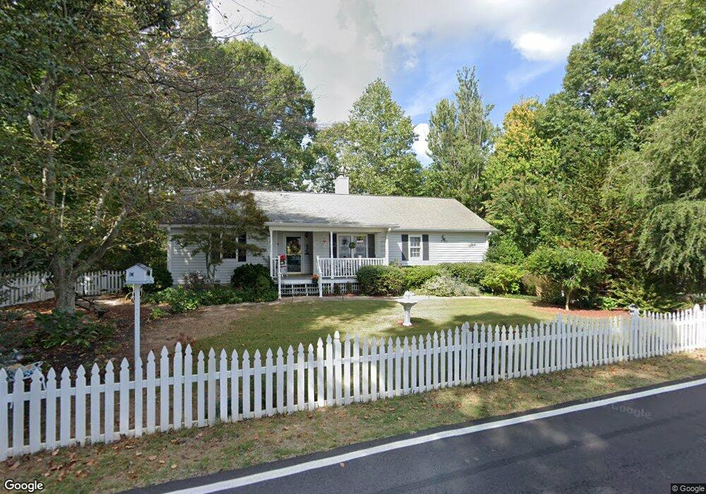
494 Calhoun Rd Dahlonega, GA 30533
Estimated Value: $297,000 - $396,000
--
Bed
2
Baths
1,626
Sq Ft
$210/Sq Ft
Est. Value
About This Home
This home is located at 494 Calhoun Rd, Dahlonega, GA 30533 and is currently estimated at $340,942, approximately $209 per square foot. 494 Calhoun Rd is a home located in Lumpkin County with nearby schools including Clay County Middle School and Lumpkin County High School.
Ownership History
Date
Name
Owned For
Owner Type
Purchase Details
Closed on
Jul 1, 2005
Sold by
Neubauer Michael K
Bought by
Dowsett Gail
Current Estimated Value
Home Financials for this Owner
Home Financials are based on the most recent Mortgage that was taken out on this home.
Original Mortgage
$144,400
Outstanding Balance
$72,141
Interest Rate
5%
Mortgage Type
New Conventional
Estimated Equity
$268,801
Purchase Details
Closed on
Sep 15, 1999
Sold by
Dallman Glenn R
Bought by
Neubauer Michael K
Purchase Details
Closed on
May 12, 1988
Sold by
Dallman Glenn R
Bought by
Dallman Glenn R
Purchase Details
Closed on
Dec 1, 1975
Bought by
Owen Margaret
Purchase Details
Closed on
Jul 1, 1973
Sold by
Owen Margaret
Bought by
Dallman Glenn R
Create a Home Valuation Report for This Property
The Home Valuation Report is an in-depth analysis detailing your home's value as well as a comparison with similar homes in the area
Home Values in the Area
Average Home Value in this Area
Purchase History
| Date | Buyer | Sale Price | Title Company |
|---|---|---|---|
| Dowsett Gail | $180,500 | -- | |
| Neubauer Michael K | $152,300 | -- | |
| Dallman Glenn R | $11,000 | -- | |
| Owen Margaret | -- | -- | |
| Dallman Glenn R | -- | -- |
Source: Public Records
Mortgage History
| Date | Status | Borrower | Loan Amount |
|---|---|---|---|
| Open | Dowsett Gail | $144,400 |
Source: Public Records
Tax History Compared to Growth
Tax History
| Year | Tax Paid | Tax Assessment Tax Assessment Total Assessment is a certain percentage of the fair market value that is determined by local assessors to be the total taxable value of land and additions on the property. | Land | Improvement |
|---|---|---|---|---|
| 2024 | $153 | $96,285 | $16,000 | $80,285 |
| 2023 | $103 | $90,952 | $16,000 | $74,952 |
| 2022 | $291 | $84,051 | $16,000 | $68,051 |
| 2021 | $37 | $66,650 | $10,000 | $56,650 |
| 2020 | $29 | $65,089 | $10,000 | $55,089 |
| 2019 | $66 | $69,089 | $14,000 | $55,089 |
| 2018 | $14 | $62,246 | $14,000 | $48,246 |
| 2017 | $6 | $60,919 | $14,000 | $46,919 |
| 2016 | -- | $56,877 | $14,000 | $42,877 |
| 2015 | $232 | $56,877 | $14,000 | $42,877 |
| 2014 | $232 | $57,442 | $14,000 | $43,442 |
| 2013 | -- | $58,005 | $14,000 | $44,005 |
Source: Public Records
Map
Nearby Homes
- 735 Calhoun Rd
- 99 Madeline Anthony Rd
- 99 Madeline Anthony Road Lots 44 and 45
- 0 Crown Mountain Unit 7682225
- 0 Crown Mountain Unit 10644759
- LOT 13 Crown Mountain Way
- Lot 28 Crown Mountain Way
- Lot 30 Crown Mountain Way
- Lot 20 Crown Mountain Way
- 0 Crown Mountain Way Unit 7666031
- 567 Crown Mountain Way
- 0 Calhoun Rd Unit 7643314
- 0 Calhoun Rd Unit 10598012
- 00 Calhoun Rd
- 1170 Calhoun Rd
- 0 Alicia Ln
- 168 W Main St
- 1415 Calhoun Rd
- 0 Highway 9 S Unit 10487179
- 0 Highway 9 S Unit 7548614
- 501 Calhoun Rd
- 542 Calhoun Rd
- LOT 16 Calhoun Rd
- 559 Calhoun Rd
- 437 Calhoun Rd
- 552 Calhoun Rd
- 80 Timber Oak Ln
- 0 Timber Oak Ln
- 00 Crown Mountain Dr
- 1 Crown Mountain Dr
- 590 Calhoun Rd
- 7 Crown Mountain Dr
- 69 Timber Oak Ln
- 48 Crown Mountain Dr
- 88 Timber Oak Ln
- 629 Calhoun Rd
- 628 Calhoun Rd
- 0 Crown Mountain #C Way Unit LOT C 10288350
- 0 Crown Mountain #C Way
- 364 Calhoun Rd