
Seller's Agent in 2025
David Fonseca
Bridge Realtors
(502) 333-4792
16 in this area
245 Total Sales
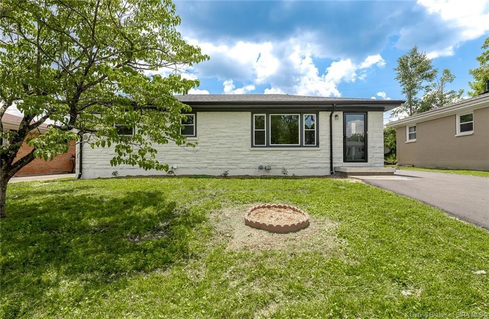
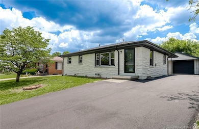
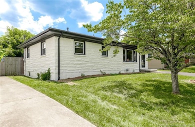
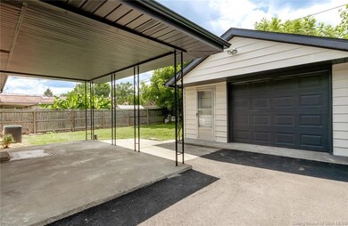
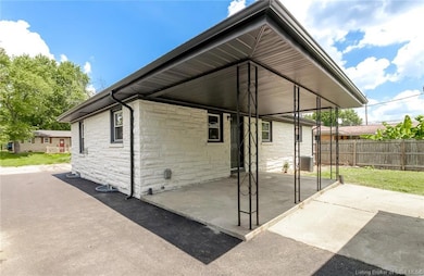
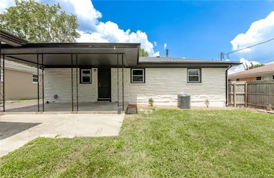
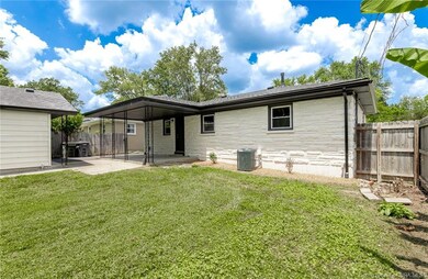
Completely remodeled with attention to detail home on quiet, dead-end street. This 3 BD, 2 BA home is a find. Original hardwood floors in bedrooms, hallway and main floor living room, New LVP everywhere else, partially finished basement with full bathroom, 1.5 car garage with new opener with plenty of room for storage. Lots of recent updates: All new plumbing, tub and shower pan, new toilets, new roof on home and garage, new kitchen cabinets with granite counters, new bath vanities, new tile surround on bathtub and shower, all new plumbing fixtures and sinks, all new lighting, new HVAC, new LVP flooring, refinished wood floors, new range/oven, dishwasher and microwave. Partially Fenced in backyard with a covered back patio that is ideal for sitting outside. Seller offering 1 year home warranty. Call/text today schedule a showing!
Last Agent to Sell the Property
Bridge Realtors License #RB14038848 Listed on: 07/04/2025
| Date | Type | Sale Price | Title Company |
|---|---|---|---|
| Quit Claim Deed | -- | None Listed On Document | |
| Warranty Deed | -- | Freibert & Mattingly Title | |
| Deed | -- | None Available | |
| Warranty Deed | -- | None Available |
| Date | Status | Loan Amount | Loan Type |
|---|---|---|---|
| Previous Owner | $50,000 | New Conventional | |
| Previous Owner | $104,192 | No Value Available | |
| Previous Owner | $111,675 | FHA |
| Date | Event | Price | Change | Sq Ft Price |
|---|---|---|---|---|
| 08/29/2025 08/29/25 | Sold | $280,000 | 0.0% | $147 / Sq Ft |
| 08/09/2025 08/09/25 | Pending | -- | -- | -- |
| 07/04/2025 07/04/25 | For Sale | $279,900 | -- | $147 / Sq Ft |
| Year | Tax Paid | Tax Assessment Tax Assessment Total Assessment is a certain percentage of the fair market value that is determined by local assessors to be the total taxable value of land and additions on the property. | Land | Improvement |
|---|---|---|---|---|
| 2024 | $1,584 | $147,200 | $15,700 | $131,500 |
| 2023 | $1,584 | $150,200 | $15,700 | $134,500 |
| 2022 | $1,608 | $151,800 | $15,700 | $136,100 |
| 2021 | $3,125 | $145,200 | $15,700 | $129,500 |
| 2020 | $1,553 | $145,200 | $15,700 | $129,500 |
| 2019 | $1,432 | $134,100 | $15,700 | $118,400 |
| 2018 | $1,175 | $107,100 | $15,700 | $91,400 |
| 2017 | $4,320 | $101,300 | $15,700 | $85,600 |
| 2016 | $1,279 | $100,600 | $15,700 | $84,900 |
| 2014 | $1,433 | $101,500 | $15,700 | $85,800 |
| 2013 | -- | $98,800 | $15,700 | $83,100 |
Seller's Agent in 2025
David Fonseca
Bridge Realtors
(502) 333-4792
16 in this area
245 Total Sales
Buyer's Agent in 2025
Greg Taylor
Semonin Realty
(502) 599-1700
5 in this area
135 Total Sales
Source: Southern Indiana REALTORS® Association
MLS Number: 202509203
APN: 22-05-02-700-755.000-008
Disclaimer: Certain information contained herein is derived from information provided by parties other than Homes.com. All information provided is deemed reliable, but is not guaranteed to be accurate and should be independently verified.
![]() IDX information is provided exclusively for consumers’ personal, noncommercial use, and it may not be used for any purpose other than to identify prospective properties consumers may be interested in purchasing. Listing data is deemed reliable but is not guaranteed accurate by the SIRA MLS.
IDX information is provided exclusively for consumers’ personal, noncommercial use, and it may not be used for any purpose other than to identify prospective properties consumers may be interested in purchasing. Listing data is deemed reliable but is not guaranteed accurate by the SIRA MLS.