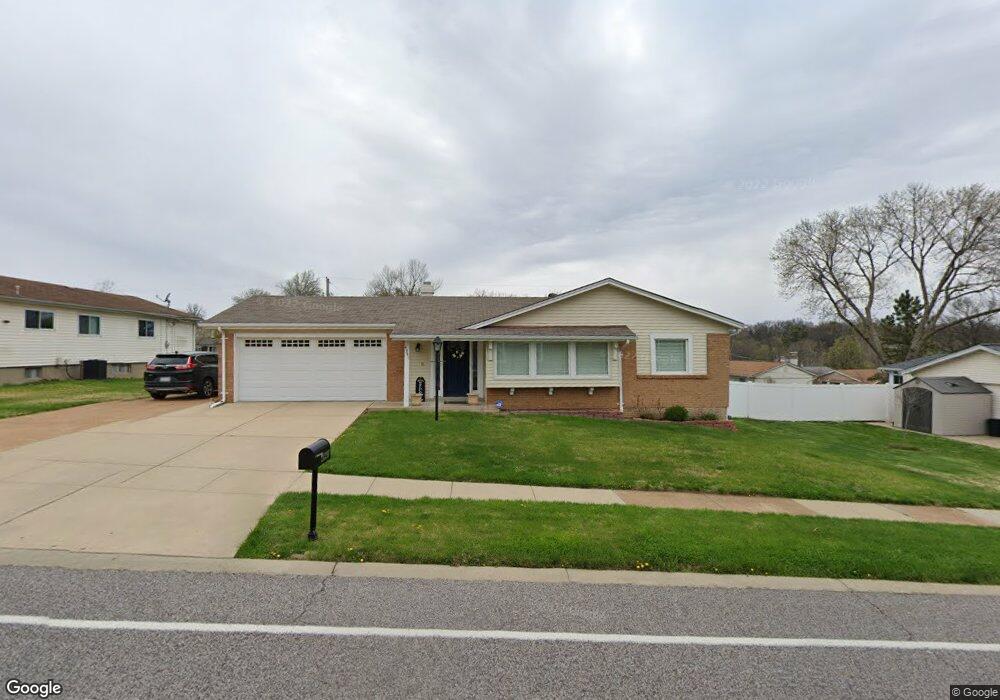
4941 Ambs Rd Saint Louis, MO 63128
Estimated Value: $305,000 - $361,000
4
Beds
2
Baths
1,649
Sq Ft
$200/Sq Ft
Est. Value
About This Home
This home is located at 4941 Ambs Rd, Saint Louis, MO 63128 and is currently estimated at $329,652, approximately $199 per square foot. 4941 Ambs Rd is a home located in St. Louis County with nearby schools including Trautwein Elementary School, Washington Middle School, and Mehlville High School.
Ownership History
Date
Name
Owned For
Owner Type
Purchase Details
Closed on
Nov 7, 2014
Sold by
Muyco Tobin A Patricia
Bought by
Muyco Ii J Antonio and Pappas Muyco Evangeline
Current Estimated Value
Home Financials for this Owner
Home Financials are based on the most recent Mortgage that was taken out on this home.
Original Mortgage
$177,721
Interest Rate
4.23%
Mortgage Type
FHA
Create a Home Valuation Report for This Property
The Home Valuation Report is an in-depth analysis detailing your home's value as well as a comparison with similar homes in the area
Home Values in the Area
Average Home Value in this Area
Purchase History
| Date | Buyer | Sale Price | Title Company |
|---|---|---|---|
| Muyco Ii J Antonio | $181,000 | Investors Title Company |
Source: Public Records
Mortgage History
| Date | Status | Borrower | Loan Amount |
|---|---|---|---|
| Closed | Muyco Ii J Antonio | $177,721 |
Source: Public Records
Tax History Compared to Growth
Tax History
| Year | Tax Paid | Tax Assessment Tax Assessment Total Assessment is a certain percentage of the fair market value that is determined by local assessors to be the total taxable value of land and additions on the property. | Land | Improvement |
|---|---|---|---|---|
| 2025 | $3,156 | $49,710 | $13,360 | $36,350 |
| 2024 | $3,156 | $46,910 | $10,370 | $36,540 |
| 2023 | $3,156 | $46,910 | $10,370 | $36,540 |
| 2022 | $2,836 | $42,900 | $10,370 | $32,530 |
| 2021 | $2,745 | $42,900 | $10,370 | $32,530 |
| 2020 | $2,300 | $34,120 | $8,890 | $25,230 |
| 2019 | $2,293 | $34,120 | $8,890 | $25,230 |
| 2018 | $2,203 | $29,580 | $7,430 | $22,150 |
| 2017 | $2,200 | $29,580 | $7,430 | $22,150 |
| 2016 | $2,218 | $28,620 | $7,430 | $21,190 |
| 2015 | $2,037 | $28,620 | $7,430 | $21,190 |
| 2014 | $2,131 | $29,660 | $5,620 | $24,040 |
Source: Public Records
Map
Nearby Homes
- 5057 Peyton Place Ct
- 4814 Hursley Dr
- 5131 Butler Bend Dr
- 5102 Peyton Place Ct
- 4839 Hursley Dr
- 5161 Butler Bend Dr
- 4508 Frederickton Ct
- 4921 Kerth Rd
- 4643 Littlebury Dr
- 4753 Morestead Dr
- 4540 Butler Hill Rd
- 4818 Chapel Hill Dr
- 5317 Hamlin Ct
- 5263 Faro Dr
- 5135 Towne Centre Dr
- 4803 Broad Oak Dr
- 5251 Tuscan Chase Ct
- 4947 Butler Hill Rd
- 4801 Langtree Dr
- 4645 Tauneybrook Dr
- 4949 Ambs Rd
- 4933 Ambs Rd
- 4712 Towne Centre Dr
- 4940 Ambs Rd
- 4700 Brawley Ct
- 4707 Brawley Ct
- 4957 Ambs Rd
- 4720 Towne Centre Dr
- 4934 Ambs Rd
- 4965 Ambs Rd
- 4726 Towne Centre Dr
- 4960 Ambs Rd
- 4960 Ambs Rd
- 4960 Ambs Rd
- 4960 Ambs Rd
- 4715 Brawley Ct
- 4950 Ambs Rd
- 4706 Brawley Ct
- 4680 Towne Centre Dr
- 4711 Towne Centre Dr