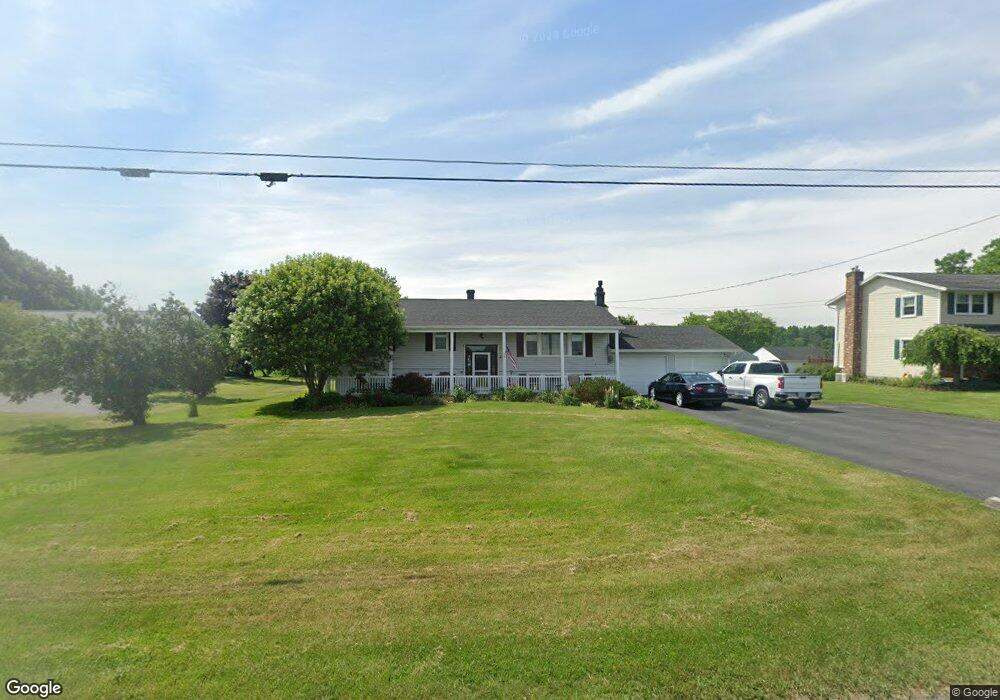
4941 Emerson Rd Canandaigua, NY 14424
Estimated Value: $288,000 - $416,000
5
Beds
2
Baths
2,428
Sq Ft
$151/Sq Ft
Est. Value
About This Home
This home is located at 4941 Emerson Rd, Canandaigua, NY 14424 and is currently estimated at $367,129, approximately $151 per square foot. 4941 Emerson Rd is a home located in Ontario County with nearby schools including Canandaigua Primary-Elementary School, Canandaigua Middle School, and Canandaigua Academy And Middle School.
Ownership History
Date
Name
Owned For
Owner Type
Purchase Details
Closed on
Aug 13, 2009
Sold by
King Marty N
Bought by
Bradley James R
Current Estimated Value
Home Financials for this Owner
Home Financials are based on the most recent Mortgage that was taken out on this home.
Original Mortgage
$176,000
Interest Rate
5.36%
Mortgage Type
Purchase Money Mortgage
Purchase Details
Closed on
Oct 31, 1994
Sold by
Boughton Olin W Leary Kindred
Bought by
King Marty P
Create a Home Valuation Report for This Property
The Home Valuation Report is an in-depth analysis detailing your home's value as well as a comparison with similar homes in the area
Home Values in the Area
Average Home Value in this Area
Purchase History
| Date | Buyer | Sale Price | Title Company |
|---|---|---|---|
| Bradley James R | $181,000 | Martin Muehe | |
| King Marty P | $95,000 | -- |
Source: Public Records
Mortgage History
| Date | Status | Borrower | Loan Amount |
|---|---|---|---|
| Open | Bradley James R | $205,000 | |
| Closed | Bradley James R | $169,722 | |
| Closed | Bradley James R | $167,500 | |
| Closed | Bradley James R | $166,550 | |
| Closed | Bradley James R | $176,000 |
Source: Public Records
Tax History Compared to Growth
Tax History
| Year | Tax Paid | Tax Assessment Tax Assessment Total Assessment is a certain percentage of the fair market value that is determined by local assessors to be the total taxable value of land and additions on the property. | Land | Improvement |
|---|---|---|---|---|
| 2024 | $5,589 | $273,000 | $26,400 | $246,600 |
| 2023 | $6,127 | $273,000 | $26,400 | $246,600 |
| 2022 | $6,307 | $213,800 | $22,000 | $191,800 |
| 2021 | $6,142 | $213,800 | $22,000 | $191,800 |
| 2020 | $5,019 | $213,800 | $22,000 | $191,800 |
| 2019 | $0 | $213,800 | $22,000 | $191,800 |
| 2018 | $4,963 | $213,800 | $22,000 | $191,800 |
| 2017 | $0 | $182,000 | $21,300 | $160,700 |
| 2016 | $4,099 | $182,000 | $21,300 | $160,700 |
| 2015 | -- | $182,000 | $21,300 | $160,700 |
| 2014 | -- | $182,000 | $21,300 | $160,700 |
Source: Public Records
Map
Nearby Homes
- 0 Emerson Rd Unit R1635632
- 5050 Emerson Rd
- 182 Kennedy St
- 2128 County Road 8
- 135 Deseyn Dr
- 28 Midlakes Dr
- 65 Midlakes Dr
- 16 Keuka Ln
- 120 Fort Hill Ave
- 55 Fort Hill Ave
- 2409 (Lot 6) Brickyard Rd
- 5605 (Lot 2) Thomas Rd
- 353 Gibson St
- 2382 State Route 21
- 40 Dungan St
- 34 Dungan St
- 79 Gibson St
- 5575 (Lot 1) Thomas Rd
- 5635 (Lot 3) Thomas Rd
- 104 N Main St
- 4949 Emerson Rd
- 4935 Emerson Rd
- 4929 Emerson Rd
- 4953 Emerson Rd
- 4959 Emerson Rd
- 4917 Emerson Rd
- 4911 Emerson Rd
- 4964 Emerson Rd
- 2155 County Road 28
- 2163 County Road 28
- 2125 County Road 28
- 4875 Emerson Rd
- 2156 County Road 28
- 2158 County Road 28
- 5000 Emerson Rd
- 0 Co Road 28 Unit R181650
- 0 Co Road 28 Unit R289788
- 0000 County Road 28
- 0 Co Road 28 Unit R1401804
- 2150 Sand Hill Rd