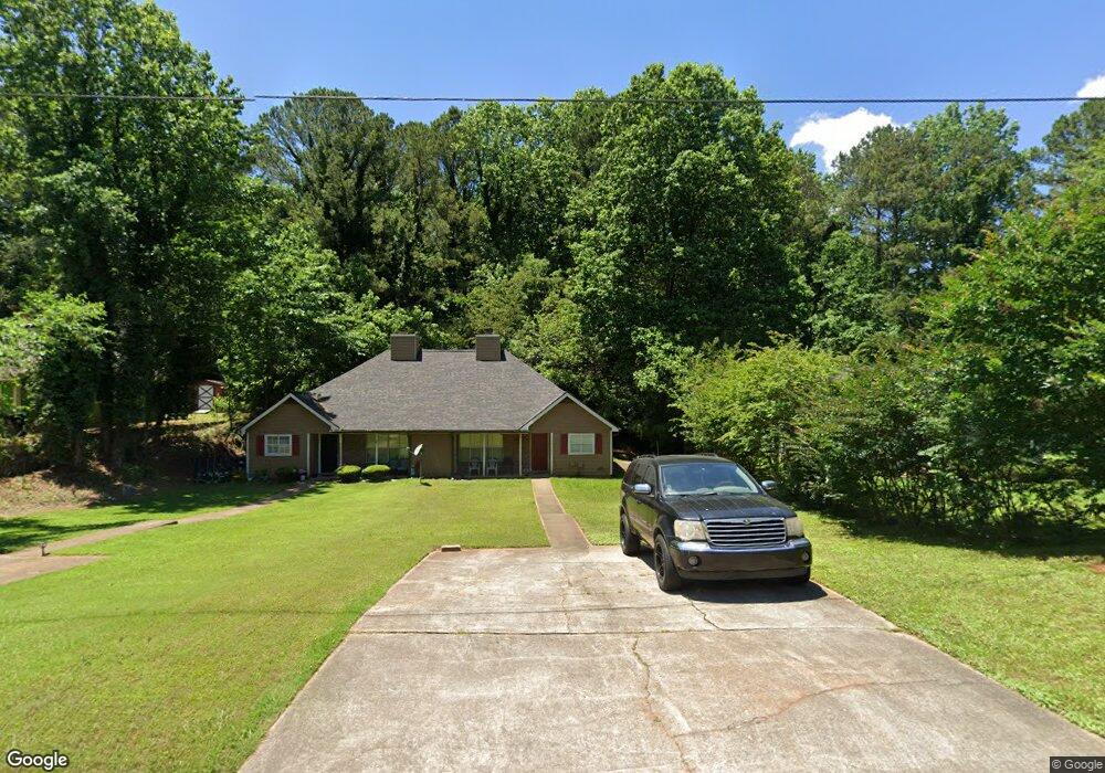
4941 Farmstead Ct NE Woodstock, GA 30188
Sandy Plains NeighborhoodEstimated Value: $181,725 - $269,000
2
Beds
2
Baths
1,048
Sq Ft
$216/Sq Ft
Est. Value
About This Home
This home is located at 4941 Farmstead Ct NE, Woodstock, GA 30188 and is currently estimated at $226,181, approximately $215 per square foot. 4941 Farmstead Ct NE is a home located in Cobb County with nearby schools including Nicholson Elementary School, McCleskey Middle School, and Kell High School.
Ownership History
Date
Name
Owned For
Owner Type
Purchase Details
Closed on
Feb 22, 2022
Sold by
Whitlock Acquisitions Llc
Bought by
Cellini James Paul
Current Estimated Value
Purchase Details
Closed on
Feb 18, 2022
Sold by
Stanley Fountain
Bought by
Whitlock Acquisitions Llc
Purchase Details
Closed on
Dec 11, 2014
Sold by
Kelly Meridith Mcglon
Bought by
Fountain Stanley
Create a Home Valuation Report for This Property
The Home Valuation Report is an in-depth analysis detailing your home's value as well as a comparison with similar homes in the area
Home Values in the Area
Average Home Value in this Area
Purchase History
| Date | Buyer | Sale Price | Title Company |
|---|---|---|---|
| Cellini James Paul | $108,000 | Okelley & Sorohan | |
| Whitlock Acquisitions Llc | $554,300 | Okelley & Sorohan Attorneys At | |
| Fountain Stanley | $105,000 | -- |
Source: Public Records
Tax History Compared to Growth
Tax History
| Year | Tax Paid | Tax Assessment Tax Assessment Total Assessment is a certain percentage of the fair market value that is determined by local assessors to be the total taxable value of land and additions on the property. | Land | Improvement |
|---|---|---|---|---|
| 2024 | $2,384 | $79,076 | $24,000 | $55,076 |
| 2023 | $1,302 | $43,200 | $11,240 | $31,960 |
| 2022 | $1,930 | $63,596 | $16,000 | $47,596 |
| 2021 | $1,358 | $44,752 | $12,000 | $32,752 |
| 2020 | $1,272 | $41,924 | $8,000 | $33,924 |
| 2019 | $1,272 | $41,924 | $8,000 | $33,924 |
| 2018 | $999 | $32,900 | $8,000 | $24,900 |
| 2017 | $893 | $31,056 | $8,000 | $23,056 |
| 2016 | $659 | $22,920 | $4,800 | $18,120 |
| 2015 | $619 | $21,000 | $4,800 | $16,200 |
| 2014 | $641 | $21,588 | $0 | $0 |
Source: Public Records
Map
Nearby Homes
- 5142 Farm Place Dr NE
- 639 Tigers Eye Terrace
- 540 Stockwood Dr
- 4793 Moonstone Trace
- 4785 Moonstone Trace
- The Gavin E Plan at The Village at Shallowford - Signature Series
- The Marion A Plan at The Village at Shallowford - Classic Series
- The Cary A Plan at The Village at Shallowford - Classic Series
- 4669 Blue Topaz Trail
- 4778 Moonstone Trace
- 707 Smokey Quartz Way
- 710 Smokey Quartz Way
- 694 Smokey Quartz Way
- 4785 Moonstone NE
- 703 Smokey Quartz Way
- 706 Smokey Quartz Way
- 702 Smokey Quartz Way
- 4939 Farmstead Ct NE Unit 4939-4941
- 4939 Farmstead Ct NE Unit 4941
- 4939 Farmstead Ct NE
- 4943 Farmstead Ct NE Unit 4945
- 4943 Farmstead Ct NE
- 4937 Farmstead Ct NE Unit 2
- 4947 Farmstead Ct NE
- 4935 Farmstead Ct NE Unit 2
- 0 Farmstead Ct NE Unit 3286371
- 0 Farmstead Ct NE Unit 7574713
- 4949 Farmstead Ct NE
- 211 Farm Ridge Dr NE
- 4933 Farmstead Ct NE
- 4942 Farmstead Ct NE
- 4938 Farmstead Ct NE Unit 4938
- 4938 Farmstead Ct NE
- 4938 Farmstead Ct NE Unit NE
- 5110 Hill Farm Dr NE Unit 6
- 209 Farm Ridge Dr NE Unit 209/11
- 209 Farm Ridge Dr NE