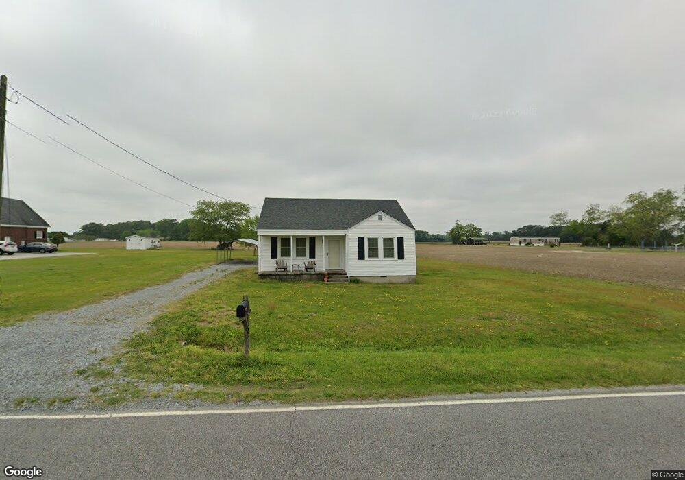
4941 Pauls Path Rd La Grange, NC 28551
Estimated Value: $101,487 - $299,000
2
Beds
1
Bath
870
Sq Ft
$216/Sq Ft
Est. Value
About This Home
This home is located at 4941 Pauls Path Rd, La Grange, NC 28551 and is currently estimated at $187,622, approximately $215 per square foot. 4941 Pauls Path Rd is a home located in Lenoir County with nearby schools including La Grange Elementary School, E.B. Frink Middle School, and North Lenoir High School.
Ownership History
Date
Name
Owned For
Owner Type
Purchase Details
Closed on
Dec 22, 2024
Sold by
Lewis Thomas Robert
Bought by
Thomas Ashley Craig
Current Estimated Value
Purchase Details
Closed on
Apr 26, 2011
Sold by
Holland David L and Holland Robert B
Bought by
Thomas Sylvia H
Purchase Details
Closed on
Oct 15, 2008
Sold by
Kirkland Grace H and Kirkland Richard
Bought by
Holland Robert B and Thomas Sylvia H
Create a Home Valuation Report for This Property
The Home Valuation Report is an in-depth analysis detailing your home's value as well as a comparison with similar homes in the area
Home Values in the Area
Average Home Value in this Area
Purchase History
| Date | Buyer | Sale Price | Title Company |
|---|---|---|---|
| Thomas Ashley Craig | -- | None Listed On Document | |
| Thomas Ashley Craig | -- | None Listed On Document | |
| Thomas Sylvia H | $48,500 | None Available | |
| Thomas Sylvia H | $48,500 | -- | |
| Holland Robert B | $58,500 | None Available |
Source: Public Records
Tax History Compared to Growth
Tax History
| Year | Tax Paid | Tax Assessment Tax Assessment Total Assessment is a certain percentage of the fair market value that is determined by local assessors to be the total taxable value of land and additions on the property. | Land | Improvement |
|---|---|---|---|---|
| 2025 | $786 | $107,166 | $18,912 | $88,254 |
| 2024 | $459 | $49,667 | $12,000 | $37,667 |
| 2023 | $530 | $49,667 | $12,000 | $37,667 |
| 2022 | $530 | $49,667 | $12,000 | $37,667 |
| 2021 | $530 | $49,667 | $12,000 | $37,667 |
| 2020 | $530 | $49,667 | $12,000 | $37,667 |
| 2019 | $530 | $49,667 | $12,000 | $37,667 |
| 2018 | $522 | $49,667 | $12,000 | $37,667 |
| 2017 | $519 | $49,667 | $12,000 | $37,667 |
| 2014 | $520 | $49,854 | $12,000 | $37,854 |
| 2013 | -- | $49,854 | $12,000 | $37,854 |
| 2011 | -- | $45,854 | $8,000 | $37,854 |
Source: Public Records
Map
Nearby Homes
- 3796 Pecan Grove Cir
- 5130 Aldridge Store Rd
- 4310 Colie Rd
- 3821 Lindsey Ln
- 3803 Huntcliff Dr
- 3730 Huntcliff Dr
- 3766 Huntcliff Dr
- 3740 Huntcliff Dr
- 3777 Waters Mill Rd
- 3725 Huntcliff Dr
- 3696 Drew Farmer Rd
- 3684 Drew Farmer Rd
- 3711 Drew Farmer Rd
- 5024 Gladys Owens St
- 113 Institute
- 109 Institute
- 107 Institute
- 606 N Caswell St
- Monroe Plan at Walnut Hills - Liberty Series
- 4921 Pauls Path Rd
- 4979 Pauls Path Rd
- 4995 Pauls Path Rd
- 4418 Aldridge Store Rd
- 4395 Aldridge Store Rd
- 4353 Aldridge Store Rd
- 4433 Aldridge Store Rd
- 4990 Pauls Path Rd
- 4441 Aldridge Store Rd
- 4341 Aldridge Store Rd
- 5045 Pauls Path Rd
- 5057 Pauls Path Rd
- 5089 Pauls Path Rd
- 5089 Pauls Path Rd
- 4485 Aldridge Store Rd
- 5074 Pauls Path Rd
- 4798 Pauls Path Rd
- 4528 Aldridge Store Rd
- 4796 Pauls Path Rd
- 4795 Pauls Path Rd