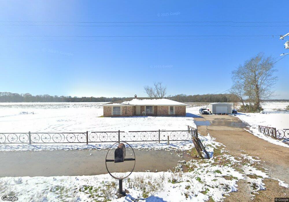
4942 Highway 71 S Bunkie, LA 71322
Estimated Value: $115,409 - $310,000
--
Bed
--
Bath
--
Sq Ft
0.52
Acres
About This Home
This home is located at 4942 Highway 71 S, Bunkie, LA 71322 and is currently estimated at $193,852. 4942 Highway 71 S is a home located in Avoyelles Parish with nearby schools including Bunkie Elementary School and Bunkie Magnet High School.
Ownership History
Date
Name
Owned For
Owner Type
Purchase Details
Closed on
Jun 14, 2023
Sold by
Frazier Clinton W and Frazier Helen Clayton
Bought by
Frazier Helen Clayton
Current Estimated Value
Purchase Details
Closed on
Apr 7, 2023
Sold by
Parks Florence Ann and Parks Thomas W
Bought by
Frazier Clinton W and Frazier Helen Clayton
Home Financials for this Owner
Home Financials are based on the most recent Mortgage that was taken out on this home.
Original Mortgage
$63,631
Interest Rate
6.39%
Mortgage Type
New Conventional
Create a Home Valuation Report for This Property
The Home Valuation Report is an in-depth analysis detailing your home's value as well as a comparison with similar homes in the area
Home Values in the Area
Average Home Value in this Area
Purchase History
| Date | Buyer | Sale Price | Title Company |
|---|---|---|---|
| Frazier Helen Clayton | -- | None Listed On Document | |
| Frazier Clinton W | -- | None Listed On Document |
Source: Public Records
Mortgage History
| Date | Status | Borrower | Loan Amount |
|---|---|---|---|
| Previous Owner | Frazier Clinton W | $63,631 |
Source: Public Records
Tax History Compared to Growth
Tax History
| Year | Tax Paid | Tax Assessment Tax Assessment Total Assessment is a certain percentage of the fair market value that is determined by local assessors to be the total taxable value of land and additions on the property. | Land | Improvement |
|---|---|---|---|---|
| 2024 | $564 | $7,660 | $1,640 | $6,020 |
| 2023 | $566 | $7,660 | $1,640 | $6,020 |
| 2022 | $410 | $5,550 | $390 | $5,160 |
| 2021 | $410 | $5,550 | $390 | $5,160 |
| 2020 | $410 | $5,550 | $390 | $5,160 |
| 2019 | $411 | $5,550 | $390 | $5,160 |
| 2018 | $411 | $5,550 | $390 | $5,160 |
| 2017 | $411 | $5,550 | $390 | $5,160 |
| 2015 | $436 | $5,870 | $180 | $5,690 |
| 2013 | $436 | $5,870 | $180 | $5,690 |
Source: Public Records
Map
Nearby Homes
- 1235 Louisiana 107
- 2179 Highway 1178 None
- Dufour Rd Unit LotWP001
- 1022 Cotton Patch Rd
- 1020 Cotton St
- 3492 Louisiana 107
- 204 Chicken Ln
- 7335 Louisiana 115
- 1584 Louisiana 362
- 940 Highway 29 S
- 611 Lake St
- 305 Hibernia St
- 1908 Louisiana 29
- 604 S Holly St
- 611 Chennault St
- 806 S Marshall Blvd
- 706 Chennault St
- 307 S Mabel St
- 300 S Sewell Place
- 202 N Mabel St