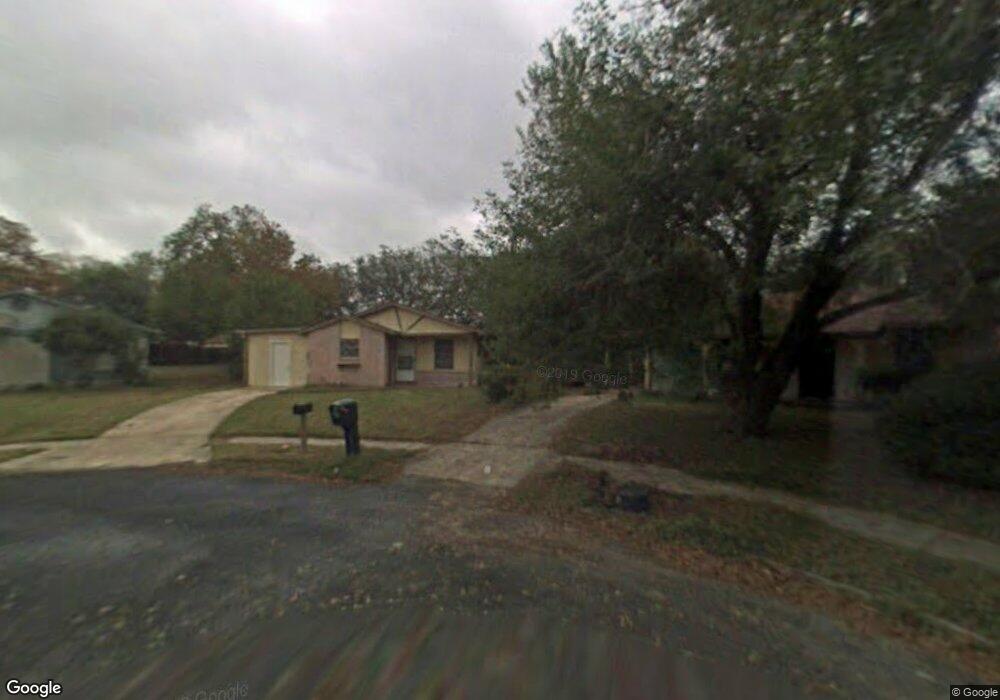
4943 Melvin Dr San Antonio, TX 78220
Southeast Side NeighborhoodEstimated Value: $145,000 - $187,000
3
Beds
2
Baths
1,267
Sq Ft
$129/Sq Ft
Est. Value
About This Home
This home is located at 4943 Melvin Dr, San Antonio, TX 78220 and is currently estimated at $162,961, approximately $128 per square foot. 4943 Melvin Dr is a home located in Bexar County with nearby schools including Hirsch Elementary School, Sam Houston High School, and Southwest Preparatory School.
Ownership History
Date
Name
Owned For
Owner Type
Purchase Details
Closed on
Apr 30, 2019
Sold by
Bilron Investments Llc
Bought by
Reyes Jorge A and Reyes Ivonne J
Current Estimated Value
Home Financials for this Owner
Home Financials are based on the most recent Mortgage that was taken out on this home.
Original Mortgage
$109,000
Outstanding Balance
$95,833
Interest Rate
4.2%
Mortgage Type
Purchase Money Mortgage
Estimated Equity
$67,128
Purchase Details
Closed on
Jan 13, 2016
Sold by
Alamo City Financial Llc
Bought by
Bilron Investments Llc
Purchase Details
Closed on
Jan 12, 2016
Sold by
Sinki Steven A
Bought by
Alamo City Financial Llc
Create a Home Valuation Report for This Property
The Home Valuation Report is an in-depth analysis detailing your home's value as well as a comparison with similar homes in the area
Home Values in the Area
Average Home Value in this Area
Purchase History
| Date | Buyer | Sale Price | Title Company |
|---|---|---|---|
| Reyes Jorge A | -- | None Available | |
| Bilron Investments Llc | -- | Independence Title Company | |
| Alamo City Financial Llc | -- | Independence Title Company |
Source: Public Records
Mortgage History
| Date | Status | Borrower | Loan Amount |
|---|---|---|---|
| Open | Reyes Jorge A | $109,000 |
Source: Public Records
Tax History Compared to Growth
Tax History
| Year | Tax Paid | Tax Assessment Tax Assessment Total Assessment is a certain percentage of the fair market value that is determined by local assessors to be the total taxable value of land and additions on the property. | Land | Improvement |
|---|---|---|---|---|
| 2025 | $2,898 | $118,780 | $40,460 | $78,320 |
| 2024 | $2,898 | $118,780 | $40,460 | $78,320 |
| 2023 | $2,898 | $119,670 | $40,460 | $79,210 |
| 2022 | $2,739 | $101,090 | $32,140 | $68,950 |
| 2021 | $2,109 | $75,490 | $19,250 | $56,240 |
| 2020 | $1,992 | $70,280 | $14,010 | $56,270 |
| 2019 | $1,636 | $57,080 | $13,010 | $44,070 |
| 2018 | $1,285 | $45,280 | $12,860 | $32,420 |
| 2017 | $1,077 | $38,150 | $12,860 | $25,290 |
| 2016 | $1,077 | $38,150 | $12,860 | $25,290 |
| 2015 | $863 | $35,000 | $12,860 | $22,140 |
| 2014 | $863 | $31,910 | $0 | $0 |
Source: Public Records
Map
Nearby Homes
- 4906 Frostwood Dr
- 302 Glenbrook
- 203 Lynhaven Dr
- 8532 Frostwood Dr
- 4851 Alfred Dr
- 4810 John Victor Dr
- 4823 John Victor Dr
- 510 Carol Crest St
- 4631 Kay Ann Dr
- 4614 Belinda Lee St
- 4610 Belinda Lee St
- 4607 Belinda Lee St
- 4603 Lavender Ln
- 4534 Kay Ann Dr
- 4842 Lord Rd
- 257 Glenoak Dr
- 126 Highway Dr
- 215 Midland Dr
- 111 Zerrcliff Ln
- 1240 Rice Rd
- 4939 Melvin Dr
- 4942 Melvin Dr
- 303 Glenbrook
- 307 Glenbrook
- 4935 Melvin Dr
- 211 Estate Dr
- 311 Glenbrook
- 4938 Melvin Dr
- 4910 Frostwood Dr
- 4931 Melvin Dr
- 315 Glenbrook
- 4934 Melvin Dr
- 4914 Frostwood Dr
- 4902 Frostwood Dr
- 4930 Melvin Dr
- 5011 Huntsmoor Ct
- 4927 Melvin Dr
- 5007 Huntsmoor Ct
- 218 Lynhaven Dr
- 4926 Melvin Dr