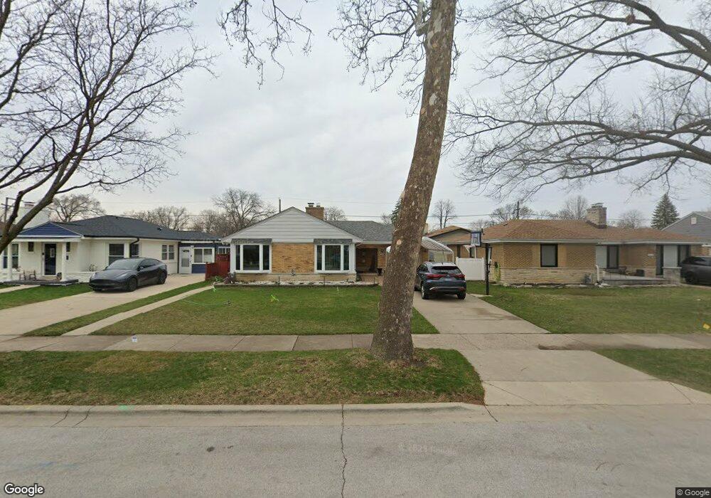
4946 Jarvis Ave Skokie, IL 60077
Southwest Skokie NeighborhoodEstimated Value: $426,000 - $485,000
2
Beds
2
Baths
1,242
Sq Ft
$369/Sq Ft
Est. Value
About This Home
This home is located at 4946 Jarvis Ave, Skokie, IL 60077 and is currently estimated at $458,744, approximately $369 per square foot. 4946 Jarvis Ave is a home located in Cook County with nearby schools including Fairview South Elementary School, Niles West High School, and Cheder Lubavitch Hebrew Day School.
Ownership History
Date
Name
Owned For
Owner Type
Purchase Details
Closed on
Nov 29, 2007
Sold by
Thomas Robert J and Kearns Teresa
Bought by
Cubero Dennis M and Cubero Lina B
Current Estimated Value
Home Financials for this Owner
Home Financials are based on the most recent Mortgage that was taken out on this home.
Original Mortgage
$299,250
Outstanding Balance
$189,511
Interest Rate
6.31%
Mortgage Type
Unknown
Estimated Equity
$269,233
Create a Home Valuation Report for This Property
The Home Valuation Report is an in-depth analysis detailing your home's value as well as a comparison with similar homes in the area
Home Values in the Area
Average Home Value in this Area
Purchase History
| Date | Buyer | Sale Price | Title Company |
|---|---|---|---|
| Cubero Dennis M | $315,000 | Sterling Title Services Llc |
Source: Public Records
Mortgage History
| Date | Status | Borrower | Loan Amount |
|---|---|---|---|
| Open | Cubero Dennis M | $299,250 |
Source: Public Records
Tax History Compared to Growth
Tax History
| Year | Tax Paid | Tax Assessment Tax Assessment Total Assessment is a certain percentage of the fair market value that is determined by local assessors to be the total taxable value of land and additions on the property. | Land | Improvement |
|---|---|---|---|---|
| 2024 | $7,729 | $34,874 | $9,040 | $25,834 |
| 2023 | $7,477 | $36,000 | $9,040 | $26,960 |
| 2022 | $7,477 | $36,000 | $9,040 | $26,960 |
| 2021 | $6,155 | $27,059 | $6,361 | $20,698 |
| 2020 | $5,936 | $27,059 | $6,361 | $20,698 |
| 2019 | $6,049 | $30,066 | $6,361 | $23,705 |
| 2018 | $5,705 | $26,010 | $5,524 | $20,486 |
| 2017 | $5,774 | $26,010 | $5,524 | $20,486 |
| 2016 | $5,695 | $26,010 | $5,524 | $20,486 |
| 2015 | $4,657 | $20,460 | $4,687 | $15,773 |
| 2014 | $4,515 | $20,460 | $4,687 | $15,773 |
| 2013 | $5,083 | $22,460 | $4,687 | $17,773 |
Source: Public Records
Map
Nearby Homes
- 4944 Jarvis Ave
- 4939 Fargo Ave
- 5037 Fargo Ave
- 4858 W Chase Ave
- 4838 Howard St Unit 401
- 4838 Howard St Unit 301
- 7500 Laramie Ave
- 4931 Brummel St
- 7507 Frontage Rd
- 8146 N Kilpatrick Ave Unit 1S
- 5153 Dobson St
- 7241 N Kilpatrick Ave
- 7748 Lincoln Ave
- 7638 Knox Ave
- 4907 Hull St
- 4856 Hull St
- 4906 Hull St
- 7848 Lincoln Ave
- 8030 N Kenton Ave Unit 2A
- 4545 W Touhy Ave Unit 511
- 4952 Jarvis Ave
- 4952 Jarvis Ave
- 4956 Jarvis Ave
- 4940 Jarvis Ave
- 4943 Fargo Ave
- 4949 Fargo Ave
- 4949 Fargo Ave
- 4930 Jarvis Ave
- 7417 Lavergne Ave
- 4933 Fargo Ave
- 4947 Jarvis Ave
- 4943 Jarvis Ave
- 4951 Jarvis Ave
- 4951 Jarvis Ave
- 4935 Jarvis Ave
- 4935 Jarvis Ave
- 4929 Fargo Ave
- 4924 Jarvis Ave
- 7400 Lavergne Ave