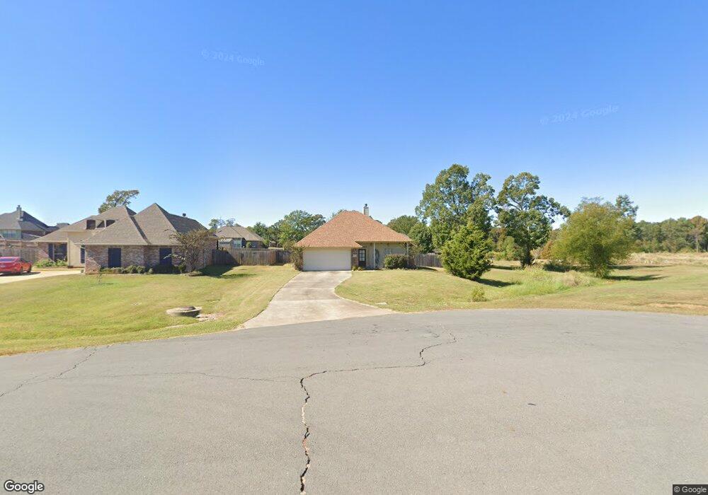
4946 Par Cir Shreveport, LA 71107
Estimated Value: $219,367 - $256,000
3
Beds
2
Baths
1,619
Sq Ft
$147/Sq Ft
Est. Value
About This Home
This home is located at 4946 Par Cir, Shreveport, LA 71107 and is currently estimated at $238,342, approximately $147 per square foot. 4946 Par Cir is a home with nearby schools including Blanchard Elementary School, Judson Fundamental Elementary School, and Fairfield Magnet School.
Ownership History
Date
Name
Owned For
Owner Type
Purchase Details
Closed on
Jul 24, 2013
Sold by
Bossier Mobile Homes Inc
Bought by
Mason Kenneth Scott and Mason Nicole Marie
Current Estimated Value
Home Financials for this Owner
Home Financials are based on the most recent Mortgage that was taken out on this home.
Original Mortgage
$130,400
Outstanding Balance
$95,100
Interest Rate
3.99%
Mortgage Type
New Conventional
Estimated Equity
$143,242
Purchase Details
Closed on
Jul 30, 2010
Sold by
E & L Development Inc
Bought by
Teel John R
Home Financials for this Owner
Home Financials are based on the most recent Mortgage that was taken out on this home.
Original Mortgage
$186,424
Interest Rate
4.54%
Mortgage Type
New Conventional
Create a Home Valuation Report for This Property
The Home Valuation Report is an in-depth analysis detailing your home's value as well as a comparison with similar homes in the area
Home Values in the Area
Average Home Value in this Area
Purchase History
| Date | Buyer | Sale Price | Title Company |
|---|---|---|---|
| Mason Kenneth Scott | $21,995 | First Commerce Title Co | |
| Teel John R | $179,900 | None Available |
Source: Public Records
Mortgage History
| Date | Status | Borrower | Loan Amount |
|---|---|---|---|
| Open | Mason Kenneth Scott | $130,400 | |
| Previous Owner | Teel John R | $186,424 |
Source: Public Records
Tax History Compared to Growth
Tax History
| Year | Tax Paid | Tax Assessment Tax Assessment Total Assessment is a certain percentage of the fair market value that is determined by local assessors to be the total taxable value of land and additions on the property. | Land | Improvement |
|---|---|---|---|---|
| 2024 | $2,975 | $18,835 | $2,789 | $16,046 |
| 2023 | $3,051 | $18,835 | $2,789 | $16,046 |
| 2022 | $3,051 | $18,835 | $2,789 | $16,046 |
| 2021 | $3,053 | $18,835 | $2,789 | $16,046 |
| 2020 | $3,053 | $18,835 | $2,789 | $16,046 |
| 2019 | $2,965 | $18,427 | $2,789 | $15,638 |
| 2018 | $1,668 | $18,427 | $2,789 | $15,638 |
| 2017 | $2,928 | $18,427 | $2,789 | $15,638 |
| 2015 | $1,624 | $17,880 | $2,790 | $15,090 |
| 2014 | $1,635 | $17,880 | $2,790 | $15,090 |
| 2013 | -- | $17,880 | $2,790 | $15,090 |
Source: Public Records
Map
Nearby Homes
- 4863 Chipshot Ln
- 4917 Players Loop
- 5862 Northwood Oaks Dr
- 4840 Pin High Cir
- 4857 Sandtrap Cir
- 4835 Bogey Ln
- 4821 Bogey Ln
- 4833 Bogey Ln
- 4845 Bogey Ln
- Lot 94 Chickamauga Trail
- Lot 95 Chickamauga Trail
- 5785 Bunker Way
- 5536 Northwood S
- 6026 Cherry Hill Ave
- 6001 N Market St
- 6420 Sand Hill Ave
- 1021 Scarpengo Rd
- 6032 N Market St
- 6105 Shadow Wood Dr
- 0 Buckingham Dr Unit 21060001