Estimated Value: $358,000 - $537,315
3
Beds
2
Baths
3,216
Sq Ft
$133/Sq Ft
Est. Value
About This Home
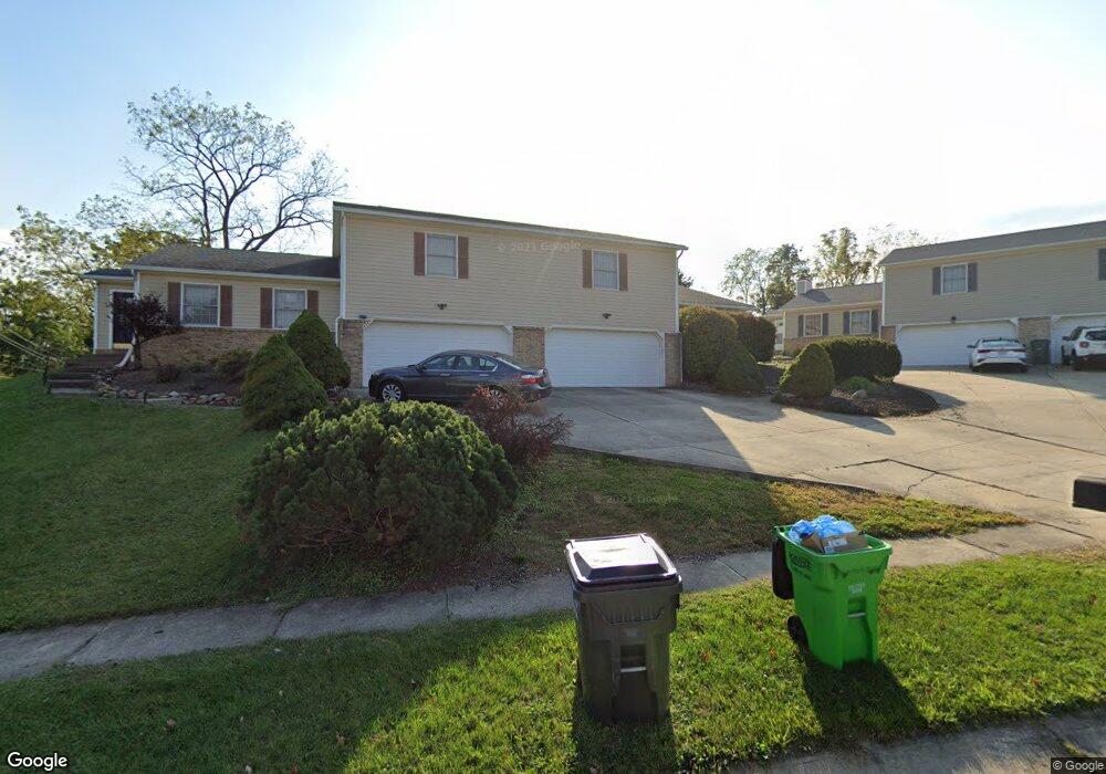
This home is located at 4947 Friar Rd Unit 4945, Stow, OH 44224 and is currently estimated at $426,829, approximately $132 per square foot. 4947 Friar Rd Unit 4945 is a home located in Summit County with nearby schools including Stow-Munroe Falls High School, Primrose School of Hudson, and Holy Family Elementary School.
Ownership History
Date
Name
Owned For
Owner Type
Purchase Details
Closed on
Aug 26, 2009
Sold by
Fannie Mae
Bought by
Miles Jeffrey H
Current Estimated Value
Home Financials for this Owner
Home Financials are based on the most recent Mortgage that was taken out on this home.
Original Mortgage
$179,639
Outstanding Balance
$117,483
Interest Rate
5.19%
Mortgage Type
FHA
Estimated Equity
$309,346
Purchase Details
Closed on
Feb 17, 2009
Sold by
Montz Stephen A
Bought by
Federal National Mortgage Association
Create a Home Valuation Report for This Property
The Home Valuation Report is an in-depth analysis detailing your home's value as well as a comparison with similar homes in the area
Home Values in the Area
Average Home Value in this Area
Purchase History
| Date | Buyer | Sale Price | Title Company |
|---|---|---|---|
| Miles Jeffrey H | $185,500 | Accutitle Agency Inc | |
| Federal National Mortgage Association | $180,000 | None Available |
Source: Public Records
Mortgage History
| Date | Status | Borrower | Loan Amount |
|---|---|---|---|
| Open | Miles Jeffrey H | $179,639 |
Source: Public Records
Tax History Compared to Growth
Tax History
| Year | Tax Paid | Tax Assessment Tax Assessment Total Assessment is a certain percentage of the fair market value that is determined by local assessors to be the total taxable value of land and additions on the property. | Land | Improvement |
|---|---|---|---|---|
| 2025 | $8,650 | $150,371 | $12,964 | $137,407 |
| 2024 | $8,650 | $150,371 | $12,964 | $137,407 |
| 2023 | $8,650 | $150,371 | $12,964 | $137,407 |
| 2022 | $7,594 | $116,565 | $10,049 | $106,516 |
| 2021 | $6,815 | $116,565 | $10,049 | $106,516 |
| 2020 | $6,700 | $116,570 | $10,050 | $106,520 |
| 2019 | $5,446 | $88,360 | $9,850 | $78,510 |
| 2018 | $5,359 | $88,360 | $9,850 | $78,510 |
| 2017 | $5,320 | $88,360 | $9,850 | $78,510 |
| 2016 | $5,471 | $85,190 | $9,850 | $75,340 |
| 2015 | $5,320 | $85,190 | $9,850 | $75,340 |
| 2014 | $5,325 | $85,190 | $9,850 | $75,340 |
| 2013 | $4,959 | $79,430 | $11,610 | $67,820 |
Source: Public Records
Map
Nearby Homes
- 4917 Independence Cir Unit B
- 4901 Independence Cir Unit B
- 4901 Pebblehurst Dr
- 4621 Graford Ln
- 2444 Port Charles Dr
- 2380 Port Williams Dr Unit 2380
- 2418 Wrens Dr S Unit G
- 4903 Fishcreek Rd Unit 11B
- 0 Stow Rd Unit 5102979
- 4731 Haughton Ct
- 2327 Crockett Cir
- 5465 Park Vista Ct
- 2140 Woodlawn Cir Unit 2144
- 4227 Baird Rd
- 5473 Young Rd
- 4131 Burton Dr
- 3165 Peterboro Dr
- 2028 Willowdale Dr
- 5431 Diana Lynn Dr
- 1627 Cypress Ct
- 4943 Friar Rd Unit 4941
- 4941 Friar Rd
- 2612 Call Rd
- 4944 Friar Rd
- 4944 Friar Rd
- 4944 Friar Rd
- 4944 Friar Rd
- 4944 Friar Rd Unit C
- 4944 Friar Rd Unit A
- 4944 Friar Rd Unit B
- 2599 Call Rd
- 2622 Call Rd
- 4701 Fox Run Dr
- 2625 Call Rd
- 4929 Independence Cir
- 4929 Independence Cir Unit 9C
- 4929 Independence Cir Unit 9B
- 4929 Independence Cir
- 4929 Independence Cir Unit A
- 4929 Independence Cir Unit C