Estimated Value: $168,000 - $230,475
3
Beds
1
Bath
--
Sq Ft
0.67
Acres
About This Home
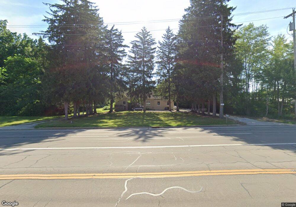
This home is located at 4947 State Route 43, Kent, OH 44240 and is currently estimated at $207,825. 4947 State Route 43 is a home located in Portage County with nearby schools including Brimfield Elementary School, Field Middle School, and Field High School.
Ownership History
Date
Name
Owned For
Owner Type
Purchase Details
Closed on
Feb 9, 2005
Sold by
Folk Theodore L and Folk Virginia L
Bought by
Chicoski Joseph W and Chicoski Allyson S
Current Estimated Value
Purchase Details
Closed on
Oct 28, 2003
Sold by
Folk Theodore L and Folk Virginia L
Bought by
State Of Ohio
Purchase Details
Closed on
Aug 30, 2002
Sold by
Durham James L
Bought by
Folk Theodore L and Folk Virginia L
Purchase Details
Closed on
Jan 1, 1990
Bought by
Durham James L and Durham Sherry
Create a Home Valuation Report for This Property
The Home Valuation Report is an in-depth analysis detailing your home's value as well as a comparison with similar homes in the area
Home Values in the Area
Average Home Value in this Area
Purchase History
| Date | Buyer | Sale Price | Title Company |
|---|---|---|---|
| Chicoski Joseph W | $130,000 | Chicago Title Insurance Co | |
| State Of Ohio | $3,500 | -- | |
| Folk Theodore L | $115,000 | First Pointe Title Agency | |
| Durham James L | -- | -- |
Source: Public Records
Tax History Compared to Growth
Tax History
| Year | Tax Paid | Tax Assessment Tax Assessment Total Assessment is a certain percentage of the fair market value that is determined by local assessors to be the total taxable value of land and additions on the property. | Land | Improvement |
|---|---|---|---|---|
| 2024 | $3,116 | $63,640 | $15,300 | $48,340 |
| 2023 | $2,512 | $40,990 | $12,950 | $28,040 |
| 2022 | $2,586 | $40,990 | $12,950 | $28,040 |
| 2021 | $2,479 | $40,990 | $12,950 | $28,040 |
| 2020 | $2,552 | $33,880 | $12,950 | $20,930 |
| 2019 | $2,539 | $33,880 | $12,950 | $20,930 |
| 2018 | $2,404 | $32,800 | $12,950 | $19,850 |
| 2017 | $2,404 | $32,800 | $12,950 | $19,850 |
| 2016 | $2,112 | $32,800 | $12,950 | $19,850 |
| 2015 | $2,111 | $32,800 | $12,950 | $19,850 |
| 2014 | $2,163 | $32,800 | $12,950 | $19,850 |
| 2013 | $2,022 | $32,800 | $12,950 | $19,850 |
Source: Public Records
Map
Nearby Homes
- V/L Sherman Rd
- Poplar Plan at Woodland Reserve
- Nassau Cove Plan at Woodland Reserve
- 1224 Cedar Ridge Rd
- 1236 Cedar Ridge Rd
- 4682 State Route 43
- 0 Meloy Rd Unit 5162435
- 1354 Brimfield Dr
- 4837 King Meadow Trail
- 1625 S Lincoln St
- 720 Ivan Dr
- 847 Lakeview Ct
- 1587 Chadwick Rd
- 4649 Creekside Dr Unit 4649
- 1755 Honeychuck Ln
- 703 Avondale St
- 708 Berkeley St
- 4891 Edson Rd
- 238 Valleyview Dr
- 1426 Loop Rd Unit 1426
- 4941 State Route 43
- 4965 State Route 43
- 4967 State Route 43
- 4963 State Route 43
- 5023 State Route 43
- 5023 State Route 43
- 5005 State Route 43
- 5041 State Route 43
- 1201 Cedar Ridge Rd Unit 36852980
- 1209 Cedar Ridge Dr
- 1228 Cedar Ridge Dr
- 1236 Cedar Ridge Dr
- 1205 Cedar Ridge Dr
- 4891 State Route 43
- 5054 State Route 43
- 5062 State Route 43
- 4980 Ohio 43
- 5060 Ohio 43
- 5082 State Route 43
- 5090 State Route 43