Estimated Value: $364,986 - $395,000
3
Beds
2
Baths
1,733
Sq Ft
$220/Sq Ft
Est. Value
About This Home
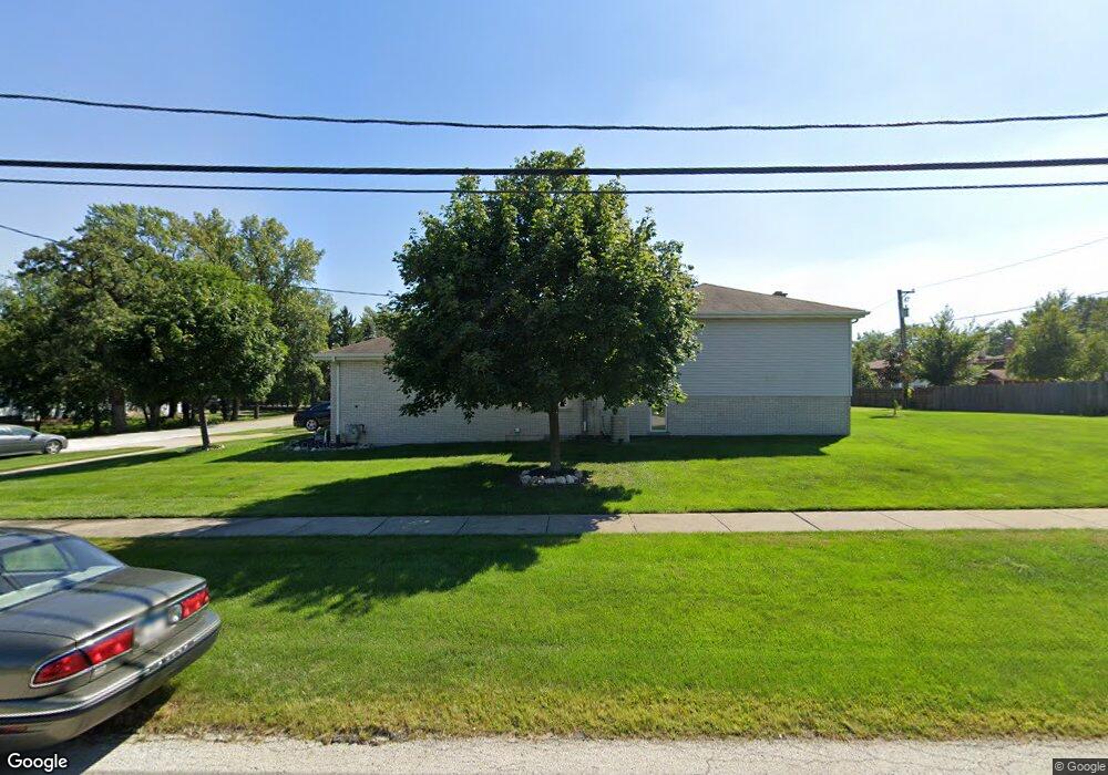
This home is located at 4947 W 118th St, Alsip, IL 60803 and is currently estimated at $381,997, approximately $220 per square foot. 4947 W 118th St is a home located in Cook County with nearby schools including Hazelgreen Elementary School, Prairie Jr High School, and A B Shepard High School.
Ownership History
Date
Name
Owned For
Owner Type
Purchase Details
Closed on
Feb 25, 1999
Sold by
Alvarez Victor N and Alvarez Iris S
Bought by
Quinn James T and Porter Quinn Anne M
Current Estimated Value
Home Financials for this Owner
Home Financials are based on the most recent Mortgage that was taken out on this home.
Original Mortgage
$120,000
Interest Rate
7.04%
Purchase Details
Closed on
Jan 27, 1997
Sold by
State Bank Of Countryside
Bought by
Alvarez Victor N and Alvarez Iris S
Home Financials for this Owner
Home Financials are based on the most recent Mortgage that was taken out on this home.
Original Mortgage
$152,000
Interest Rate
7.81%
Create a Home Valuation Report for This Property
The Home Valuation Report is an in-depth analysis detailing your home's value as well as a comparison with similar homes in the area
Home Values in the Area
Average Home Value in this Area
Purchase History
| Date | Buyer | Sale Price | Title Company |
|---|---|---|---|
| Quinn James T | $199,000 | Professional National Title | |
| Alvarez Victor N | $190,000 | -- |
Source: Public Records
Mortgage History
| Date | Status | Borrower | Loan Amount |
|---|---|---|---|
| Previous Owner | Quinn James T | $120,000 | |
| Previous Owner | Alvarez Victor N | $152,000 |
Source: Public Records
Tax History Compared to Growth
Tax History
| Year | Tax Paid | Tax Assessment Tax Assessment Total Assessment is a certain percentage of the fair market value that is determined by local assessors to be the total taxable value of land and additions on the property. | Land | Improvement |
|---|---|---|---|---|
| 2024 | $8,510 | $29,000 | $5,789 | $23,211 |
| 2023 | $6,733 | $29,000 | $5,789 | $23,211 |
| 2022 | $6,733 | $20,185 | $3,618 | $16,567 |
| 2021 | $6,439 | $20,185 | $3,618 | $16,567 |
| 2020 | $6,451 | $20,185 | $3,618 | $16,567 |
| 2019 | $8,337 | $24,712 | $3,376 | $21,336 |
| 2018 | $8,024 | $24,712 | $3,376 | $21,336 |
| 2017 | $8,104 | $24,712 | $3,376 | $21,336 |
| 2016 | $7,881 | $22,826 | $2,894 | $19,932 |
| 2015 | $7,770 | $22,826 | $2,894 | $19,932 |
| 2014 | $7,522 | $22,826 | $2,894 | $19,932 |
| 2013 | $7,841 | $25,465 | $2,894 | $22,571 |
Source: Public Records
Map
Nearby Homes
- 11906 S Cicero Ave
- 11601 S Lawler Ave
- 11841 S Leamington Ave
- 11756 S Leamington Ave
- 11608 S Leamington Ave
- 11553 S Joalyce Dr
- 11534 S Lee Rd
- 4511 W Howdy Ln
- 12147 S Cicero Ave
- 5008 W 122nd St Unit 2B
- 4808 W 118th St
- 4804 W 118th St
- 12211 S Spencer St
- 11558 S Kolmar Ave
- 5128 W 113th St
- 5311 W Mint Julip Dr Unit 301
- 11604 S Kenneth Ave
- 5118 W 112th Place
- 4833 W 123rd Place
- 11624 S Tripp Ave
- 11800 S Lamon Ave
- 4951 W 118th St
- 11754 S Lamon Ave
- 11808 S Lamon Ave
- 11640 S Lamon Ave
- 11740 S Lamon Ave
- Lot 2 S Lamon Ave
- Lot 1 S Lamon Ave
- 11600-40 S Lamon Ave
- 11815 S Laporte Ave
- 11748 S Lamon Ave
- 11816 S Lamon Ave
- 4855 W 118th St
- 11817 S Laporte Ave
- 11755 S Laporte Ave
- 11811 S Lamon Ave
- 11821 S Laporte Ave
- 11732 S Lamon Ave
- 11755 S Lamon Ave
- 11819 S Lamon Ave