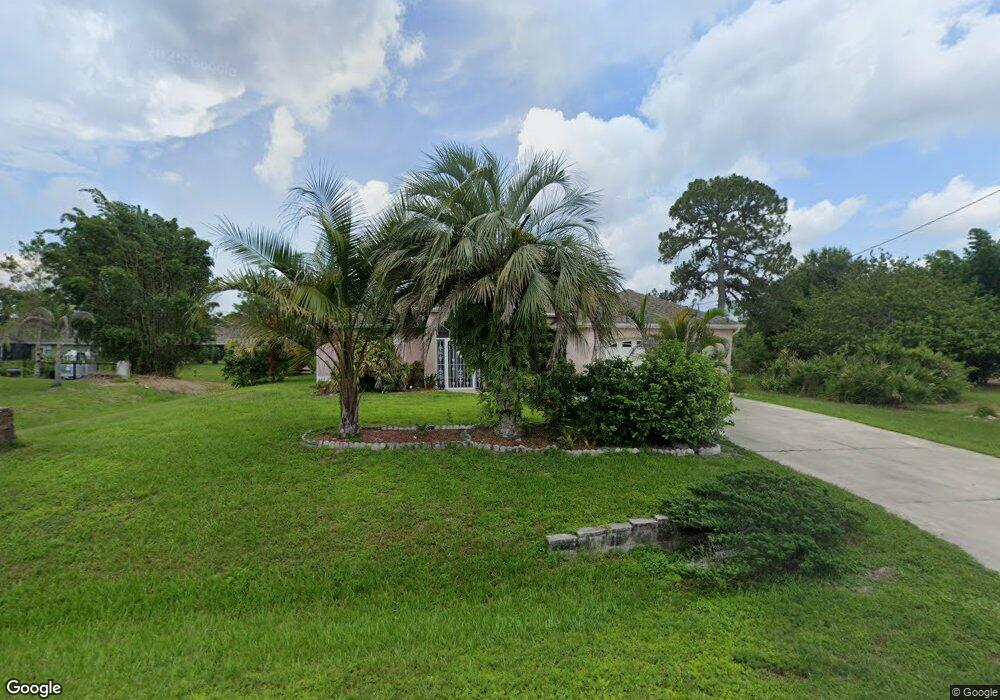
4948 Camelot St North Port, FL 34288
Estimated Value: $316,142 - $362,000
3
Beds
2
Baths
1,648
Sq Ft
$208/Sq Ft
Est. Value
About This Home
This home is located at 4948 Camelot St, North Port, FL 34288 and is currently estimated at $343,036, approximately $208 per square foot. 4948 Camelot St is a home located in Sarasota County with nearby schools including Atwater Elementary School, North Port High School, and Woodland Middle School.
Ownership History
Date
Name
Owned For
Owner Type
Purchase Details
Closed on
Nov 15, 2022
Sold by
Bingaman Robert E and Bingaman Janet G
Bought by
Bingaman Family Trust
Current Estimated Value
Purchase Details
Closed on
Jan 29, 1999
Sold by
Allstate Builders Of Sw Fl Inc
Bought by
Bingaman Robert E and Bingaman Janet G
Home Financials for this Owner
Home Financials are based on the most recent Mortgage that was taken out on this home.
Original Mortgage
$84,560
Interest Rate
6.84%
Create a Home Valuation Report for This Property
The Home Valuation Report is an in-depth analysis detailing your home's value as well as a comparison with similar homes in the area
Home Values in the Area
Average Home Value in this Area
Purchase History
| Date | Buyer | Sale Price | Title Company |
|---|---|---|---|
| Bingaman Family Trust | $100 | -- | |
| Bingaman Robert E | $105,800 | -- | |
| Bingaman Robert E | $105,800 | -- |
Source: Public Records
Mortgage History
| Date | Status | Borrower | Loan Amount |
|---|---|---|---|
| Previous Owner | Bingaman Robert E | $84,560 |
Source: Public Records
Tax History Compared to Growth
Tax History
| Year | Tax Paid | Tax Assessment Tax Assessment Total Assessment is a certain percentage of the fair market value that is determined by local assessors to be the total taxable value of land and additions on the property. | Land | Improvement |
|---|---|---|---|---|
| 2024 | $1,452 | $116,436 | -- | -- |
| 2023 | $1,452 | $92,145 | $0 | $0 |
| 2022 | $1,722 | $110,361 | $0 | $0 |
| 2021 | $1,691 | $107,147 | $0 | $0 |
| 2020 | $1,760 | $105,668 | $0 | $0 |
| 2019 | $1,702 | $103,292 | $0 | $0 |
| 2018 | $1,579 | $101,366 | $0 | $0 |
| 2017 | $1,538 | $99,281 | $0 | $0 |
| 2016 | $1,529 | $135,300 | $7,600 | $127,700 |
| 2015 | $1,548 | $121,100 | $6,000 | $115,100 |
| 2014 | $1,519 | $94,381 | $0 | $0 |
Source: Public Records
Map
Nearby Homes
- 5174 Foxhall Rd
- 0 Foxhall Rd
- 5574 Fairlane Dr
- 5509 Fairlane Dr
- 0 Jonquil Terrace
- 0 Kenvil Dr Unit MFRC7505533
- 0 Kenvil Dr Unit MFRN6141208
- 5262 Weatherton St
- 5290 Weatherton St
- 0 Pinson Dr
- 5365 Ensley Terrace
- 1415 Hedgewood Cir
- 00 Andris St
- 1434 Hedgewood Cir
- 0 Longbow Ave Unit MFRC7508594
- 0 Hedgewood Cir Unit MFRA4671292
- 0 Prosch Cir Unit MFRA4641672
- 0 Prosch Cir Unit MFRA4646491
- 1889 Northland Ave
- 0 Andris Ct Unit 2025010834
- 0 Camelot St Unit A4185929
- 0 Camelot St Unit C7436534
- 0 Camelot St Unit D6114128
- 0 Camelot St Unit A4438422
- 4967 Camelot St
- 4949 Camelot St
- 4912 Camelot St
- 5029 Dewberry St
- 4985 Camelot St
- 4931 Camelot St
- 4993 Dewberry St
- 5016 Camelot St
- 4975 Dewberry St
- 5701 Fairlane Dr
- 0 Dewberry Unit C690260
- 0 Dewberry St Unit N5913832
- 0 Dewberry St Unit D6120948
- 0 Dewberry St Unit C7436535
- 0 Dewberry St Unit D6114120
- 5689 Fairlane Dr