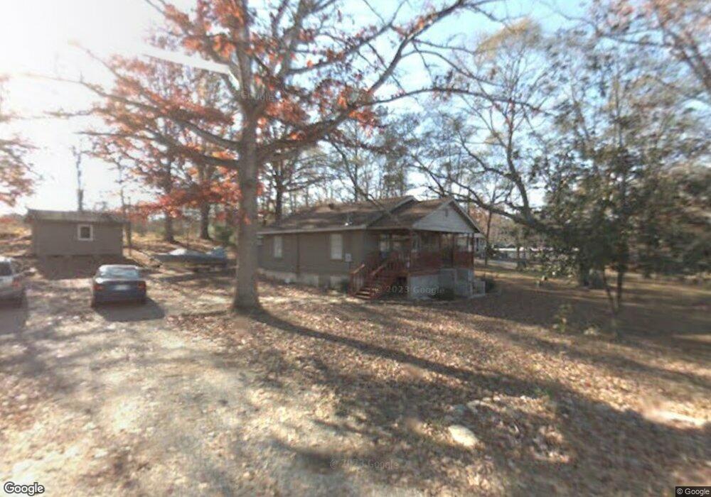
4948 Hwy 52 Alt Ce021dd3-C7a4-49f2-9fb0-d06df67b6323, GA 30705
Estimated Value: $96,000 - $151,000
3
Beds
2
Baths
1,124
Sq Ft
$114/Sq Ft
Est. Value
About This Home
This home is located at 4948 Hwy 52 Alt, Ce021dd3-C7a4-49f2-9fb0-d06df67b6323, GA 30705 and is currently estimated at $128,416, approximately $114 per square foot. 4948 Hwy 52 Alt is a home located in Murray County with nearby schools including Woodlawn Elementary School, Bagley Middle School, and North Murray High School.
Ownership History
Date
Name
Owned For
Owner Type
Purchase Details
Closed on
Jun 30, 2015
Sold by
Simmons Brittany Leanne Gr
Bought by
Simmons Heath
Current Estimated Value
Purchase Details
Closed on
Feb 16, 2009
Sold by
Hester Roy
Bought by
Simmons Brittany Leanne Grant
Purchase Details
Closed on
Dec 14, 2004
Sold by
Williams Perry C
Bought by
Hester Roy
Purchase Details
Closed on
Jan 16, 1997
Bought by
Williams Perry C
Create a Home Valuation Report for This Property
The Home Valuation Report is an in-depth analysis detailing your home's value as well as a comparison with similar homes in the area
Home Values in the Area
Average Home Value in this Area
Purchase History
| Date | Buyer | Sale Price | Title Company |
|---|---|---|---|
| Simmons Heath | -- | -- | |
| Simmons Brittany Leanne Grant | -- | -- | |
| Hester Roy | $34,000 | -- | |
| Williams Perry C | $50,000 | -- |
Source: Public Records
Tax History Compared to Growth
Tax History
| Year | Tax Paid | Tax Assessment Tax Assessment Total Assessment is a certain percentage of the fair market value that is determined by local assessors to be the total taxable value of land and additions on the property. | Land | Improvement |
|---|---|---|---|---|
| 2024 | $647 | $29,524 | $6,560 | $22,964 |
| 2023 | $739 | $32,804 | $6,560 | $26,244 |
| 2022 | $655 | $29,284 | $6,560 | $22,724 |
| 2021 | $561 | $24,804 | $6,560 | $18,244 |
| 2020 | $485 | $21,724 | $6,560 | $15,164 |
| 2019 | $487 | $21,724 | $6,560 | $15,164 |
| 2018 | $536 | $21,724 | $6,560 | $15,164 |
| 2017 | $0 | $19,964 | $7,040 | $12,924 |
| 2016 | $399 | $17,564 | $5,480 | $12,084 |
| 2015 | -- | $17,564 | $5,480 | $12,084 |
| 2014 | -- | $17,564 | $5,480 | $12,084 |
| 2013 | -- | $17,564 | $5,480 | $12,084 |
Source: Public Records
Map
Nearby Homes
- 0 Old Free Hope Rd
- 543 Callie Jones Rd
- 247 Robert Jackson Rd
- 0 Leon Cir
- 3807 Georgia 52
- 156 Goldsmith Ln
- 210 Gordon Dr
- 117 Indian Trace
- 184 Indian Trace
- 00 Indian Trace
- 00 Tipi Ln
- 0 Hwy 52 Alt Unit 121627
- 162 Alcoa Dr
- 5111 Mark Brown Rd NE
- 0 Highway 225 S Unit 7662590
- 0 Highway 225 S Unit 9659
- 00 Highway 225 S
- 741 North Dr SE
- 600 Tibbs Bridge Rd
- 135 Hillcrest Dr
- 4948 Georgia 52
- 4970 Hwy 52 Alt
- 98 Bishop Rd
- 4959 Highway 52a
- 00 Bishop Rd
- 5008 Georgia 52
- 4887 Highway 52a
- 409 Thornton Rd S
- 123 Bishop Rd
- 4850 Highway 52 Alt
- 351 Thornton Rd S
- 331 Thornton Rd S
- 309 Thornton Rd S
- 358 Thornton Rd S
- 171 Old East Rd
- 131 Old East Rd
- 334 Thornton Rd S
- 310 Thornton Rd S
- 5108 Highway 52
- 5108 Georgia 52