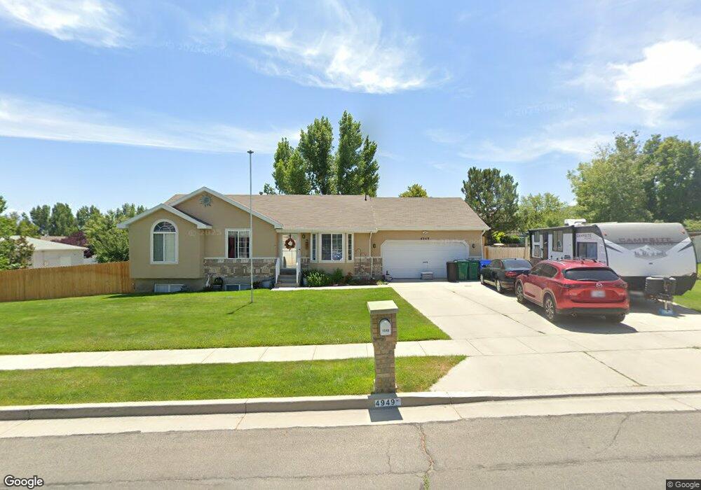
4949 Kessler Peak Dr Riverton, UT 84096
Estimated Value: $575,000 - $614,000
4
Beds
3
Baths
1,390
Sq Ft
$428/Sq Ft
Est. Value
About This Home
This home is located at 4949 Kessler Peak Dr, Riverton, UT 84096 and is currently estimated at $595,602, approximately $428 per square foot. 4949 Kessler Peak Dr is a home located in Salt Lake County with nearby schools including Foothills School, South Hills Middle School, and Mountain Ridge High School.
Ownership History
Date
Name
Owned For
Owner Type
Purchase Details
Closed on
Sep 16, 2004
Sold by
Dorius Investments Inc
Bought by
Hollstein Clifford R and Hollstein Niki A
Current Estimated Value
Home Financials for this Owner
Home Financials are based on the most recent Mortgage that was taken out on this home.
Original Mortgage
$170,000
Outstanding Balance
$89,614
Interest Rate
6.85%
Mortgage Type
New Conventional
Estimated Equity
$505,988
Purchase Details
Closed on
Jun 7, 2002
Sold by
Dorius Jody L
Bought by
Oak Woods Holding
Purchase Details
Closed on
Oct 29, 2001
Sold by
Clements John
Bought by
Dorius Jody L
Home Financials for this Owner
Home Financials are based on the most recent Mortgage that was taken out on this home.
Original Mortgage
$145,350
Interest Rate
6.84%
Purchase Details
Closed on
Feb 1, 2001
Sold by
Clements Annette
Bought by
Clements John
Purchase Details
Closed on
Aug 18, 1999
Sold by
Household Properties Inc
Bought by
Clements John and Clements Annette
Home Financials for this Owner
Home Financials are based on the most recent Mortgage that was taken out on this home.
Original Mortgage
$134,300
Interest Rate
7.63%
Purchase Details
Closed on
Jun 29, 1999
Sold by
Hunstman Robert T and Huntsman Roxiann
Bought by
Household Properties
Home Financials for this Owner
Home Financials are based on the most recent Mortgage that was taken out on this home.
Original Mortgage
$134,300
Interest Rate
7.63%
Purchase Details
Closed on
Apr 10, 1998
Sold by
Edmunds Allen L and Edmunds Karen L
Bought by
Huntsman Robert T and Huntsman Roxiann
Home Financials for this Owner
Home Financials are based on the most recent Mortgage that was taken out on this home.
Original Mortgage
$139,200
Interest Rate
6.79%
Purchase Details
Closed on
Nov 10, 1997
Sold by
Taylor L Eugene
Bought by
Edmunds Allen L and Edmunds Karen L
Home Financials for this Owner
Home Financials are based on the most recent Mortgage that was taken out on this home.
Original Mortgage
$116,410
Interest Rate
7.23%
Mortgage Type
Balloon
Purchase Details
Closed on
Oct 10, 1997
Sold by
Development Associates Inc
Bought by
Taylor L Eugene
Home Financials for this Owner
Home Financials are based on the most recent Mortgage that was taken out on this home.
Original Mortgage
$116,410
Interest Rate
7.23%
Mortgage Type
Balloon
Create a Home Valuation Report for This Property
The Home Valuation Report is an in-depth analysis detailing your home's value as well as a comparison with similar homes in the area
Home Values in the Area
Average Home Value in this Area
Purchase History
| Date | Buyer | Sale Price | Title Company |
|---|---|---|---|
| Hollstein Clifford R | -- | Cottonwood Title Ins Agency | |
| Oak Woods Holding | -- | -- | |
| Dorius Jody L | -- | -- | |
| Clements John | -- | -- | |
| Clements John | -- | -- | |
| Household Properties | $116,000 | Granite Title | |
| Huntsman Robert T | -- | -- | |
| Edmunds Allen L | -- | -- | |
| Taylor L Eugene | -- | -- |
Source: Public Records
Mortgage History
| Date | Status | Borrower | Loan Amount |
|---|---|---|---|
| Open | Hollstein Clifford R | $170,000 | |
| Previous Owner | Dorius Jody L | $145,350 | |
| Previous Owner | Clements John | $134,300 | |
| Previous Owner | Huntsman Robert T | $139,200 | |
| Previous Owner | Edmunds Allen L | $116,410 | |
| Closed | Edmunds Allen L | $24,775 | |
| Closed | Clements John | $23,700 |
Source: Public Records
Tax History
| Year | Tax Paid | Tax Assessment Tax Assessment Total Assessment is a certain percentage of the fair market value that is determined by local assessors to be the total taxable value of land and additions on the property. | Land | Improvement |
|---|---|---|---|---|
| 2025 | $3,195 | $607,100 | $237,000 | $370,100 |
| 2024 | $3,195 | $553,000 | $217,700 | $335,300 |
| 2023 | $3,389 | $552,900 | $201,500 | $351,400 |
| 2022 | $3,494 | $559,300 | $197,600 | $361,700 |
| 2021 | $2,911 | $414,900 | $152,400 | $262,500 |
| 2020 | $2,808 | $373,100 | $118,500 | $254,600 |
| 2019 | $2,710 | $354,000 | $112,900 | $241,100 |
| 2016 | $2,356 | $283,400 | $104,300 | $179,100 |
Source: Public Records
Map
Nearby Homes
- 14026 S Ben Lomond Peak Dr
- 13878 S Shaggy Peak Dr
- 4722 W Cillian Ln Unit 2411
- 4722 W Cillian Ln
- 5244 W Shaggy Peak Dr
- 4714 W Cillian Ln
- 4714 W Cillian Ln Unit 2410
- 4688 W Cillian Ln Unit 2408
- 4688 W Cillian Ln
- 4682 W Cillian Ln Unit 2407
- 13597 S Firetip Ct
- 4676 W Cillian Ln Unit 2406
- 4676 W Cillian Ln
- 4662 W Cillian Ln Unit 2405
- 13626 S Bluewing Way
- 4638 W Cillian Ln Unit 2403
- 4596 W Watchmen Way Unit 1402
- 13687 S Hanley Ln Unit DD102
- 13687 S Hanley Ln Unit DD203
- 4467 W Monument Peak Dr
- 13941 Hoyt Peak Cir
- 13941 S Hoyt Peak Cir
- 13920 Kessler Peak Cir
- 13940 S Kessler Peak Cir
- 13940 Kessler Peak Cir
- 4962 W Kessler Peak Dr
- 4962 Kessler Peak Dr
- 4950 Kessler Peak Dr
- 14063 Grand View Peak Cir
- 13953 Hoyt Peak Cir
- 13938 S Hoyt Peak Cir
- 13938 Hoyt Peak Cir
- 4936 Kessler Peak Dr
- 4976 W Kessler Peak Dr
- 4976 Kessler Peak Dr
- 13946 Kessler Peak Cir
- 13946 S Kessler Peak Cir
- 13958 Hoyt Peak Cir
- 13965 S Hoyt Peak Cir
- 13965 Hoyt Peak Cir
Your Personal Tour Guide
Ask me questions while you tour the home.