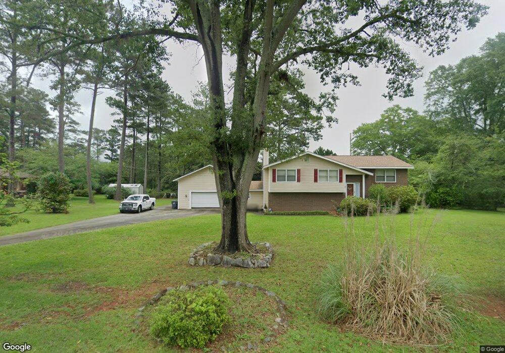
495 Carya Ln Forsyth, GA 31029
Estimated Value: $264,000 - $294,000
3
Beds
3
Baths
2,588
Sq Ft
$107/Sq Ft
Est. Value
About This Home
This home is located at 495 Carya Ln, Forsyth, GA 31029 and is currently estimated at $278,037, approximately $107 per square foot. 495 Carya Ln is a home located in Monroe County with nearby schools including Katherine B. Sutton Elementary School and Mary Persons High School.
Ownership History
Date
Name
Owned For
Owner Type
Purchase Details
Closed on
Aug 29, 2012
Sold by
Krysak William J
Bought by
Brooks Stephanie W
Current Estimated Value
Home Financials for this Owner
Home Financials are based on the most recent Mortgage that was taken out on this home.
Original Mortgage
$98,979
Outstanding Balance
$68,522
Interest Rate
3.58%
Mortgage Type
New Conventional
Estimated Equity
$209,515
Purchase Details
Closed on
Nov 30, 1984
Sold by
Equitable Relocation Management Corporat
Bought by
Krysak William J
Purchase Details
Closed on
Feb 23, 1982
Sold by
Webb James W
Bought by
Fry Keith A
Create a Home Valuation Report for This Property
The Home Valuation Report is an in-depth analysis detailing your home's value as well as a comparison with similar homes in the area
Home Values in the Area
Average Home Value in this Area
Purchase History
| Date | Buyer | Sale Price | Title Company |
|---|---|---|---|
| Brooks Stephanie W | $94,000 | -- | |
| Krysak William J | $67,000 | -- | |
| Fry Keith A | $63,000 | -- |
Source: Public Records
Mortgage History
| Date | Status | Borrower | Loan Amount |
|---|---|---|---|
| Open | Brooks Stephanie W | $98,979 |
Source: Public Records
Tax History Compared to Growth
Tax History
| Year | Tax Paid | Tax Assessment Tax Assessment Total Assessment is a certain percentage of the fair market value that is determined by local assessors to be the total taxable value of land and additions on the property. | Land | Improvement |
|---|---|---|---|---|
| 2024 | $1,832 | $72,108 | $10,440 | $61,668 |
| 2023 | $1,764 | $65,988 | $10,440 | $55,548 |
| 2022 | $1,622 | $65,988 | $10,440 | $55,548 |
| 2021 | $1,673 | $65,988 | $10,440 | $55,548 |
| 2020 | $1,393 | $54,960 | $8,360 | $46,600 |
| 2019 | $1,403 | $54,960 | $8,360 | $46,600 |
| 2018 | $1,407 | $54,960 | $8,360 | $46,600 |
| 2017 | $1,762 | $54,960 | $8,360 | $46,600 |
| 2016 | $1,241 | $51,520 | $8,360 | $43,160 |
| 2015 | $1,504 | $51,520 | $8,360 | $43,160 |
| 2014 | $1,482 | $51,520 | $8,360 | $43,160 |
Source: Public Records
Map
Nearby Homes
- 3487 Georgia 42
- 3271 Georgia 42
- 3471 Georgia 42
- 24 George St
- 47 Ensign Rd
- 225 N Indian Springs Dr
- 200 Indian Springs Dr
- 205 Solomon St
- 4616 Capulet Ct
- 5407 Felles Way Unit 356
- 5399 Felles Way Unit 358
- 5399 Felles Way
- 5393 Felles Way Unit 359
- 5387 Felles Way
- 5387 Felles Way Unit 360
- 81 Langston Ave
- Cypress Plan at Juliette Crossing
- Jackson Plan at Juliette Crossing
- Cannaberra Plan at Juliette Crossing
- Oakwood Plan at Juliette Crossing
- 17 Pinecrest Dr
- 491 Carya Ln
- 21 Pinecrest Dr
- 15 Pineview Cir
- 13 Pinecrest Dr
- 18 Pinecrest Dr
- 260 Powerhouse Rd
- 81 Powerhouse Rd
- 25 Pinecrest Dr
- 71 Powerhouse Rd
- 24 Pinecrest Dr
- 53 Pineview Cir
- 15 Lakeshore Dr
- 69 Powerhouse Rd
- 20 Colvin Dr
- 26 Pineview Cir
- 30 Colvin Dr
- 111 Lakeside Dr
- 185 N Frontage Rd
- 40 Colvin Dr