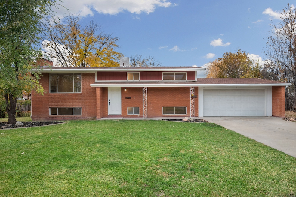
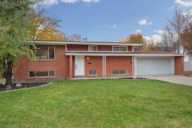

495 Spurlock St Layton, UT 84041
Estimated payment $2,535/month
Highlights
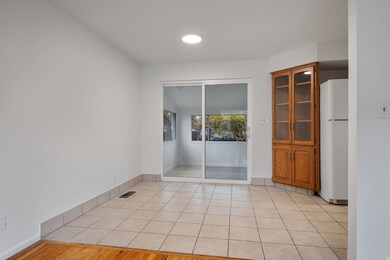
- Second Kitchen
- Mountain View
- Main Floor Primary Bedroom
- Mature Trees
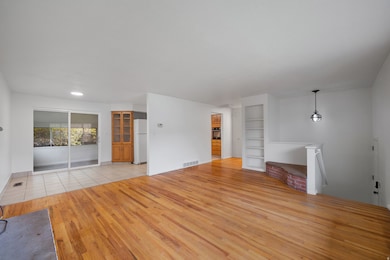
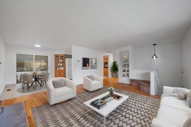
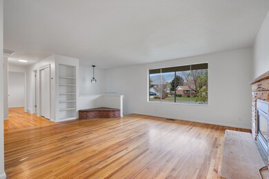
- Wood Flooring
- 2 Fireplaces
About This Home
Darling split level, brick home with large lot, fully fenced yard and 2 car garage. With two kitchens, washer/dryer hookups on both levels and a separate basement entrance, this property has potential for rental income. Beautiful hardwood floors and new carpet and paint. Bonus sunroom off the kitchen and two fireplaces. This home is conveniently located in a cul-de-sac with close proximity to restaurants, I-15 and FrontRunner station. Square footage figures are provided as a courtesy estimate only and were obtained from county records. Buyer is advised to obtain an independent measurement.
Listing Agent
Brittany Walker
Equity Real Estate (Solid) License #6324099 Listed on: 11/13/2025
Open House Schedule
-
Saturday, November 15, 20252:30 to 4:00 pm11/15/2025 2:30:00 PM +00:0011/15/2025 4:00:00 PM +00:00Add to Calendar
Home Details
Home Type
- Single Family
Est. Annual Taxes
- $2,006
Year Built
- Built in 1962
Lot Details
- 0.29 Acre Lot
- Cul-De-Sac
- Property is Fully Fenced
- Landscaped
- Mature Trees
- Property is zoned Single-Family, R-1-8
Parking
- 2 Car Attached Garage
Home Design
- Split Level Home
- Brick Exterior Construction
Interior Spaces
- 2,170 Sq Ft Home
- 2-Story Property
- 2 Fireplaces
- Sliding Doors
- Mountain Views
- Second Kitchen
Flooring
- Wood
- Carpet
- Linoleum
- Tile
Bedrooms and Bathrooms
- 4 Bedrooms | 2 Main Level Bedrooms
- Primary Bedroom on Main
Laundry
- Dryer
- Washer
Basement
- Walk-Out Basement
- Exterior Basement Entry
- Natural lighting in basement
Outdoor Features
- Porch
Schools
- Crestview Elementary School
- Central Davis Middle School
- Layton High School
Utilities
- Evaporated cooling system
- Forced Air Heating System
- Natural Gas Connected
Community Details
- No Home Owners Association
Listing and Financial Details
- Assessor Parcel Number 10-097-0011
Map
Home Values in the Area
Average Home Value in this Area
Tax History
| Year | Tax Paid | Tax Assessment Tax Assessment Total Assessment is a certain percentage of the fair market value that is determined by local assessors to be the total taxable value of land and additions on the property. | Land | Improvement |
|---|---|---|---|---|
| 2025 | $2,007 | $210,650 | $118,786 | $91,864 |
| 2024 | $1,930 | $204,049 | $137,328 | $66,721 |
| 2023 | $1,872 | $191,950 | $84,464 | $107,485 |
| 2022 | $1,886 | $347,000 | $152,815 | $194,185 |
| 2021 | $1,815 | $274,000 | $125,829 | $148,171 |
| 2020 | $1,650 | $239,000 | $102,484 | $136,516 |
| 2019 | $1,629 | $231,000 | $94,344 | $136,656 |
| 2018 | $1,475 | $210,000 | $94,344 | $115,656 |
| 2016 | $1,283 | $94,215 | $32,472 | $61,743 |
| 2015 | $1,211 | $84,480 | $32,472 | $52,008 |
| 2014 | $1,055 | $75,204 | $32,472 | $42,732 |
| 2013 | -- | $77,755 | $19,245 | $58,510 |
Property History
| Date | Event | Price | List to Sale | Price per Sq Ft |
|---|---|---|---|---|
| 11/13/2025 11/13/25 | For Sale | $450,000 | -- | $207 / Sq Ft |
Purchase History
| Date | Type | Sale Price | Title Company |
|---|---|---|---|
| Interfamily Deed Transfer | -- | -- | |
| Interfamily Deed Transfer | -- | Bonneville Title Company Inc | |
| Interfamily Deed Transfer | -- | Bonneville Title Company Inc | |
| Interfamily Deed Transfer | -- | Bonneville Title Company Inc |
Mortgage History
| Date | Status | Loan Amount | Loan Type |
|---|---|---|---|
| Closed | $60,000 | No Value Available |
Source: UtahRealEstate.com
MLS Number: 2122667
APN: 10-097-0011
Disclaimer: Certain information contained herein is derived from information provided by parties other than Homes.com. All information provided is deemed reliable, but is not guaranteed to be accurate and should be independently verified.
![]() IDX information is provided exclusively for consumers’ personal, non-commercial use, that it may not be used for any purpose other than to identify prospective properties consumers may be interested in purchasing, and that the data is deemed reliable but is not guaranteed accurate by the MLS. Licensor is only providing the MLS Content and not other sources of data provided in the Product.
IDX information is provided exclusively for consumers’ personal, non-commercial use, that it may not be used for any purpose other than to identify prospective properties consumers may be interested in purchasing, and that the data is deemed reliable but is not guaranteed accurate by the MLS. Licensor is only providing the MLS Content and not other sources of data provided in the Product.
Based on information from the Wasatch Front Regional Multiple Listing Service, Inc.. All data, including all measurements and calculations of area, is obtained from various sources and has not been, and will not be, verified by broker or the MLS. All information should be independently reviewed and verified for accuracy. Properties may or may not be listed by the office/agent presenting the information.
- 480 Spurlock St
- 441 Church St
- 6 Grover St
- 142 Green Dr
- 356 W 25 N
- 526 King St Unit 2
- 355 W Gentile St
- 485 W 100 N
- 157 N Fort Ln Unit A
- 1131 N 150 W
- 785 Sherwood Dr
- 1180 N 100 E
- 174 W Dawson St
- 937 Rainbow Dr
- 551 Colonial St
- 267 S Melody St
- 794 Valeria Dr
- 806 Valeria Dr
- 750 W Gentile St
- 654 Colonial St