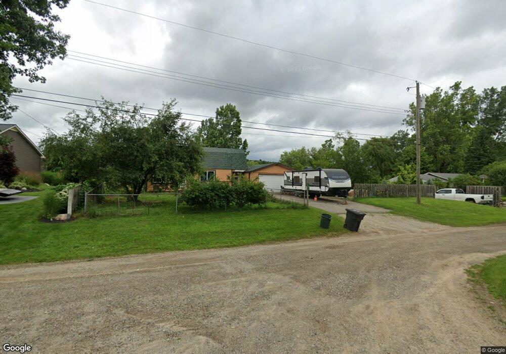
4950 E Princeton Ave Clarkston, MI 48348
Estimated Value: $193,000 - $275,000
3
Beds
1
Bath
1,192
Sq Ft
$205/Sq Ft
Est. Value
About This Home
This home is located at 4950 E Princeton Ave, Clarkston, MI 48348 and is currently estimated at $244,787, approximately $205 per square foot. 4950 E Princeton Ave is a home located in Oakland County.
Ownership History
Date
Name
Owned For
Owner Type
Purchase Details
Closed on
Oct 16, 2015
Sold by
Hoffman Ginger K
Bought by
Johnson Benjamin C
Current Estimated Value
Home Financials for this Owner
Home Financials are based on the most recent Mortgage that was taken out on this home.
Original Mortgage
$87,000
Interest Rate
4.5%
Mortgage Type
New Conventional
Purchase Details
Closed on
Oct 30, 2009
Sold by
Estate Of Mable A Rondo
Bought by
Hoffman Ginger K
Purchase Details
Closed on
Oct 25, 2002
Sold by
Sloas Mary T
Bought by
Rondo Mabel
Purchase Details
Closed on
Jun 29, 1995
Sold by
Rondo Mabel
Bought by
Rondo Mabel
Create a Home Valuation Report for This Property
The Home Valuation Report is an in-depth analysis detailing your home's value as well as a comparison with similar homes in the area
Home Values in the Area
Average Home Value in this Area
Purchase History
| Date | Buyer | Sale Price | Title Company |
|---|---|---|---|
| Johnson Benjamin C | $85,000 | First American Title Insuran | |
| Hoffman Ginger K | $50,000 | Multiple | |
| Rondo Mabel | -- | -- | |
| Rondo Mabel | -- | -- |
Source: Public Records
Mortgage History
| Date | Status | Borrower | Loan Amount |
|---|---|---|---|
| Previous Owner | Johnson Benjamin C | $87,000 |
Source: Public Records
Tax History
| Year | Tax Paid | Tax Assessment Tax Assessment Total Assessment is a certain percentage of the fair market value that is determined by local assessors to be the total taxable value of land and additions on the property. | Land | Improvement |
|---|---|---|---|---|
| 2025 | $2,167 | $107,200 | $56,400 | $50,800 |
| 2024 | $1,439 | $97,900 | $50,300 | $47,600 |
| 2023 | $1,940 | $86,800 | $43,300 | $43,500 |
| 2022 | $1,946 | $79,000 | $39,400 | $39,600 |
| 2021 | $1,946 | $77,000 | $38,800 | $38,200 |
| 2020 | $1,256 | $73,400 | $37,400 | $36,000 |
| 2018 | $1,863 | $70,600 | $43,100 | $27,500 |
| 2015 | -- | $53,400 | $0 | $0 |
| 2014 | -- | $48,600 | $0 | $0 |
| 2011 | -- | $42,400 | $0 | $0 |
Source: Public Records
Map
Nearby Homes
- 5049 Smokey Hollow Ln
- 9515 Woodside Dr
- 9225 Thendara Blvd
- 5277 Coulter Lake Trail
- 8840 Minne Wanna Rd
- 8955 Maplewood Ave
- 4998 Menominee Ln Unit 1
- 8670 N Eston Rd
- 8646 Thendara Blvd
- 5045 Ashford Rd Unit 10
- 4314 Hazel St Unit 58
- 4335 Hazel St Unit 440
- 4306 Hazel St Unit 55
- 4376 Lancaster Dr
- 5525 Avington Pkwy
- 3869 Apple St Unit 337
- 3826 Cherry St Unit 363
- 8848 Stonewall E
- 3858 Apple St
- 3810 Cherry St Unit 367
- 4954 E Princeton Ave
- 4920 E Princeton Ave
- 0 W Princeton Ave Unit 218057304
- 0 W Princeton Ave Unit R217084452
- 9620 Yale Ave
- 4902 E Princeton Ave
- 4955 E Harvard Ave
- 9617 Yale Ave
- 4958 E Princeton Ave
- 4911 E Princeton Ave
- 4963 E Harvard Ave
- 4962 E Harvard Ave
- 4890 E Princeton Ave
- 9605 Yale Ave
- 4990 E Princeton Ave
- 9591 Cornell Ave
- 4884 E Princeton Ave
- 4971 E Harvard Ave
- 9595 Yale Ave Unit Bldg-Unit
- 9595 Yale Ave
Your Personal Tour Guide
Ask me questions while you tour the home.