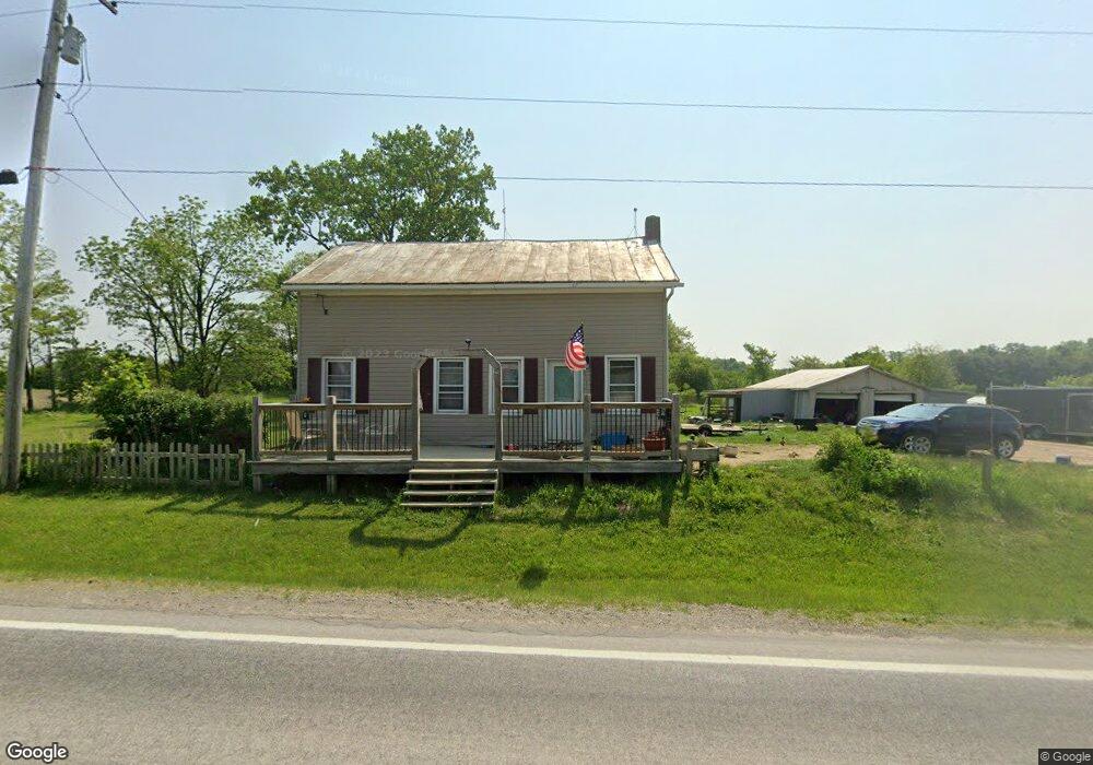
4951 State Route 314 Mount Gilead, OH 43338
Estimated Value: $217,000 - $365,000
4
Beds
2
Baths
1,732
Sq Ft
$153/Sq Ft
Est. Value
About This Home
This home is located at 4951 State Route 314, Mount Gilead, OH 43338 and is currently estimated at $264,659, approximately $152 per square foot. 4951 State Route 314 is a home located in Morrow County with nearby schools including Northmor Elementary School and Northmor High School.
Ownership History
Date
Name
Owned For
Owner Type
Purchase Details
Closed on
Sep 1, 2016
Sold by
Leander Keim
Bought by
Lonthair Robert and Lonthair Christina
Current Estimated Value
Home Financials for this Owner
Home Financials are based on the most recent Mortgage that was taken out on this home.
Original Mortgage
$101,576
Outstanding Balance
$81,213
Interest Rate
3.46%
Estimated Equity
$183,446
Purchase Details
Closed on
Jun 24, 2014
Sold by
William R William R and Conner William M
Bought by
Keim Leander and Keim Fannie
Purchase Details
Closed on
Jan 21, 2011
Sold by
Hsbc Mortgage Services Inc
Bought by
Conner William M and Conner Dixie
Purchase Details
Closed on
Apr 27, 1998
Sold by
Cremeans Bernard A
Bought by
Cremeans Bernard A and Cremeans Rebecca
Purchase Details
Closed on
Jul 1, 1996
Bought by
Cremeans Bernard A
Create a Home Valuation Report for This Property
The Home Valuation Report is an in-depth analysis detailing your home's value as well as a comparison with similar homes in the area
Home Values in the Area
Average Home Value in this Area
Purchase History
| Date | Buyer | Sale Price | Title Company |
|---|---|---|---|
| Lonthair Robert | -- | -- | |
| Keim Leander | -- | -- | |
| Conner William M | $41,900 | -- | |
| Cremeans Bernard A | -- | -- | |
| Cremeans Bernard A | $67,000 | -- |
Source: Public Records
Mortgage History
| Date | Status | Borrower | Loan Amount |
|---|---|---|---|
| Open | Lonthair Robert | $101,576 | |
| Closed | Lonthair Robert | -- |
Source: Public Records
Tax History Compared to Growth
Tax History
| Year | Tax Paid | Tax Assessment Tax Assessment Total Assessment is a certain percentage of the fair market value that is determined by local assessors to be the total taxable value of land and additions on the property. | Land | Improvement |
|---|---|---|---|---|
| 2024 | $2,106 | $56,810 | $17,570 | $39,240 |
| 2023 | $2,106 | $56,810 | $17,570 | $39,240 |
| 2022 | $1,660 | $39,870 | $11,520 | $28,350 |
| 2021 | $1,642 | $39,870 | $11,520 | $28,350 |
| 2020 | $1,625 | $39,870 | $11,520 | $28,350 |
| 2019 | $1,471 | $35,290 | $10,190 | $25,100 |
| 2018 | $1,472 | $35,290 | $10,190 | $25,100 |
| 2017 | $1,456 | $35,290 | $10,190 | $25,100 |
| 2016 | $1,206 | $28,710 | $8,930 | $19,780 |
| 2015 | $1,067 | $27,060 | $8,930 | $18,130 |
| 2014 | $1,084 | $27,060 | $8,930 | $18,130 |
| 2013 | $1,086 | $28,460 | $9,380 | $19,080 |
Source: Public Records
Map
Nearby Homes
- 7000 Township Road 85
- 6410 Township Road 84
- 6043 Township Road 87
- 6713 U S 42
- 7117 County Road 59
- 6530 U S 42
- 6351 U S 42
- 5615 County Road 98
- 8047 Ohio 314
- 6602 Township Road 29
- 7326 State Route 19 Unit 1 Lots 62-63
- 7326 State Route 19 Unit 6 Lots 90 91 92
- 2785 Rd
- 2869 Eckert Rd
- 6334 Black Rd
- 6870 County Road 109
- 5643 Yankee St
- 2670 Kings Corners Rd E
- 00 County Road 98 Unit Lot B
- 000 County Road 98 Unit Lot C
- 5206 State Route 314
- 4674 State Route 314
- 4722 State Route 314
- 4644 State Route 314
- 5040 State Route 314
- 5056 State Route 314
- 5171 State Route 314
- 5275 State Route 314
- 4897 State Route 314
- 4823 State Route 314
- 5050 State Route 314
- 4951 State Route 314
- 5171 State Route 314
- 4951 State Route 314
- 4951 State Route 314
- 5275 State Route 314
- 5375 State Route 314
- 5375 State Route 314
- 6464 State Route 314
- 6577 State Route 314