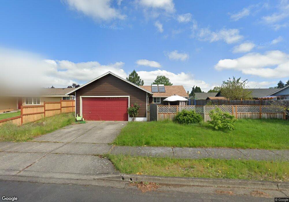
4953 Parsons Ave Eugene, OR 97402
Bethel NeighborhoodEstimated Value: $389,592 - $420,000
3
Beds
2
Baths
1,336
Sq Ft
$304/Sq Ft
Est. Value
About This Home
This home is located at 4953 Parsons Ave, Eugene, OR 97402 and is currently estimated at $406,398, approximately $304 per square foot. 4953 Parsons Ave is a home located in Lane County with nearby schools including Prairie Mountain School and Willamette High School.
Ownership History
Date
Name
Owned For
Owner Type
Purchase Details
Closed on
Sep 2, 2020
Sold by
Block Robert A and Block Elizabeth Suzanne
Bought by
Block Elizabeth
Current Estimated Value
Home Financials for this Owner
Home Financials are based on the most recent Mortgage that was taken out on this home.
Original Mortgage
$190,000
Interest Rate
3%
Mortgage Type
New Conventional
Purchase Details
Closed on
Aug 29, 2001
Sold by
Block Robert A
Bought by
Block Robert A and Block Elizabeth Suzanne
Create a Home Valuation Report for This Property
The Home Valuation Report is an in-depth analysis detailing your home's value as well as a comparison with similar homes in the area
Home Values in the Area
Average Home Value in this Area
Purchase History
| Date | Buyer | Sale Price | Title Company |
|---|---|---|---|
| Block Elizabeth | -- | Cascade Title Co | |
| Block Robert A | -- | American Title Group |
Source: Public Records
Mortgage History
| Date | Status | Borrower | Loan Amount |
|---|---|---|---|
| Closed | Block Elizabeth | $190,000 |
Source: Public Records
Tax History
| Year | Tax Paid | Tax Assessment Tax Assessment Total Assessment is a certain percentage of the fair market value that is determined by local assessors to be the total taxable value of land and additions on the property. | Land | Improvement |
|---|---|---|---|---|
| 2025 | $3,599 | $206,917 | -- | -- |
| 2024 | $3,508 | $200,891 | -- | -- |
| 2023 | $3,508 | $195,040 | -- | -- |
| 2022 | $3,266 | $189,360 | $0 | $0 |
| 2021 | $3,197 | $183,845 | $0 | $0 |
| 2020 | $3,104 | $178,491 | $0 | $0 |
| 2019 | $2,951 | $173,293 | $0 | $0 |
| 2018 | $2,869 | $163,346 | $0 | $0 |
| 2017 | $2,742 | $163,346 | $0 | $0 |
| 2016 | $2,672 | $158,588 | $0 | $0 |
| 2015 | $2,619 | $153,969 | $0 | $0 |
| 2014 | $2,579 | $149,484 | $0 | $0 |
Source: Public Records
Map
Nearby Homes
- 4985 Cone Ave
- 536 Raber Rd
- 654 Saint Charles St
- 4900 Royal Ave Unit 105
- 4900 Royal Ave Unit SP13
- 647 Oakwood Dr
- 639 Oakwood Dr
- 5260 Forest Ln
- 648 Oakwood Dr
- 658 Saint Charles St
- 671 Saint Charles St
- 683 Saint Charles St
- 664 Saint Charles St
- 5254 Forest Ln
- 670 Saint Charles St
- 715 St Charles St
- 723 St Charles St
- 5275 Forest Ln
- 735 St Charles St
- 716 St Charles St
- 4955 Parsons Ave
- 4947 Parsons Ave
- 4949 Parsons Ave
- 4958 Cone Ave
- 4960 Cone Ave
- 4945 Parsons Ave
- 4954 Parsons Ave
- 4952 Parsons Ave
- 4943 Parsons Ave
- 4956 Parsons Ave
- 4958 Parsons Ave
- 4956 Cone Ave
- 4950 Parsons Ave
- 4962 Cone Ave
- 4961 Parsons Ave
- 4929 Parsons Ave
- 4940 Parsons Ave
- 4941 Parsons Ave
- 4954 Cone Ave
- 4931 Parsons Ave
Your Personal Tour Guide
Ask me questions while you tour the home.