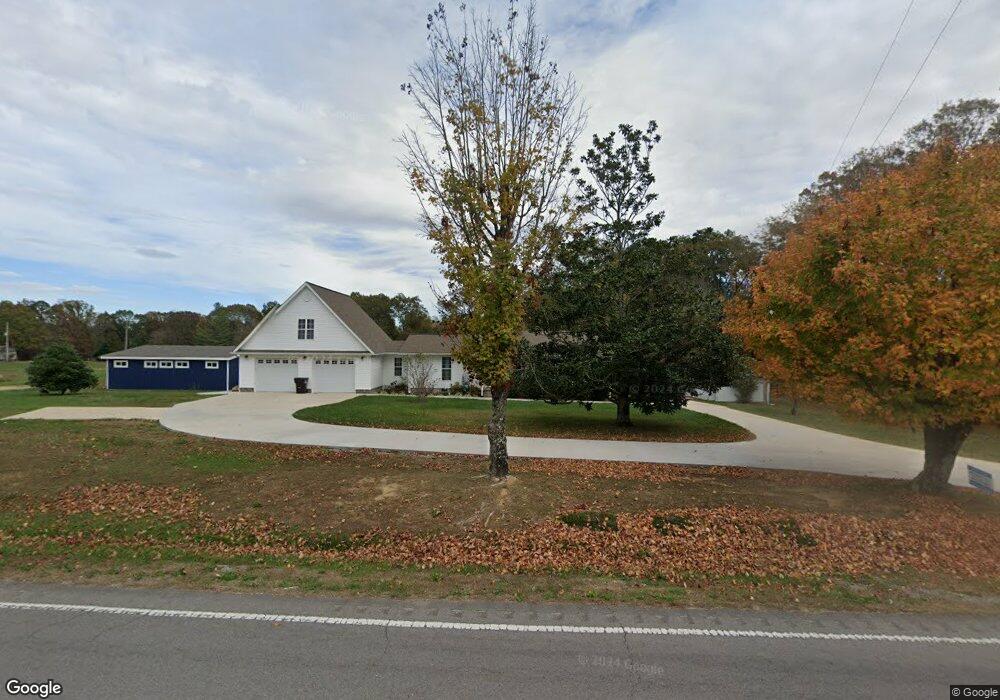
4954 Al Highway 73 Bryant, AL 35958
Estimated Value: $270,000 - $352,000
--
Bed
1
Bath
1,872
Sq Ft
$172/Sq Ft
Est. Value
About This Home
This home is located at 4954 Al Highway 73, Bryant, AL 35958 and is currently estimated at $322,000, approximately $172 per square foot. 4954 Al Highway 73 is a home with nearby schools including Bryant School, North Sand Mt. School, and Mountain View Christian Academy.
Ownership History
Date
Name
Owned For
Owner Type
Purchase Details
Closed on
Jun 13, 2018
Sold by
Hawkins Virgina G
Bought by
White Christopher L and White Abby M
Current Estimated Value
Purchase Details
Closed on
Mar 8, 2017
Sold by
White Oma Ruth
Bought by
White Abby M and White Christopher L
Purchase Details
Closed on
Aug 6, 2009
Sold by
Lowry Dora Lee and Lowrey Dora Lee
Bought by
White Christopher L and White Abby M
Home Financials for this Owner
Home Financials are based on the most recent Mortgage that was taken out on this home.
Original Mortgage
$132,600
Interest Rate
5.19%
Create a Home Valuation Report for This Property
The Home Valuation Report is an in-depth analysis detailing your home's value as well as a comparison with similar homes in the area
Home Values in the Area
Average Home Value in this Area
Purchase History
| Date | Buyer | Sale Price | Title Company |
|---|---|---|---|
| White Christopher L | $17,500 | -- | |
| White Abby M | -- | None Available | |
| White Christopher L | -- | -- |
Source: Public Records
Mortgage History
| Date | Status | Borrower | Loan Amount |
|---|---|---|---|
| Previous Owner | White Christopher L | $132,600 |
Source: Public Records
Tax History Compared to Growth
Tax History
| Year | Tax Paid | Tax Assessment Tax Assessment Total Assessment is a certain percentage of the fair market value that is determined by local assessors to be the total taxable value of land and additions on the property. | Land | Improvement |
|---|---|---|---|---|
| 2024 | $799 | $19,420 | $0 | $0 |
| 2023 | $534 | $16,660 | $0 | $0 |
| 2022 | $451 | $16,660 | $0 | $0 |
| 2021 | $451 | $16,660 | $0 | $0 |
| 2020 | $367 | $13,880 | $0 | $0 |
| 2019 | $367 | $13,880 | $0 | $0 |
| 2018 | $367 | $13,880 | $0 | $0 |
| 2017 | $289 | $112,700 | $0 | $0 |
| 2016 | $269 | $105,900 | $0 | $0 |
| 2015 | $268 | $105,600 | $0 | $0 |
| 2014 | $268 | $105,600 | $0 | $0 |
| 2013 | -- | $105,600 | $0 | $0 |
Source: Public Records
Map
Nearby Homes
- 5080 Al Hwy 73
- 5080 Alabama 73
- 40 Ac County Road 131
- Lot 1& 2 County Road 131
- 4077 Alabama 73
- 685 County Road 267
- 7010 Al Highway 73
- 356 County Road 262
- 660 County Road 724
- 158 County Road 677
- 627 County Road 331
- 14334 County Road 91
- 0 Reeves Rd Unit 1518689
- 0 Bolton Rd
- 77 Bolton Rd
- 1630 Alabama 73
- 174 Ada Lois Ln
- 2969 Worley Chapel Rd
- 1927 County Rd
- 2526 County Road 194
- 1 County Road 93
- 5080 Al Highway 73
- 5082 Al Highway 73
- 4673 Al Highway 73
- 0 County Road 291
- 0 County Road 291 Unit 1360194
- 0 County Road 291 Unit 1378187
- 0 County Road 291 Unit 1368970
- 0 County Road 291 Unit 1143687
- 0 County Road 291 Unit RTC2547780
- 0 County Road 291 Unit 1044565
- 0 County Road 291 Unit 1148321
- 0 County Road 291 Unit 1321132
- 0 County Road 291 Unit 1267874
- 123 County Road 131
- 1 County Road 291
- 494 County Road 291
- 0 Hwy 266 Unit 34401121
- 587 County Road 291
- 591 County Road 291