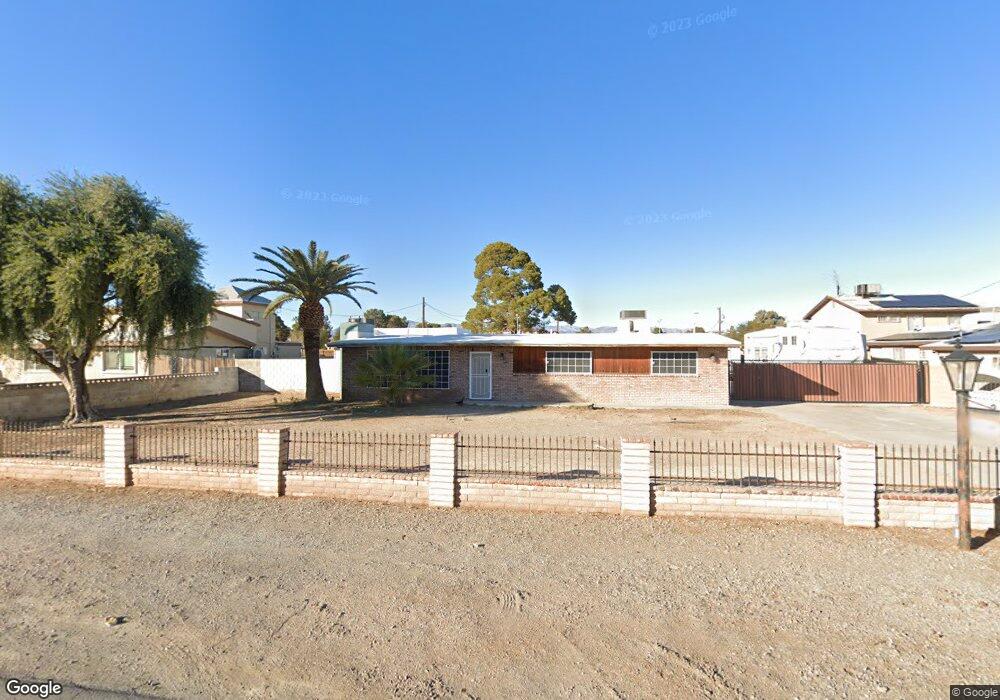
4954 Sandra Rd Las Vegas, NV 89110
East Las Vegas NeighborhoodEstimated Value: $418,000 - $509,000
3
Beds
2
Baths
1,803
Sq Ft
$265/Sq Ft
Est. Value
About This Home
This home is located at 4954 Sandra Rd, Las Vegas, NV 89110 and is currently estimated at $477,942, approximately $265 per square foot. 4954 Sandra Rd is a home located in Clark County with nearby schools including Ira J Earl Elementary School, Dell H Robison Middle School, and Eldorado High School.
Ownership History
Date
Name
Owned For
Owner Type
Purchase Details
Closed on
Mar 27, 2025
Sold by
Tussing Donald R
Bought by
Tussing Donald R and Lussier-Tussing Lee Ann
Current Estimated Value
Purchase Details
Closed on
May 3, 2002
Sold by
Tussing Donald R
Bought by
Tussing Donald R
Home Financials for this Owner
Home Financials are based on the most recent Mortgage that was taken out on this home.
Original Mortgage
$80,000
Interest Rate
7.18%
Create a Home Valuation Report for This Property
The Home Valuation Report is an in-depth analysis detailing your home's value as well as a comparison with similar homes in the area
Home Values in the Area
Average Home Value in this Area
Purchase History
| Date | Buyer | Sale Price | Title Company |
|---|---|---|---|
| Tussing Donald R | -- | Title Deeds & Needs | |
| Tussing Donald R | -- | Nevada Title Company |
Source: Public Records
Mortgage History
| Date | Status | Borrower | Loan Amount |
|---|---|---|---|
| Previous Owner | Tussing Donald R | $80,000 |
Source: Public Records
Tax History Compared to Growth
Tax History
| Year | Tax Paid | Tax Assessment Tax Assessment Total Assessment is a certain percentage of the fair market value that is determined by local assessors to be the total taxable value of land and additions on the property. | Land | Improvement |
|---|---|---|---|---|
| 2025 | $1,238 | $85,140 | $56,000 | $29,140 |
| 2024 | $1,202 | $85,140 | $56,000 | $29,140 |
| 2023 | $1,202 | $74,383 | $48,300 | $26,083 |
| 2022 | $1,279 | $63,516 | $40,250 | $23,266 |
| 2021 | $1,185 | $50,487 | $28,875 | $21,612 |
| 2020 | $1,097 | $49,926 | $28,875 | $21,051 |
| 2019 | $1,028 | $45,219 | $24,938 | $20,281 |
| 2018 | $981 | $40,083 | $21,000 | $19,083 |
| 2017 | $1,266 | $38,629 | $19,688 | $18,941 |
| 2016 | $920 | $37,897 | $19,688 | $18,209 |
| 2015 | $917 | $28,117 | $10,500 | $17,617 |
| 2014 | $888 | $27,758 | $10,500 | $17,258 |
Source: Public Records
Map
Nearby Homes
- 5023 E Monroe Ave
- 4928 E Monroe Ave
- 4932 E Washington Ave
- 4809 Sunny Brook Ave
- 1112 Sandy Cove St
- 4828 Lakestream Ave
- 1385 Ringe Ln
- 1009 Greenbank St
- 1139 Betty Ln
- 4612 Supreme Ct
- 4637 Baby Bird Ln
- 1654 Nesting Way
- 4609 Little Finch Ln
- 817 Bladensburg St
- 5383 E Washington Ave
- 4568 Little Finch Ln
- 854 Stainglass Ln
- 1611 Lovebird Ln Unit 4
- 4541 E Owens Ave
- 26 Arcade Cir
- 4964 Sandra Rd
- 4934 Sandra Rd
- 4974 Sandra Rd
- 4988 Sandra Rd
- 4916 Sandra Rd
- 4953 Sandra Rd
- 4998 Sandra Rd
- 4961 Sandra Rd
- 4943 Sandra Rd
- 4971 Sandra Rd
- 4945 E Monroe Ave
- 4935 Sandra Rd
- 4935 E Monroe Ave
- 1201 Stoney Beach St
- 1205 Stoney Beach St
- 4949 E Monroe Ave
- 4989 Sandra Rd
- 1209 Stoney Beach St
- 1109 Stoney Beach St
- 5004 Sandra Rd