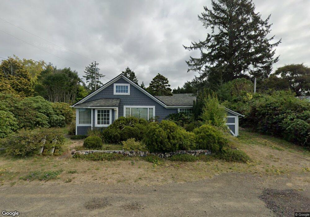
4958 Netarts Hwy W Tillamook, OR 97141
Estimated Value: $346,000 - $459,000
2
Beds
1
Bath
1,008
Sq Ft
$385/Sq Ft
Est. Value
About This Home
This home is located at 4958 Netarts Hwy W, Tillamook, OR 97141 and is currently estimated at $388,176, approximately $385 per square foot. 4958 Netarts Hwy W is a home located in Tillamook County with nearby schools including Tillamook High School.
Ownership History
Date
Name
Owned For
Owner Type
Purchase Details
Closed on
Oct 26, 2020
Sold by
Kamman Joseph T and Kamman Leslie W
Bought by
Kamman Joseph T and Kamman Leslie W
Current Estimated Value
Home Financials for this Owner
Home Financials are based on the most recent Mortgage that was taken out on this home.
Original Mortgage
$115,100
Interest Rate
2.8%
Mortgage Type
New Conventional
Create a Home Valuation Report for This Property
The Home Valuation Report is an in-depth analysis detailing your home's value as well as a comparison with similar homes in the area
Home Values in the Area
Average Home Value in this Area
Purchase History
| Date | Buyer | Sale Price | Title Company |
|---|---|---|---|
| Kamman Joseph T | -- | Ticor Title |
Source: Public Records
Mortgage History
| Date | Status | Borrower | Loan Amount |
|---|---|---|---|
| Closed | Kamman Joseph T | $115,100 |
Source: Public Records
Tax History Compared to Growth
Tax History
| Year | Tax Paid | Tax Assessment Tax Assessment Total Assessment is a certain percentage of the fair market value that is determined by local assessors to be the total taxable value of land and additions on the property. | Land | Improvement |
|---|---|---|---|---|
| 2024 | $1,729 | $136,620 | $74,430 | $62,190 |
| 2023 | $1,723 | $132,650 | $72,260 | $60,390 |
| 2022 | $1,675 | $128,790 | $70,160 | $58,630 |
| 2021 | $1,637 | $125,040 | $68,120 | $56,920 |
| 2020 | $1,601 | $121,400 | $66,140 | $55,260 |
| 2019 | $1,568 | $117,870 | $64,210 | $53,660 |
| 2018 | $1,538 | $114,440 | $62,340 | $52,100 |
| 2017 | $1,508 | $111,109 | $60,529 | $50,580 |
| 2016 | $1,461 | $107,880 | $58,770 | $49,110 |
| 2015 | $1,439 | $104,740 | $57,060 | $47,680 |
| 2014 | $1,421 | $101,690 | $55,400 | $46,290 |
| 2013 | -- | $98,730 | $53,790 | $44,940 |
Source: Public Records
Map
Nearby Homes
- 4900 Clam Way
- 1540 Vista View Dr W
- 0 Tl 3800 Unit 479246395
- 925 Happy Camp Rd W
- TL 3800 Vista View Dr W
- 218 Holly Heights Ave
- 223 Holly Heights Ave
- 224 Holly Heights Ave
- 4803 Holly Heights Ave
- 4850 Netarts Hwy W Unit 6
- 0 Netarts Oceanside Hwy W Unit 2Lots 24315118
- 0 Netarts Oceanside Hwy W Unit 2500&2600 23-95
- 4805 Leonard St W
- 4830 Netarts Hwy W
- 4745 Netarts Hwy W
- 0 Moondancer Ln Unit 25-198
- 0 Moondancer Ln Unit 62
- 4380 Sequoia Loop
- 1960 Alder Cove Rd W
- 1480 Emerald Ln
- 4952 Netarts Hwy W
- 4855 Crab Ave W
- 4960 Netarts Hwy W
- 0 Crab Ave W
- 1030 Crab Ave W
- 4953 Netarts Hwy W
- 4951 Netarts Hwy W
- 000 Three Capes Scenic Route
- 4970 W Netarts Hwy
- 4951 Netarts Hwy W
- 4949 Netarts Hwy W
- 4835 Crab Ave W
- 4960 Crab Ave W
- 1050 W Oceanic Place
- 4830 Crab Ave W
- 1050 Oceanic Place
- 4830 Crab Ave
- 4970 Netarts Hwy W
- 1300 Phelps Ave W
- 4835 Phelps St